Things to Do in Grand Junction CO: Easy Hikes
We could come up with a list of a hundred things to do in Grand Junction CO. Would a long list of reasons convince you to move to Grand Junction? Possibly. But we like to write about our own personal experiences while living in Grand Junction to provide you with a deeper perspective.
When the weekend comes, what do you want to do? I’ll share some of our favorite places. Of course, there are more things to do in Grand Junction CO, so read Paul’s posts for ideas. I put some links at the bottom of this post.
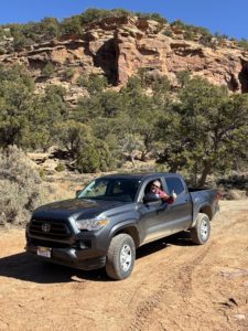
You can go on a scenic drive any day of the week for as long or short as you want. You can be warm in the valley yet ski up on the Grand Mesa. When exploring a new area, we love going for a short drive after dinner to see what we can discover.
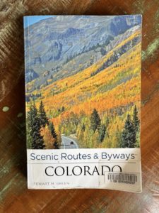
I like to get books from the Mesa County Libraries or buy them from the Friends of the Mesa County Libraries book sales. A lot of what we do in Grand Junction is because I read about it in a book and wanted to see it in person. I also follow a lot of local businesses tourism pages on Facebook and I see what events they are promoting.
Paul posts short videos and notifications of new website posts on our Facebook page called Live Your Vacation in Grand Junction.
Walk Around Town
Because of a Facebook post, one weekend we went to The Milky Way in Palisade. They had a birthday promotion of 50% off and we had never been. Great food and drink, cute place with small indoor seating and more outdoor seating in the backyard. We ran into a friend while there! After that, we walked around town and went into local shops, art galleries, and the Palisade Library. We cruised through books for purchase (building in the back of the library) and ended up checking out a few books from the library.
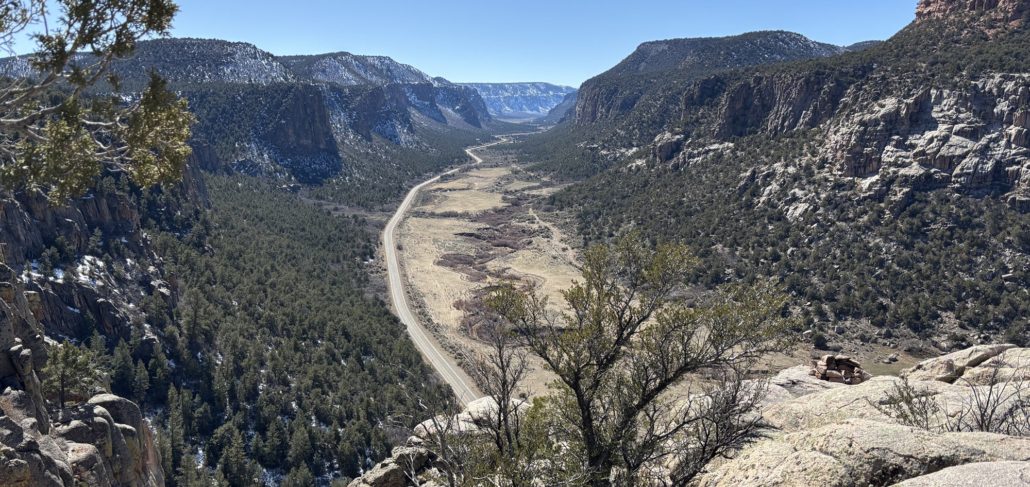
See my post about our Divide Road and Unaweep Canyon Experience. A special overlook I learned about by reading a book from the library!
During the summer we go to Palisade every Sunday for the fabulous farmer’s market. (Fruita and Grand Junction have farmers markets too.) Since it’s winter now, we’ve been missing it! When we go to Palisade, we always take the Scenic Fruit & Wine Byway as we make our way home. Sometimes stopping at a winery, distillery, or the pie shop for a slice of pie or ice cream.
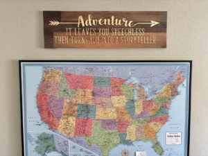
The same goes for walking around downtown Fruita or Grand Junction. Always a fun activity with things to see, places to shop, and great food and beverages. We bought a sign about adventures to hang on our wall from a local shop in downtown GJ while we were waiting to be seated at a local restaurant next door.
Hiking for Beginners
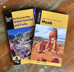 Before we moved here, friends of ours in Minnesota gave us a book called Best Easy Day Hikes in Grand Junction and Fruita by Bill Haggerty, a Falcon Guide®. It has been very useful. If you are new to hiking, I highly recommend it. These easy/short hikes can be done in a morning or afternoon, or pack a picnic lunch and make it an all-day activity.
We are working our way through the list of short hikes in the book. Here are the ones we’ve done so far. We have enjoyed all of them for different reasons. I recommend you get the book for full details. We’ve done other great hikes too, like the Palisade Rim Trail and Miracle Rock in Glade Park to name a few.
- Mica Mine (BLM Bangs Canyon) – The trail is at the bottom of the canyon, so it’s cooler here in the summer. You cross the riverbed sometimes, so be aware it may have water in it. It was very low when we were there. Mica is a shiny, flaky mineral.
-

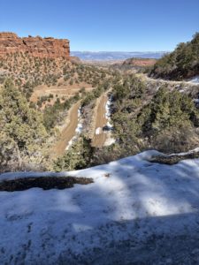
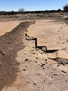
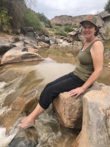
Dominguez Canyon hike Gunnison River
Dominguez Canyon (BLM Dominguez Canyon Wilderness) – This is south of Grand Junction near Whitewater off Hwy 50. A great drive and hike. We saw some old cow cabins and dipped our toes in the Gunnison River.
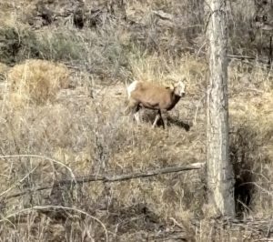
- Devils Kitchen (Colorado National Monument) – This hike prompted me to get the All Trails app on my phone because it wasn’t very well marked towards the end. Everyone says, “Stay on the trail.” but how do you do that when it’s not marked? The hike was great, steep at the end but we went inside the “devil’s kitchen” area. Not sure if that was ok, but others were there too. We saw a big horn sheep on that hike.
- Monument Canyon (Colorado National Monument) – We’ve done the first part of this one a couple of times. It’s a 5-mile loop. You are likely to see bighorn sheep here, especially nearing dusk. It’s a steep trail but there are steps. Amazing views of the canyon and Independence Monument.
-
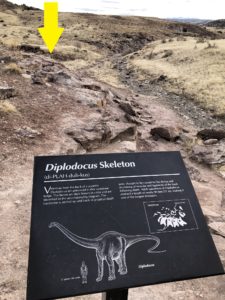
Dinosaur Bones near Fruita
Dinosaur Hill (near CNM entrance in Fruita) – It’s good to learn about the history of the area, dinosaurs include. This was good, no bones to see, just informative signs.
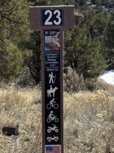
- Fruita Paleontological Area (McInnis Canyons National Conservation Area) – We saw dinosaur bones here, a great hike with many more trails in this area, like to an old cabin. Seeing the cabin is still on our list. There are lots of bones to see in nature in Moab too.
- Trail Through Time (BLM Rabbit Valley) – It was very windy the day we went but still great to see actual dinosaur bones “in the wild” still stuck in the rock. There’s a cool campground up high that overlooks Rabbit Valley, and you can see all the way to the La Sal Mountains in Utah. This trail is near the Utah border.
- Coal Canyon Trail (BLM Book Cliffs Wild Horse Range) – We drove this one during the time of year when driving is allowed. We didn’t get out and hike. This is where you can see wild horses. It was cool to see ribbons of coal in the rock as we drove by. The wall with coal is so close you can touch it as you slowly drive by. The gates into Coal Canyon Road are closed to vehicles from December 1 through May 31 during the foaling season and for wildlife protection.
-
Mesa Lakes Lodge Lake Loop
Mesa Lakes Area Trails (Grand Mesa National Forest) – We have done this a few times with friends and visitors. Trails go through the woods and around small lakes. Mesa Lakes Lodge is there, that’s where we park and get some appetizers inside when we are done. We went snowshoeing here in the winter. You can ice fish too. Bring bug spray in the summer months.
- Colorado Riverfront Trail (Colorado River) – This is one of our favorite walks. We usually park in Las Colonias near the bridge and Camp Eddy campground. We had family stay at Camp Eddy for a month, two thumbs up! We cross the Colorado River or just walk down the trail towards the boat launch, beach, and lazy river. The zipline is here too that goes over the river. This trail can take you all the way to Palisade or Fruita too! Good for walking or biking.

To wrap it up, there are a lot of great things to do in Grand Junction, Fruita, Palisade and the surrounding communities. These are just a few. You can read a post about each city to learn more. You might enjoy Paul’s post about which water bottles we have, why we chose them, and where to get them locally.
If you are considering a trip to the Grand Valley and maybe moving here, Paul would like to show you around the area and maybe schedule a few properties to show you in person while you are here. Connect with Paul.
Other posts you might enjoy as you find things to do in the Grand Valley.
Two-Day Itinerary in Grand Junction, Why Move to Grand Junction
Golf Courses in Grand Junction
Follow us on Facebook: Live Your Vacation in Grand Junction
Follow us on Instagram: @liveyourvacationingj
Guest post written by Michelle Aspelin
© 2025 Paul Aspelin, REALTOR®. MovetoGrandJunction.com and Michelle Aspelin Copyright protected. All rights reserved.