Hiking Monument Canyon Trail Review: What to Expect
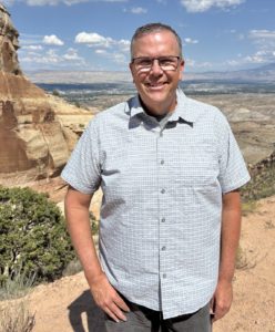
Guest post by Michelle Aspelin
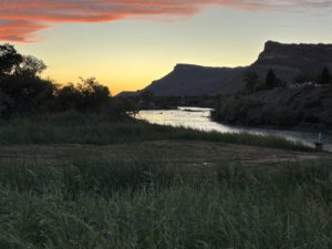
What it’s Really Like Hiking Monument Canyon Trail
If you’re planning on hiking Monument Canyon Trail in the Colorado National Monument, you’ve probably heard it’s “moderate” and takes 2–3 hours. Spoiler alert: it might take longer, it did for us.
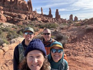
I attempted hiking Monument Canyon Trail with Wedding Canyon twice before finishing it, and even seasoned hikers feel the challenge. Here’s our honest experience, so you can plan accordingly.
When we first moved to Grand Junction, Paul completed this hike and found it to be much more of a challenge than he expected. He couldn’t believe he finished it.
I want to prepare you because locals will encourage you to hike this popular trail when you first move to Grand Junction. I want to give you our impression so you can decide for yourself when you are ready to hike it.
Quick Stats: Monument Canyon Trail
- Distance: 5 miles
- Elevation Gain: 770’ (that’s like 77 flights of stairs)
- Difficulty: Moderate to challenging
- Time: 2-3 hours (or 5 hours!)
Is Monument Canyon Trail really “moderate”? Our experience says otherwise.
Our Monument Canyon Trail Experience
Here’s the link to Paul’s quick Hiking Monument Canyon Trail Video on his Move to Grand Junction YouTube Channel – be sure to watch and give it a “like”.
Hiking at higher elevation makes even a “moderate” trail more challenging. We stopped often to catch our breath, despite living at 4,583’ of elevation in Grand Junction. Adding time for lunch, snacks, and scenic stops, the 5-mile hike took us 5 hours.
We quickly learned that “moderate” doesn’t always match expectations, it depends on elevation, terrain, and pacing. We purposely hiked at a slower pace, we had to stop to breathe, but the 770’ elevation gain during the hike does have an impact, even though we are acclimated to the elevation. It’s like climbing 77 flights of stairs.
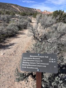
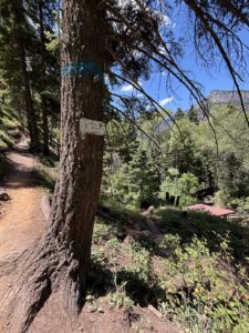
Hiking Monument Canyon Trail: Trailhead Route and Tips
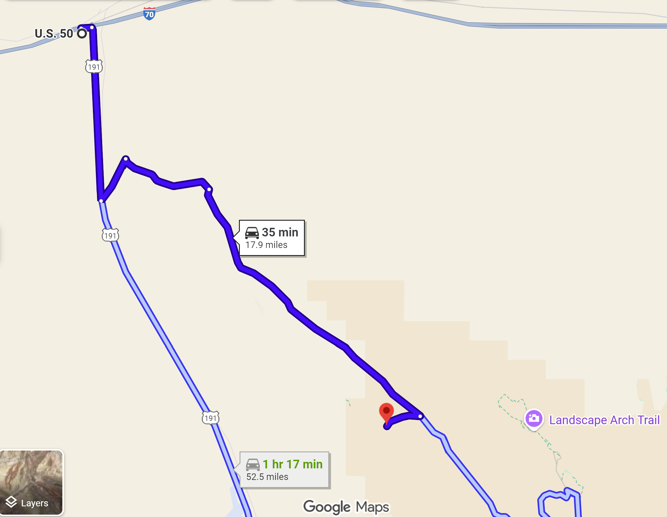
 The AllTrails app says that hiking Monument Canyon Trail loop with Wedding Canyon should take 2 hours and 7 minutes and is moderate. We knew it would take us longer, but not 5 hours! After all, we aren’t 25 anymore. We were just surprised. Were we really THAT slow or was it just more challenging?
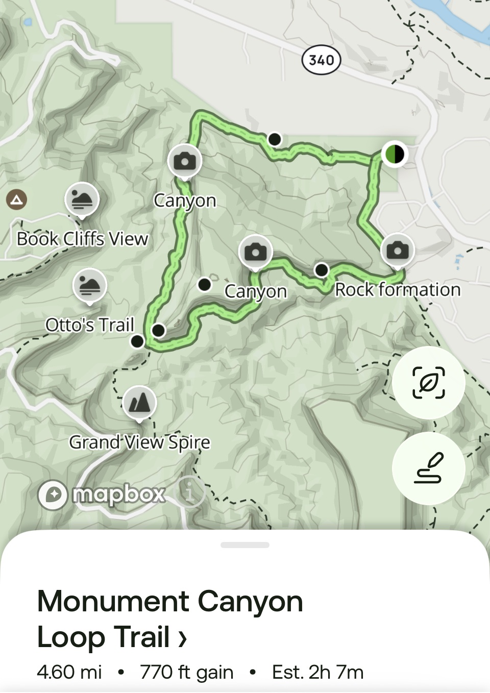
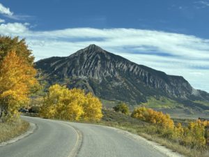
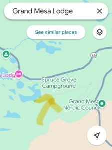
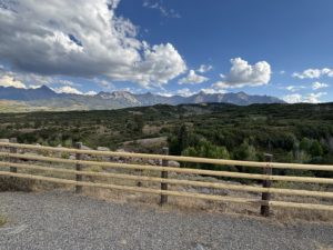
On this map, Wedding Canyon is at the top, trailhead on the right, Monument Canyon is on the bottom, Independence Monument on the left.
Our 2026 experience was mixed initially. After the hike we were exhausted and I wasn’t sure I wanted to write about it and promote this hike. But after we recovered, and I reflected on what we saw, and more importantly, experienced, I thought it would be good to warn you, I mean, share it with you.
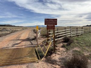
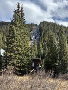
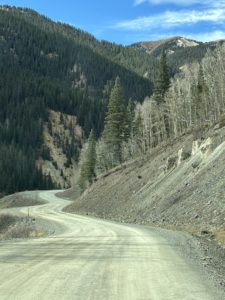
Trailhead: Take Broadway/Hwy 340 to the Lower Monument Canyon Trailhead. There’s a small parking lot with two portable toilets.
The Trail Itself
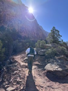
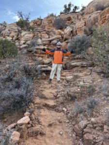
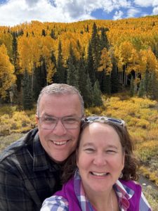
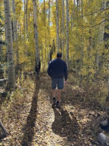
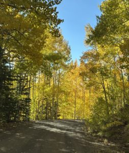
Paul hiking the Wedding Canyon Trail
After our first two attempts at starting on the Lower Monument Canyon Trail, we were advised to start on the Wedding Canyon Trail and I think that’s what made the difference in our ability to complete the 5-mile hike.
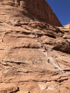
Starting the hike with Monument Canyon Trail is a slow uphill climb almost the entire time, with lots of steps. From the loop trailhead it’s 2.5 miles to reach Independence Monument, considered the half-way point of this loop hike.
Wedding Canyon Trail starts out with a steep descent with switchbacks over loose gravel, a walk across flat open land, then the ascent to Independence Monument. It was much easier to descend through Monument Canyon than to start on that trail, in our opinion.
We discovered after we reached Independence Monument that the Wedding Canyon Trail is “unimproved”. Ah, ok, that makes sense. That’s why there were steep climbs, no steps, loose gravel, rocky terrain, and several spots that were washed out.
In one section, run-off washed away the “shelf” part of the trail so much so that the edge to step across the wash was about as wide as your shoe. We went slow and sort of hopped over the gap in the trail. Luckily, we had our hiking poles to balance us on the ascent. We both slipped a couple of times but didn’t fall. The trail is both narrow and wide. We were walking along a huge sandstone cliff which offered some shade.
We started at 10:30am so the sun was behind the cliff part of the time. That helped keep us cool. It was about 55 degrees, but the sun made it feel like it was in the 70s. We hiked in mid-March. Be careful when you decide to hike, mornings are always better than mid-afternoons due to the heat and sun.
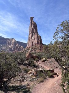
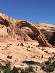
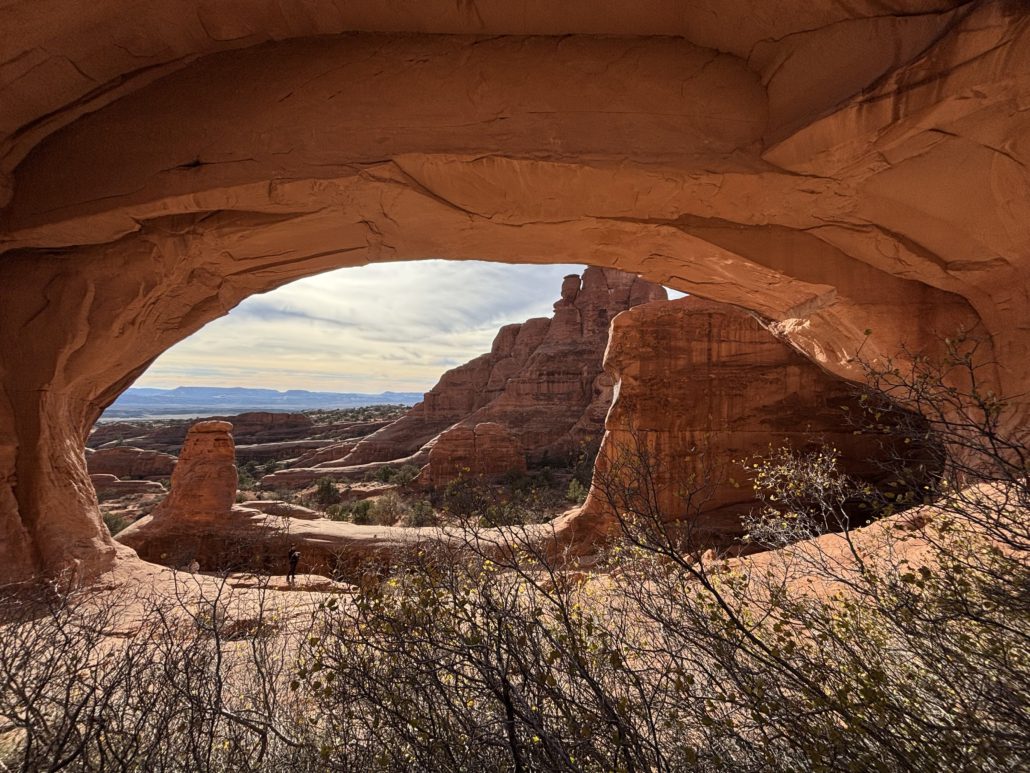
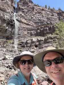
Independence Monument: The Highlight
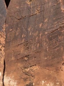
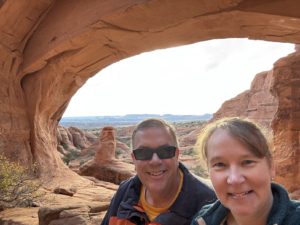
 Once we reached the base of Independence Monument we stopped to eat our lunch. It was much-needed break. We discovered a huge rock with words etched into the top, likely the Declaration of Independence or they could be about John Otto and the significance of this monument in the park. The words were difficult to read after years of exposure to the elements. Let us know what you think they say if you do this hike.
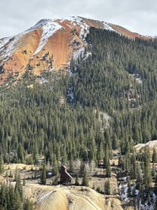
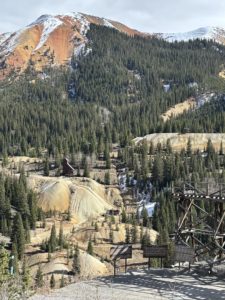
Independence Monument was formed after water and ice eroded walls that once connected the pinnacle to mesas on each side. Sandstone was deposited in this area 210 million years ago and forms the cliffs we see today. Quite amazing. There are so many colorful layers.
The Tradition of Climbing Independence Monument
One of the highlights of hiking Monument Canyon Trail is reaching Independence Monument, a 450-foot sandstone monolith. Every year on the 4th of July, a crew climbs the monument to hoist an American flag, celebrating our nation’s independence. The flag flies for about a week.
John Otto was the first to climb Independence Monument in June and July in 1910, honoring Flag Day and Independence Day. He also built many of the trails in the Monument and became the first official custodian after the Monument was established in 1911, earning a salary of just $1 a month, according to my book Scenic Driving Colorado by Stewart M. Green.
Standing at the base of Independence Monument, knowing its history, makes the hike feel both physically rewarding and historically significant. I’m glad we went.
Hiking Monument Canyon Trail: Returning via Lower Monument Canyon
After reaching Independence Monument, we turned left onto Lower Monument Canyon Trail to head back, which was mostly downhill. (If you turn right, you’ll be on Upper Monument Canyon Trail, which climbs up to Rim Rock Drive.) The full Monument Canyon Trail from bottom to top is about 6 miles with an elevation gain of 1,843 feet, rated “moderate and steep.” We were only on the lower part of the trail.
With the sun at our backs, the return hike was more comfortable. We stopped frequently to take photos of Independence Monument again. We were grateful we weren’t climbing the steps this time. The trail hugs the cliff wall in a few spots but is wide enough elsewhere for other hikers to pass us safely.
The last half mile felt exhausting. When we finally reached the parking lot, we joined hands and raised our arms like we were finishing a marathon. We were completely spent but thrilled to have completed our longest hike to date.
Afterward, we drove home, collapsed on the couch, and groaned every time we moved. My hips, middle back, ankles, and even toes were sore. But two days later, we went on another hike.
Gear & Preparation Checklist
- Water (more than you think)
- Snacks/lunch
- Sturdy hiking shoes or boots
- Sun protection
- A hat and sunglasses
- Trekking poles (recommended but not required)
- Layered clothing if starting out early when it’s still cool
- For fast-acting hydration we take electrolyte fast chews by Salt Stick
- Hydration powder with electrolytes in your water helps too
- For a burst of energy, we like Skratch Labs brand of energy chews (sport fuel)
You can get these items at REI in Grand Junction including a small waist pack, backpack or hydration vest with pockets to carry everything you need to be prepared for hiking in the high desert. Read our post about Water Bottles in Grand Junction: Why it Matters Here.
You can read our How to Avoid Altitude Sickness in Grand Junction guide for more hydration tips.
Wildlife + Wow Factor
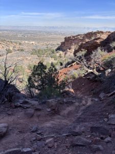
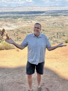
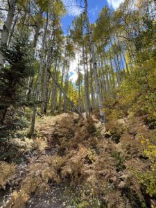
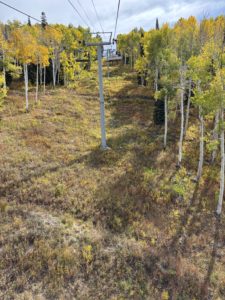
Wedding Canyon Trail and view towards Fruita
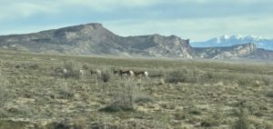
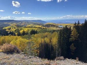
If you want to see bighorn sheep, look for them in Monument Canyon about midway between Independence Monument and where the trail leaves the neighborhood fence line. We did see two in Wedding Canyon on our hike, but people see them regularly in the Monument Canyon, especially early or later in the day, not so much midday.
Seeing the canyons themselves is amazing. The pretty little flowers, the diverse landscape, the huge walls of different rock layers are all stunning.
To be at the base of Independence Monument was very satisfying and, to be honest, felt a bit patriotic. I was glad we did the hike. I am thankful to be able to say, “I’ve been there” and experienced this special place in the Colorado National Monument. Will I hike the loop again? Probably, but not anytime soon. I need the trauma of the experience to wear off first.
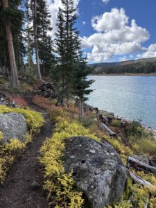
Hiking Mary’s Loop to Pizza Point: A Scenic McInnis Canyons Hike
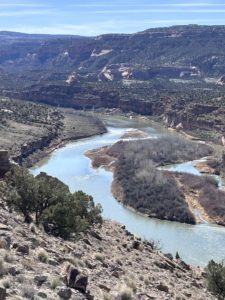
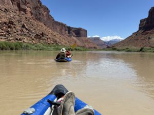
Pizza Point Colorado River Overlook
Two days after our Monument Canyon/Wedding Canyon loop hike, we tackled a 4-mile hike in the McInnis Canyons National Conservation Area with only 568 feet of elevation gain, and it felt much easier and enjoyable.
We took Mary’s Loop to Pizza Point. We returned via Steve’s Loop, which offers breathtaking views of a steep canyon and we saw grazing cows, and an interesting slot canyon to explore. This is in the Horsethief Canyon area between Mack and Loma.
Pizza Point is an incredible overlook of the Colorado River and was our halfway point. We spotted boaters and kayakers below and enjoyed a quick snack while taking in the scenery. The full 4-mile hike took us just about 2 hours, including the stop at the river overlook. Much faster than the Monument Trail loop hike!
This trail is shared with mountain bikers, hikers, and trail runners, so be aware of bikers coming up behind you. Across the river, we could see the dramatic Rattlesnake Canyon, a truly stunning view. We have hiked to Rattlesnake Arches, very cool.
For reference, here’s the official BLM map of McInnis Canyon National Conservation Area if you want to hike in this beautiful area.
What This Hike Taught Us About Living in Grand Junction
The outdoor lifestyle is real here. While this particular hike was challenge for us, there are many more trails we’ve hiked before this that we really enjoyed. Anything 4 miles and under is likely going to be enjoyable to us, longer than that starts to be “not so fun” anymore.
We learned what “moderate” mixed with 770’ elevation gain really means. Know we know what an unimproved trail looks like and feels like. We were glad to have our trekking poles.
You build up to this type of hike.
I felt good knowing we CAN do this sort of hike, given enough time. We planned it on a day when we wouldn’t feel rushed. We did try to enjoy it along the way. Sometimes you look down at the trail itself too much (so you don’t trip on a rock) that you forget to look up and enjoy the scenery and stop to hear the sounds of nature.
I guess we did more stopping and looking than we realized. Reflecting back, I enjoyed it. I am glad we did it mid-March. If it was hot out, it would have made it even more difficult.
If you’re planning on hiking Monument Canyon Trail after moving to Grand Junction, knowing what to expect can make all the difference.
If you’d like to live near trails like this, Get Started!
You might also enjoy these posts…
- Your Grand Junction Relocation Guide
- Things to do in Grand Junction: Easy Hikes
- Why people are moving to Grand Junction
- Retire in Grand Junction
- Don’t Wait, Semi-Retire in Grand Junction
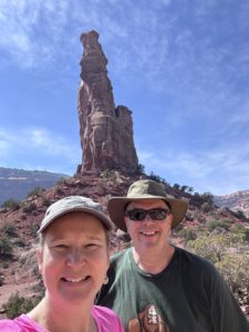
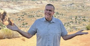
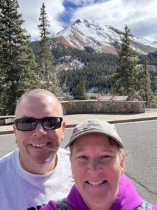
at the base of Independence Monument
If you’re thinking about moving to Grand Junction and want honest insight into what daily life is really like here, we share that on this site and we’re always happy to help answer questions.
Contact Paul for a tour of Fruita, Grand Junction or Palisade, or sign up for his real estate market updates if you want to learn more about properties in Mesa County.
Guest post by Michelle Aspelin
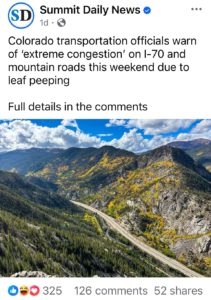
 Fruita, CO is the last stop in Colorado on I-70 before entering a long stretch with NO SERVICES on the way west to Moab. So get your drinks and go to the bathroom before you leave the area. There is one pit toilet as you cross the border and a rest stop with just bathrooms and a short hike up a hill if you need a little exercise.

 The first ¼ mile is the hardest. I was intimidated when I saw “rock scramble” in the reviews. Yes, we needed our hands, but we did it as novice hikers. We had Emma and Josh with us (daughter and son-in-law), and they were very encouraging and patient while we did our first scramble.
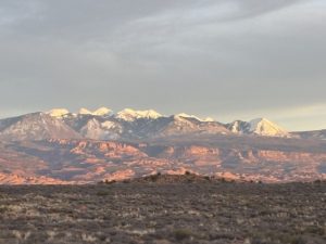
 Move to Grand Junction and Live Your Vacation Every Day!

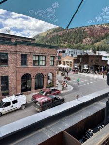
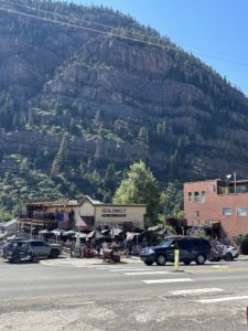
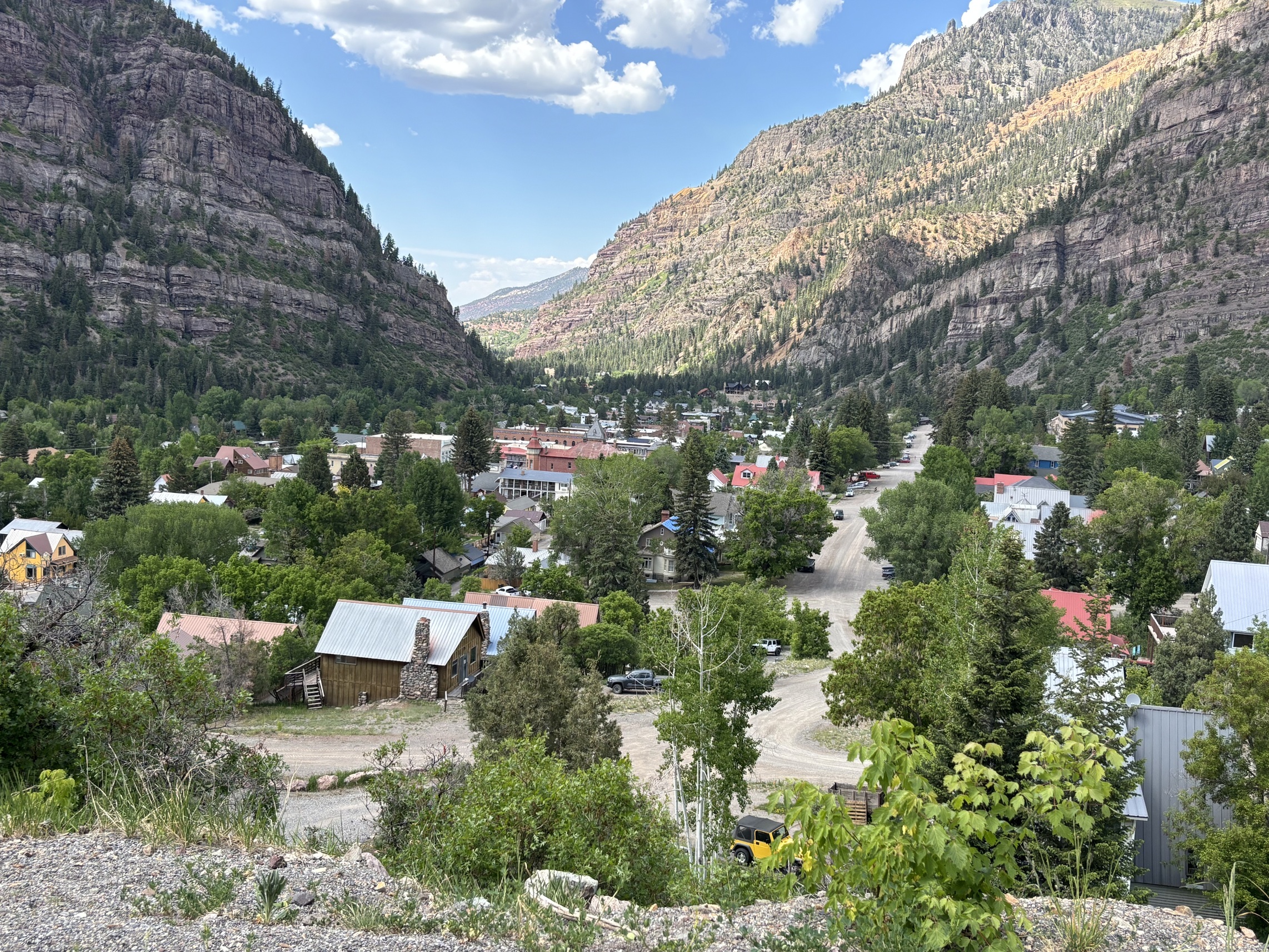
 What an amazing day trip to Telluride! What started out as just a Last Dollar Road Day Trip also included discovering where Last Dollar Ranch was, the house in the John Wayne movie True Grit, Ralph Lauren’s Double RL Ranch, Last Dollar Pass, Tom Cruise’s old neighborhood, the Telluride one runway regional airport and drinks on the roof of the Last Dollar Saloon. Oh yes, and an indescribable experience of a Mushroom Parade down the main street in Telluride! So unexpected, it left us speechless.
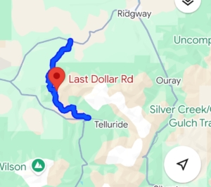
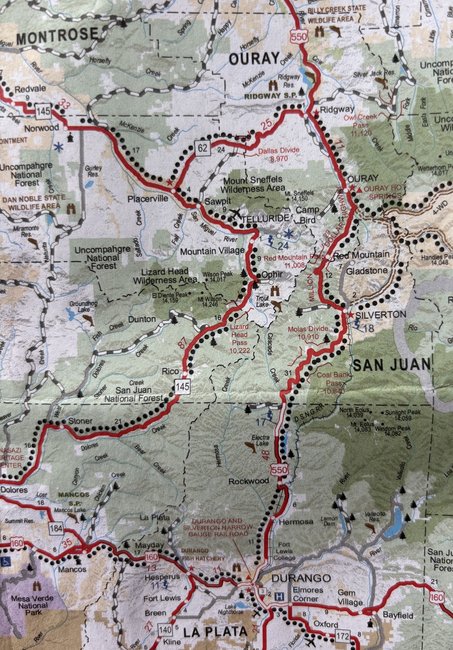
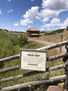 After the scenic overlook near Ridgway, we took a left onto CR-58P. There’s a sign for Last Dollar Road. The road is closed from January to May due to snow. This is where our Last Dollar Road day trip officially begins. The unpaved county road was wide and well maintained. Our first photo op was at Mattie Ross’ Ranch from the True Grit movie with John Wayne. True Grit was filmed in 1969 and begins and ends at the family ranch of young Mattie Ross (Kim Darby), which was filmed at a historic home on Last Dollar Road above Ridgway. In the final scene, John Wayne jumps his horse over a fence and rides off into the distance. The ranch house has been restored and remains private property. The scenery around it hasn’t changed much and is as gorgeous as it was then.
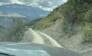
 Driving the Last Dollar Road: Narrow, Steep, and Stunning
 A Thrilling Descent into Telluride
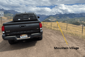 We continued our descent and popped out right at the
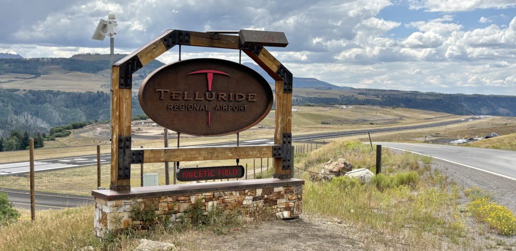
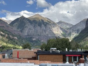
 The Mushroom Festival was unexpected and eye-opening. People were dressed up as mushrooms, wearing mushroom hats and other unique costumes. It’s a weekend festival described on their website as “A weekend of mushroom love, community connection and fungi everything. You can expect expert hosted forays to ID mushrooms in the great San Juan Wilderness, talks from world-renowned mycologists, a foundation of the fest rooted off psychedelics and its current resurgence, large community gatherings, culinary delights, dozens of mushroom vendors and of course the world renown Telluride Mushroom Festival parade. Every year the festival attracts 1000’s of fungi fans from across the world.”
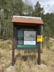 We sure loved our Last Dollar Road day trip. I think we will be talking about everything we experienced for years to come. We loved the gorgeous aspen forest with unobstructed views of Sneffels Mountain Range and Wilson Peak. The range of colors from brown, green, and red against the bright blue sky was so beautiful. I forgot to mention that we noticed some forest service road camp sites on the Telluride side of the pass. There were no bathrooms, water or other services along the trail. It’s as rustic as it gets. We loved seeing the large ranches on the Ridgway side and the views from the Last Dollar Pass at an elevation of 10,663 feet. If we had family or friends in town, we might drive to Telluride on the highway and just go up to the Last Dollar Pass from Telluride and back down again. That would take less time and still offer spectacular views. Until next time!
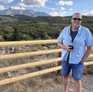
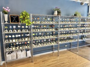
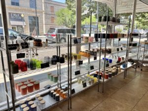
 I wanted to make small candles, so I went to Goodwill and bought a variety of small drink glasses for about $1.12 or $1.59 each. We also had some small fruit mason jars on hand. I took all 13 to Candle Kitchen GJ on a Saturday morning and made candles for my mom, sisters, nieces and nephews, my kids, and of course, a couple for myself. It was a blast!
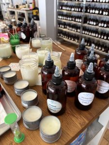
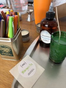 I started with the Margarita scent because it seemed like a great candle scent. From there I made candles with mountain smells like juniper, fir, spruce, pine, and sage. I made some with Palisade peach, pear, mango, eucalyptus, goji berry, jasmine, lavender, and lavender fields (slightly different). I used some unique scents like green tea too.
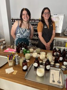 Nikki and Teagan were working that day and both were absolutely terrific. Helping me determine what might make a good blend. Nikki instructed me on the process, how I measure out my essential oils, checking the smell as I went along, then adding it to the hot wax in my jar and stirring it for a minute to make sure it blends with the wax.
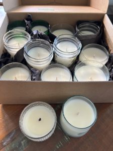 I came back two and a half hours later to pick up my hardened candles. They had cleaned the edges to make them look nice, straighten the wicks, and put a final glaze on the top to finish them off. Nikki applied the handwritten labels I had made to the bottom of each candle.