Silverton Day Trip from Grand Junction
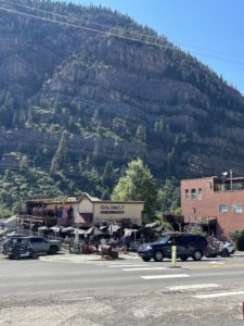
It was late October when we took our most recent Silverton day trip from Grand Junction. We have been there two other times and always enjoyed this calm, scenic mountain town.
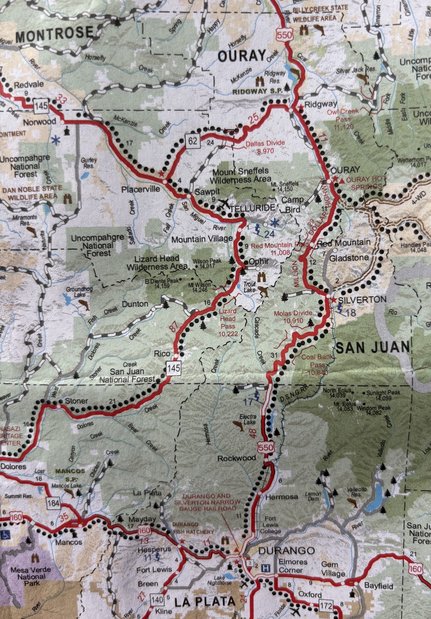
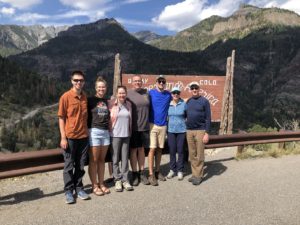
Our first experience in Silverton, CO was in 2021 when we drove from Arizona to Grand Junction to see our daughter on our way back to Minnesota. From Grand Junction we drove south along Hwy 550 to Durango. We hit many small towns in Colorado before turning north to Minnesota. That trip included our first experience on the Million Dollar Highway.
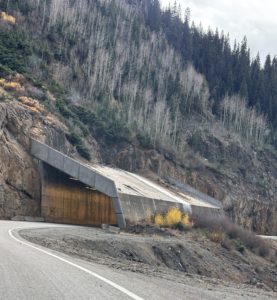
The Million Dollar Highway
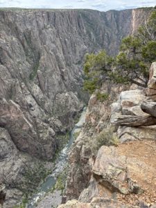
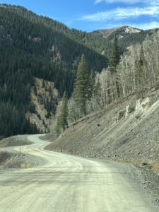
We didn’t do much research about the Million Dollar Highway our first time to Silverton. I thought it was all about the “million-dollar views”. Boy, were we surprised! Paul drove with white knuckles while I could barely look out the side window down the 1000’ cliff. We both watched the road as we twisted and turned along the side of the mountain and the cliff. No guardrails. Speed limit gets down to 15 mph because of the tight curves. Once we made it safely to Durango, I looked it up online and the first website to pop up was “Most Dangerous Roads” … gulp! I texted our daughter’s boyfriend at the time, Josh, and asked him about people dying on that road. And his reply, I remember to this day, “Yeah, about a dozen people die each year on that road but it’s mostly during the winter so you don’t really need to worry.” What?!?!?!
The second time we drove it was to give our relatives a chance to see Silverton and the Road while they were visiting. I sat behind the driver vs in the passenger seat, and it went much smoother. The most recent time was in October 2025 and this time we stopped along the way and really took in the experience. We are more comfortable driving on the mountain roads now. It was much more enjoyable. We went on a Sunday when the Broncos were playing, so there was hardly any traffic on the road which made a huge difference. The first time we drove it a semi carrying logging timber came around the corner and Paul practically came to a stop in his lane (we were only going about 15 mph anyway) until the semi passed and we both gave a sigh of relief.
Where is the Million Dollar Highway?
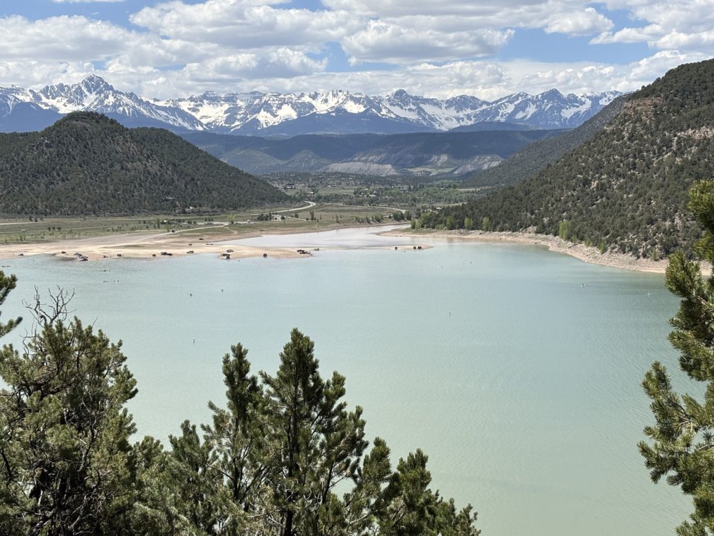
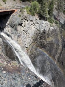
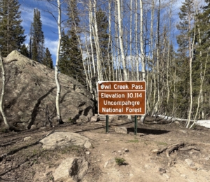
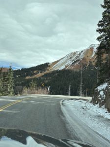
The Million Dollar Highway is officially the stretch of Hwy 550 between Ouray and Silverton, part of the larger San Juan Skyway that makes a big loop in SW Colorado. About halfway, you go over Red Mountain Pass (10,899 ft. elevation). It’s very beautiful. There are only parts of the road with the steep drop-offs and absolutely no shoulder. Other times it flattens out and gets wide as you go through a valley closer to Silverton. I think it’s something everyone should experience once. Just go slowly and only go in good weather without snow on the ground or rain so you can enjoy it. I feel like every day trip we take is like a mini vacation. We get so lost in the experience of it all, it’s a great break.

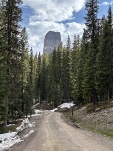
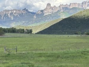
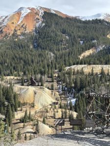
Red Mountain Pass and Yankee Girl Mine
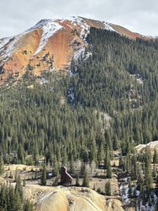
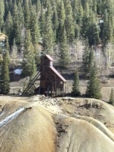
This is a stunning part of Hwy 550. There are actually 3 Red Mountains, named 1, 2 and 3 that stand out against the deep blue sky. There is a pullout near the top, on the north side of the pass that explains the multitude of mines in this area. It is there that we learned that the Yankee Girl Mine was one of the most profitable silver mines in the United States.
The Yankee Girl mine went nearly straight down to a depth of 1200 vertical feet. The remaining structure serves as a relic of the area’s rich mining history, and it was fun to photograph it. It was in operation from 1882 to 1890. The Yankee Girl Mine helped bring attention to the Red Mountain Mining District, which eventually became a significant mining area known around the world.
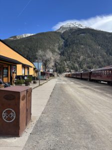
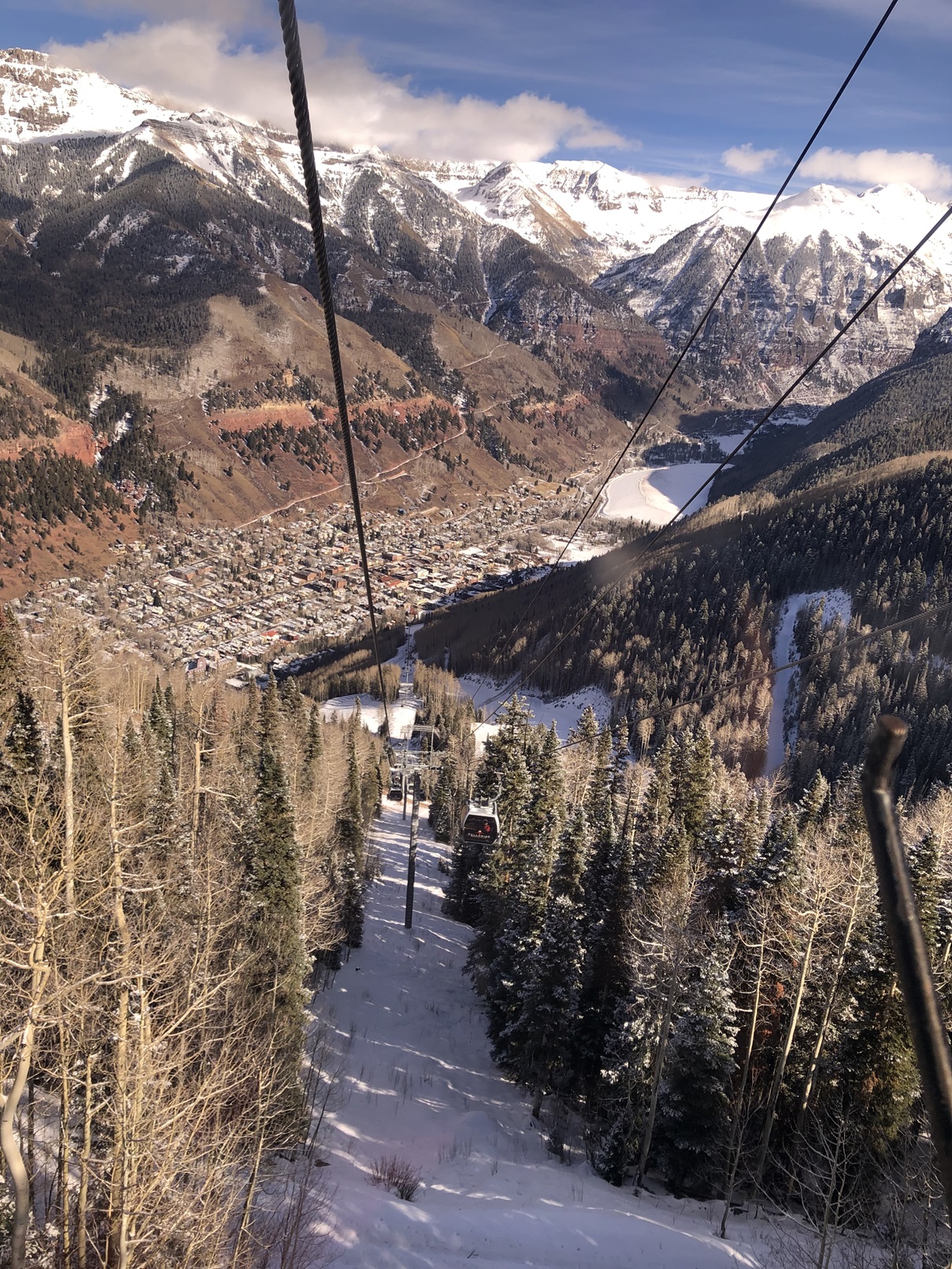
Silverton Durango Narrow Gauge Railroad
Another way to get to Silverton is to take the train north from Durango. The train drops passengers off in the downtown business district. There was a train at the station when we last visited. You can start your adventure when the train drops you off and visit the many shops, galleries, and restaurants. They offer a round trip from Durango with a 2-hour layover in Silverton or trips with an overnight stay in Silverton. There’s a special Polar Express experience during the holiday season. Get your tickets and more information at https://www.durangotrain.com.
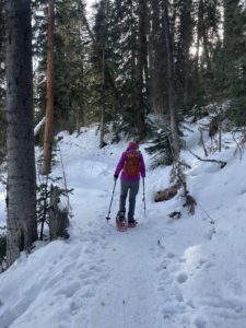
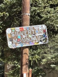
Silverton Mountain Backcountry Ski Area
Paul gets asked a lot by clients coming in from out of state about the closest place to downhill ski. We tell them about Powderhorn Mountain Resort on the Grand Mesa or Telluride Ski Resort. But did you know that Silverton has a chairlift? It’s at Silverton Mountain about 6 miles out of town. This is no ordinary resort, in fact, there is no resort at all. Just a chairlift.
Silverton Mountain describes the experience like this. “Imagine a place where the average total snowfall of over 400 inches exceeds the amount of daily visitors. Advanced and expert only riding, no groomers, no clearcut runs and a real mountain experience with plenty of adventure on tap. All thrills, no frills.” That’s right, we saw the chairlift but no clearcut ski runs through the trees. They offer heliskiing where a helicopter drops you off, up to six times in one day, to ski Silverton’s backcountry. Be sure to bring your own food and water. They rent ski and snowboard equipment suitable for the area. It’s open to the public Thursday-Sundays during the winter and spring ski season. Private heliskiing is available 7 days a week, including Monday through Wednesday when mountain operations are closed. Learn more at https://silvertonmountain.com.
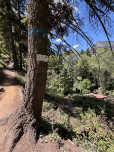
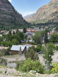
The Town of Silverton, Colorado
Ok, enough about getting to Silverton, let’s talk about what you can do while you are there for your Silverton day trip from Grand Junction. Silverton is a tiny, historic mountain town with a little over 700 residents. There are miles of ruggedly beautiful mountains surrounding the town that serve as their playground with great jeeping, hiking, biking, mountaineering, fishing, ATVing, and river running. It’s an official Colorado Creative District offering a vibrant arts community. They have outdoor music and many festivals and events during the summer months, including a farmers market in July, August and September.
The buildings are mostly classic Victorian era including the notorious Blair Street, home to bars, brothels and bunkhouses for the miners. It’s now home to shops, art galleries and restaurants, some with funky names. The main street is called Greene Street, and I think it’s the only paved road through town. It’s small but charming and welcoming. We ate at a saloon on Greene Street that still had a bullet in the wall behind the bar from the “wild west” days. The Silverton Cemetery attracts visitors during the day and even at night to experience some paranormal activities. Some buildings are said to be haunted as well. There are museums and mine tours to learn about the rich mining history.
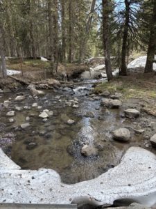
We saw a small grocery store. There are hotels and RV Parks with cabin rentals if you want to stay the night and continue your adventure. Maybe rent an ATV and do the Alpine Loop? There are loads of small creeks that lead into the Cement Creek, Animas River and Mineral Creek. The scenery is stunning everywhere you look, just like most of Colorado.
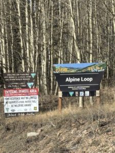
Access the Alpine Loop
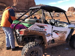
You can stay in Silverton and access the 63-mile Alpine Loop. From Silverton, the Alpine Loop connects with Lake City and there’s another access from Hwy 550 on the Million Dollar Highway that takes you to Ouray. ATVs are no longer allowed to drive through town, so you’ll need to trailer them up to a staging area or have someone drop you off for your adventure. Plan on a full day, or more, to drive the loop. The Alpine Loop is demanding, and you need to be prepared. The two 12,000-foot passes (Cinnamon and Engineer) require a high-clearance four-wheel-drive vehicle, but the well-prepared traveler reaps the rewards: pristine mountain views, abundant wildflowers, hiking and biking trails, great camping opportunities, and ample solitude in the heart of the San Juan Mountains.
These rocky roads were first used by 19th-century miners, who carted their ore to Silverton, Ouray, and Lake City in mule-drawn wagons. They weren’t built for automobiles. There are seven ghost towns along the loop. We’d like to see Animas Forks Ghost Town someday. Make sure someone knows your travel plans and do your homework before you start your trip. Be sure you have a full tank of gas and ample food and water supplies as there are no services along the Alpine Loop itself. Oh, and it’s closed in winter. We haven’t driven the loop, we just drove a small portion from Silverton and we went a few miles on it from Lake City. Someday we will rent ATVs and experience the full loop.
In Silverton, you can rent ATVs, golf carts, e-bikes, mountain bikes, go horseback riding and participate in guided hikes. There are all sorts of outdoor adventures you can take advantage of on a Silverton day trip from Grand Junction. I really enjoyed strolling the main street and going into the shops and galleries.
Book Recommendation
If you want to experience the 4×4 and jeeping backcountry roads in Colorado, I highly recommend the book by Charles A. Wells called “Guide to Colorado Backroads & 4-Wheel Drive Trails” and there is a “Northern” version for roads north of I-70. I was able to snag the book at a Friends of the Library book sale, and I purchased the northern version, a spiral bound book, but we haven’t ventured north of I-70 yet. The San Juans keep pulling us south.
The books categorize the trails by easy, moderate, or difficult. They include photos, detailed maps, and descriptions about what to expect at what mile point along the trail. It helps keep us out of trouble. We stick to the “easy” roads. However, we took one 4×4 only trail in our Tacoma, Washington Gulch, to get us to Emerald Lake from Crested Butte. THAT was amazing but we got lucky. That particular road wasn’t in the book, and I think it was definitely a moderate trail. Not good for our first experience! Ask Paul to tell you the story about our trip and what the lady at the Visitor Center advised us to do! Lesson learned, do your own homework first and know your limits.
There are plenty of adventures beyond a Silverton day trip from Grand Junction that you can enjoy within 2–3 hours of the Grand Valley — and the journey is always stunningly scenic. I hope you enjoyed this post about our Silverton day trip. If you want us to write about other Grand Junction day trips, let Paul know. There is so much to see and do in Grand Junction and the surrounding mountain and desert communities. Paul has lots of stories he can share.
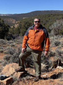
Red Mountain Pass mining district overlook
If you are considering moving to Grand Junction, Paul will give you a tour when you first come for a visit. Learn more About Paul and how he’s been serving his clients since 2001.
Live Your Vacation in Grand Junction!
Follow us on Facebook:
https://facebook.com/LiveYourVacationinGrandJunction
Guest Post by Michelle Aspelin
growyourmindshare.com
Connect with Michelle on LinkedIn
© 2025 Paul Aspelin, REALTOR® MovetoGrandJunction.com and Michelle Aspelin. Copyright protected. All Rights Reserved.