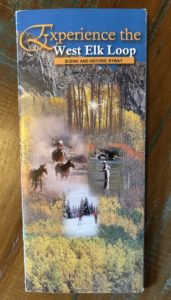
Day Trips from Grand Junction: North Rim of the Black Canyon of the Gunnison National Park
If you’re based in Grand Junction and looking for an unforgettable day of hiking, the North Rim of the Black Canyon of the Gunnison National Park is a must-see adventure.
I’ve read a few places that claim the Black Canyon of the Gunnison National Park is the least visited National Park. It’s not because it lacks facilities and features like camping and hiking and an astounding 2000’ deep canyon. I think it’s because it’s located a little off the beaten path. Not along a major Interstate highway. To go to the main South Rim Visitor Center, you enter from Montrose and get access to the west side of the river.
Get notifications about new posts and watch my short videos on my Facebook page called Live Your Vacation in Grand Junction.
Drive to the North Rim Ranger Station

click to enlarge
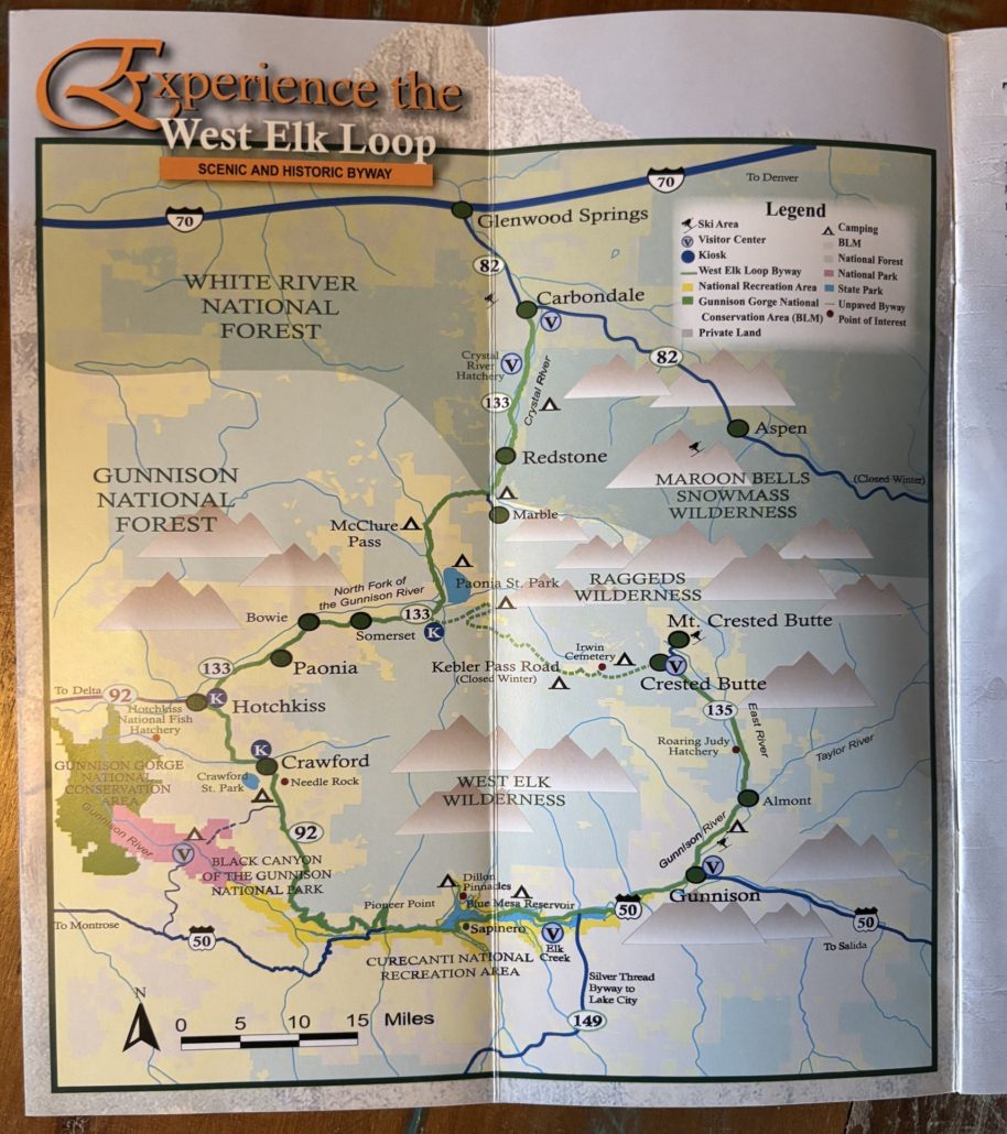
To access the North Rim of the Black Canyon of the Gunnison National Park, like we did for this post, you take a different route to reach the north and east side of the canyon. From Grand Junction, it’s about a 2-hour drive to the North Rim. From town, go south on CR-50 to Delta, east on 92 to Hotchkiss. Continue on CR-92 south to Crawford. This is part of the West Elk Loop Scenic and Historic Byway.
Use your mapping software to get you to the North Rim Ranger Station. The paved road turns into gravel for the last 6 miles or so, but it’s very manageable in any vehicle. Download any hiking trail maps because you most likely will not have cell service in this area.
Exclamation Point Hike
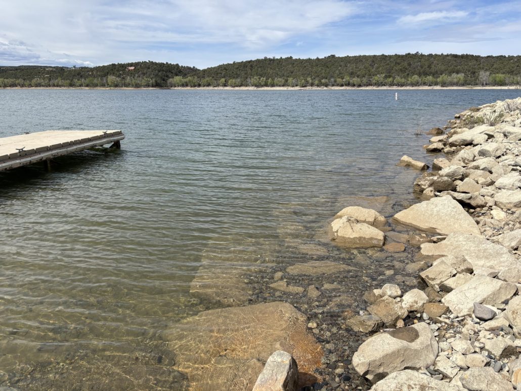
We parked at the Ranger Station and took the Vista Trail to Exclamation Point and back. The hike took us through an open meadow with so many flowers, then patches of trees that offered us some shade. We continued to the end, a cliffside overlook that looks down on the Gunnison River 2700’ feet below us. It was absolutely amazing. One of my top 5 best hikes so far.
We went in mid-May so the wildflowers were in bloom. The temperature was comfortable in the 70’s. The trail is listed as easy but there are a couple challenges where you need to pay close attention to your footing. Mostly sandy or gravel trails, sometimes rocky, but not much. Wear hiking boots/shoes if you have them. Hiking poles may come in handy, but we don’t have any and did just fine.
We hiked at a leisurely pace and stop frequently to just look around and soak it all in. We typically stop at the end for a snack before heading back. This trail is 2.9 miles out and back with a 344 ft elevation gain and it took us about an hour and 45 minutes to complete it. The All Trails apps says average time is one hour 10 minutes.
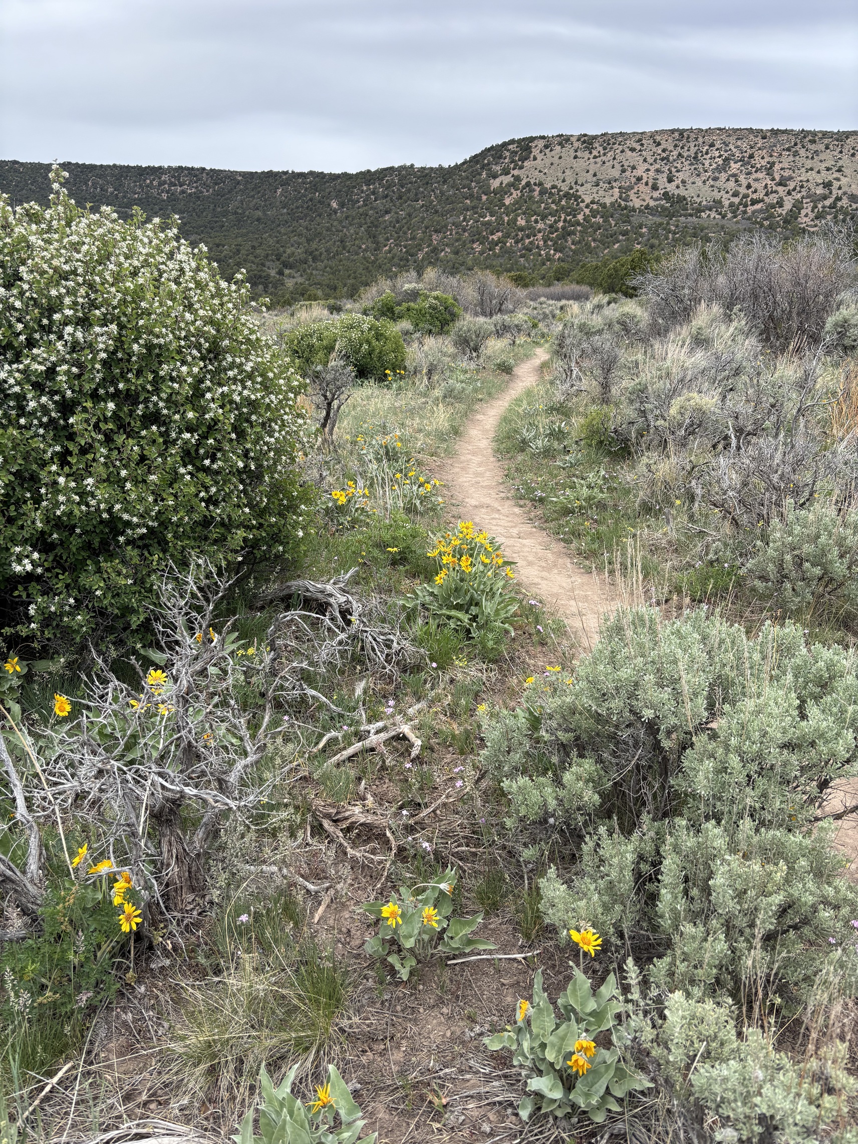
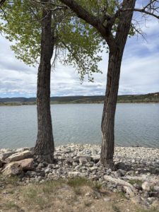
Vista Trail flowers and meadow
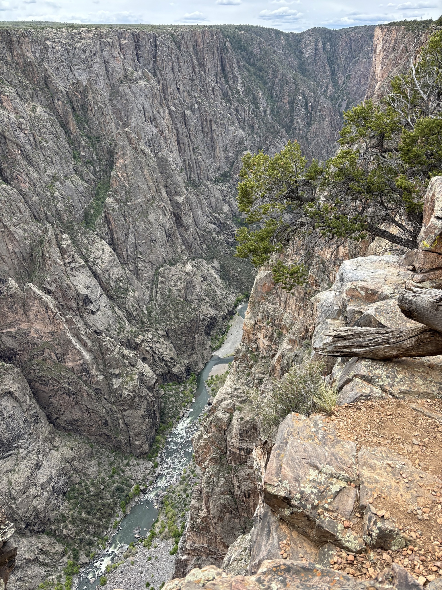
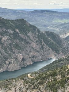
North Rim Exclamation Point view to Gunnison River
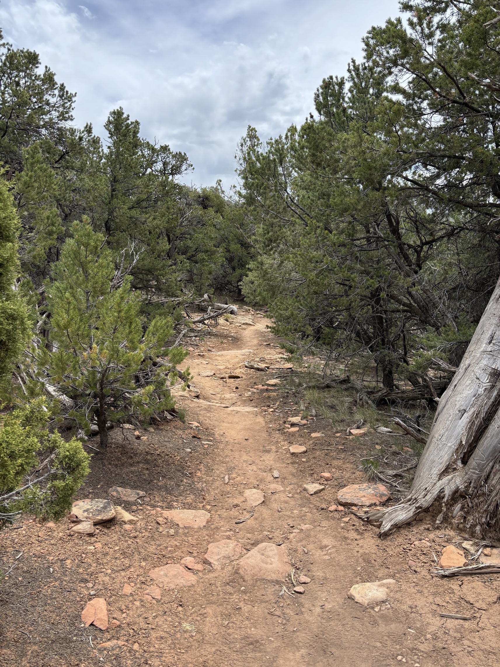
Vista Trail to Exclamation Point
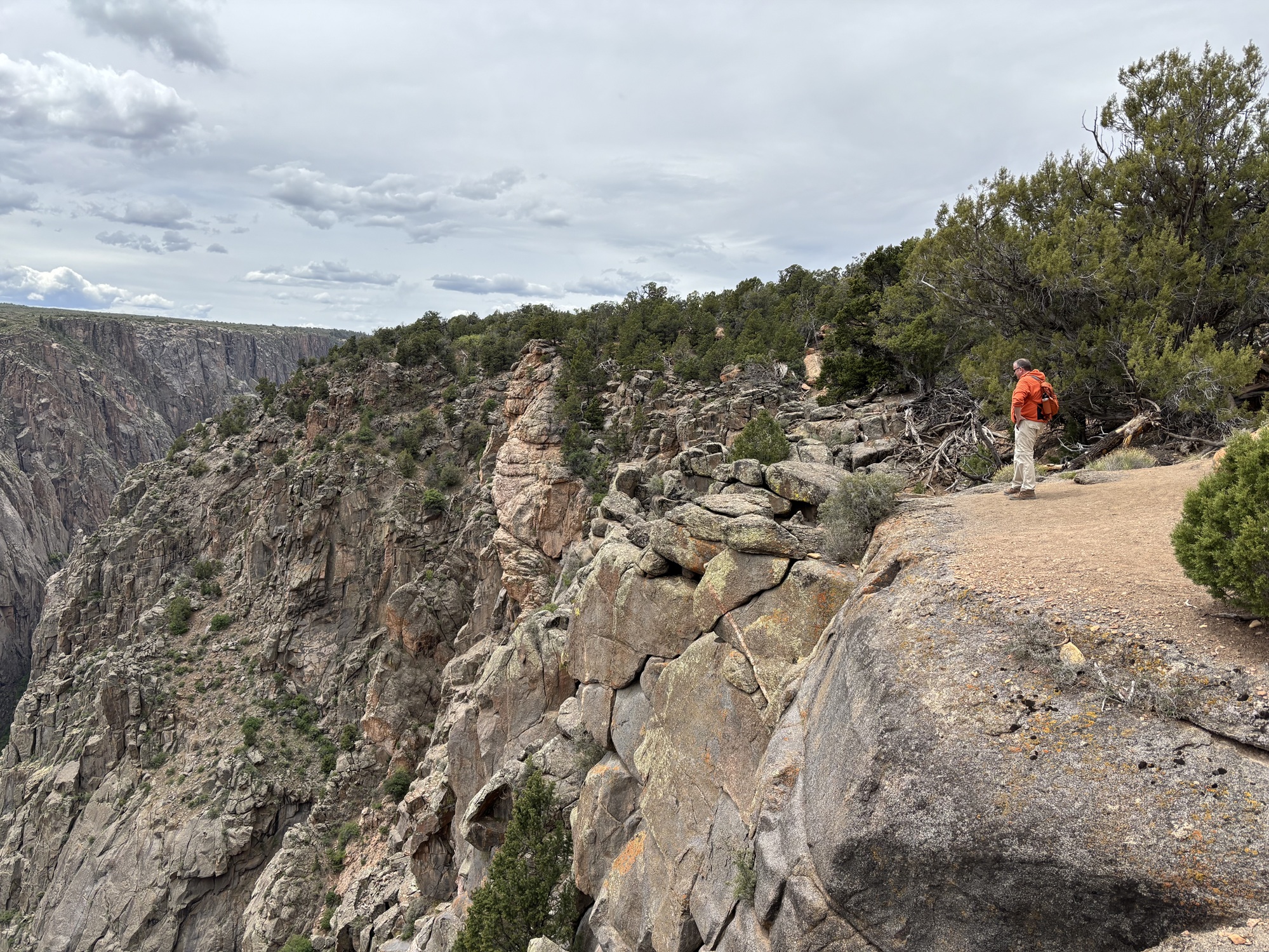
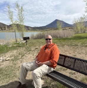
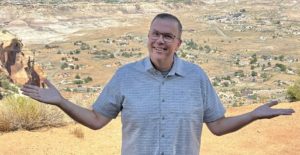
Me at the Overlook before we reached Exclamation Point
More to see
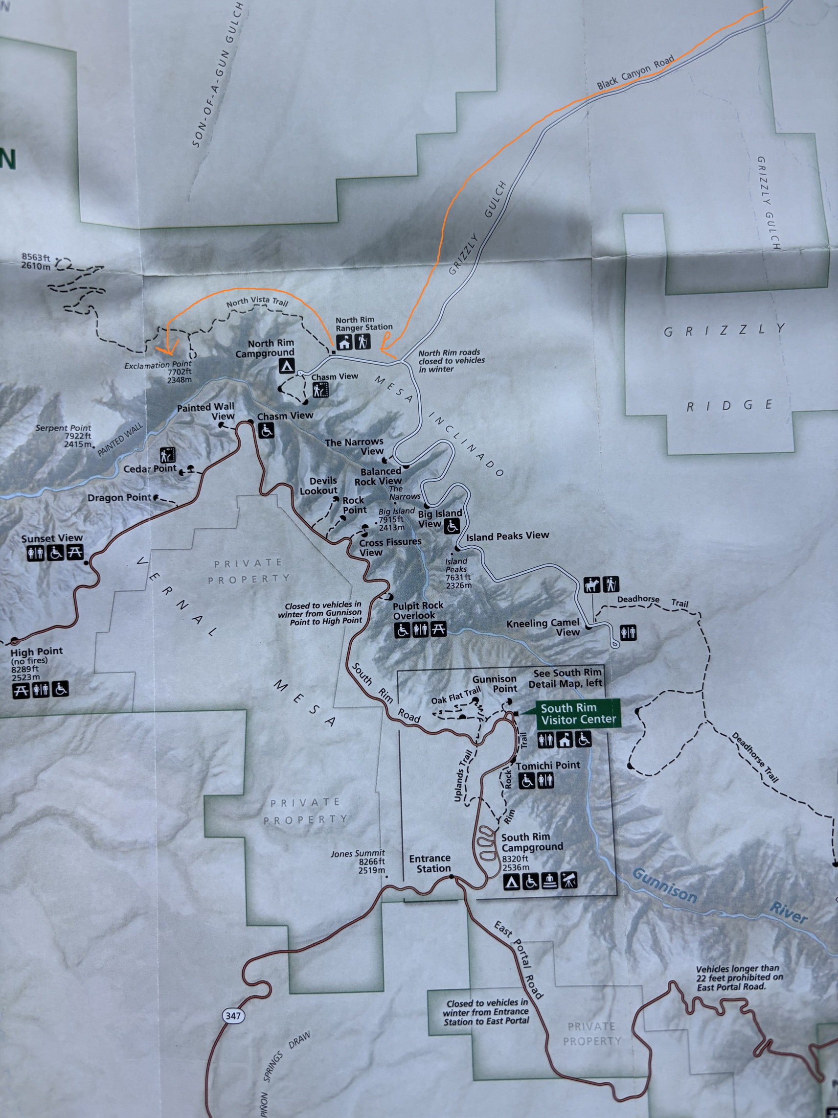
From the North Rim Ranger Station you can drive south along the canyon rim for more overlooks and hiking trails. There is a campground on the North Rim.
You need a permit to hike down to the river’s edge and some extreme skills to handle the elevation change and steep slopes.
You can read more about the main Visitor Center and the South Rim Black Canyon of the Gunnison on my Top Day Trips from Grand Junction post.
Amazing Views on CR-92 South of Crawford, CO
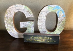
Because we first stopped at the Crawford State Park Visitor Center, we got some excellent advice from the volunteers working that day. They recommended, instead of driving back to GJ the way we came, to continue south on CR-92 following the Gunnison River canyon and take Hwy 50 west into Montrose and back to Grand Junction. Because we have a decorative sign in our home that says, “always take the scenic route”, we did just that! Boy was that stunning! So many overlooks along the road, even some rumble strips to remind drivers to keep their eyes on the road. You can read my post about the Crawford State Park.
There were so many aspen trees. We plan to go back in the fall because we anticipate this to be a great place to see the fall colors. At their suggestion, we also stopped at Hermits Rest Vista. So thankful we did. More amazing views of the nearby mountains and the Gunnison River far below. We will bring friends to this spot when they come for a visit!
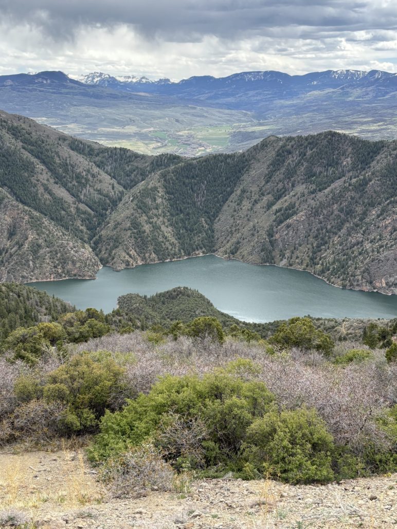
Gunnison River from Hwy 92 near Hermits Rest Vista
Live Your Vacation Every Day… Move to Grand Junction!
If you are considering moving to Grand Junction, please give me a call. I’d love to explain your housing options and show you around Grand Junction, Fruita, and Palisade.
Watch my short videos on my Facebook page called Live Your Vacation in Grand Junction.
PAUL ASPELIN, your Grand Junction Relocation & Listing Expert
REALTOR®, GRI, SRES®, CNE
Text or Call (612) 306-9558
Connect with me on LinkedIn or send me an email.
Serving Mesa County and the Grand Valley of Colorado.
© 2025 Paul Aspelin, REALTOR®. MovetoGrandJunction.com Copyright protected. All rights reserved.
 We have a Colorado State Park Pass. We got our pass when we renewed our license tabs for our Toyota Tacoma. It’s less expensive to get your state park pass with your car tabs.