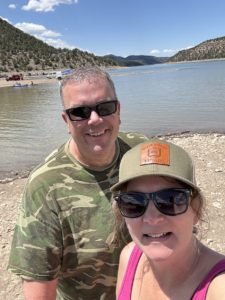
Guest Post by Michelle Aspelin
Follow Live your Vacation in Grand Junction on Facebook and Instagram
Follow Move to Grand Junction on YouTube
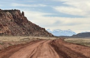
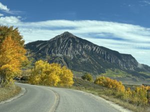
What’s Moab?
Before we can talk about the many adventures near Moab, first you might be asking “Where is Moab, Utah?” I can still remember the first time we heard the word “Moab”. We were standing at the Colorado Mesa University booth at the College Fair at our local high school in Chanhassen, MN. The 2 representatives were raving about going to Moab for the weekends and all they had access to in relation to outdoor activities. Then went on and on, our eyes got wide, so did our oldest daughters. She eventually attended CMU for college and we moved here. Needless to say, what those representatives said that day changed the course of our lives, for the better.
At first, we thought Moab was some adventure park, an entertainment venue to visit. We slowly realized it’s the name of the popular adventure town, in a remote area of SE Utah, but only 90 miles from Grand Junction. My daughter jokes it’s just an hour away. The speed limit on I-70 in Utah is 80 mph…
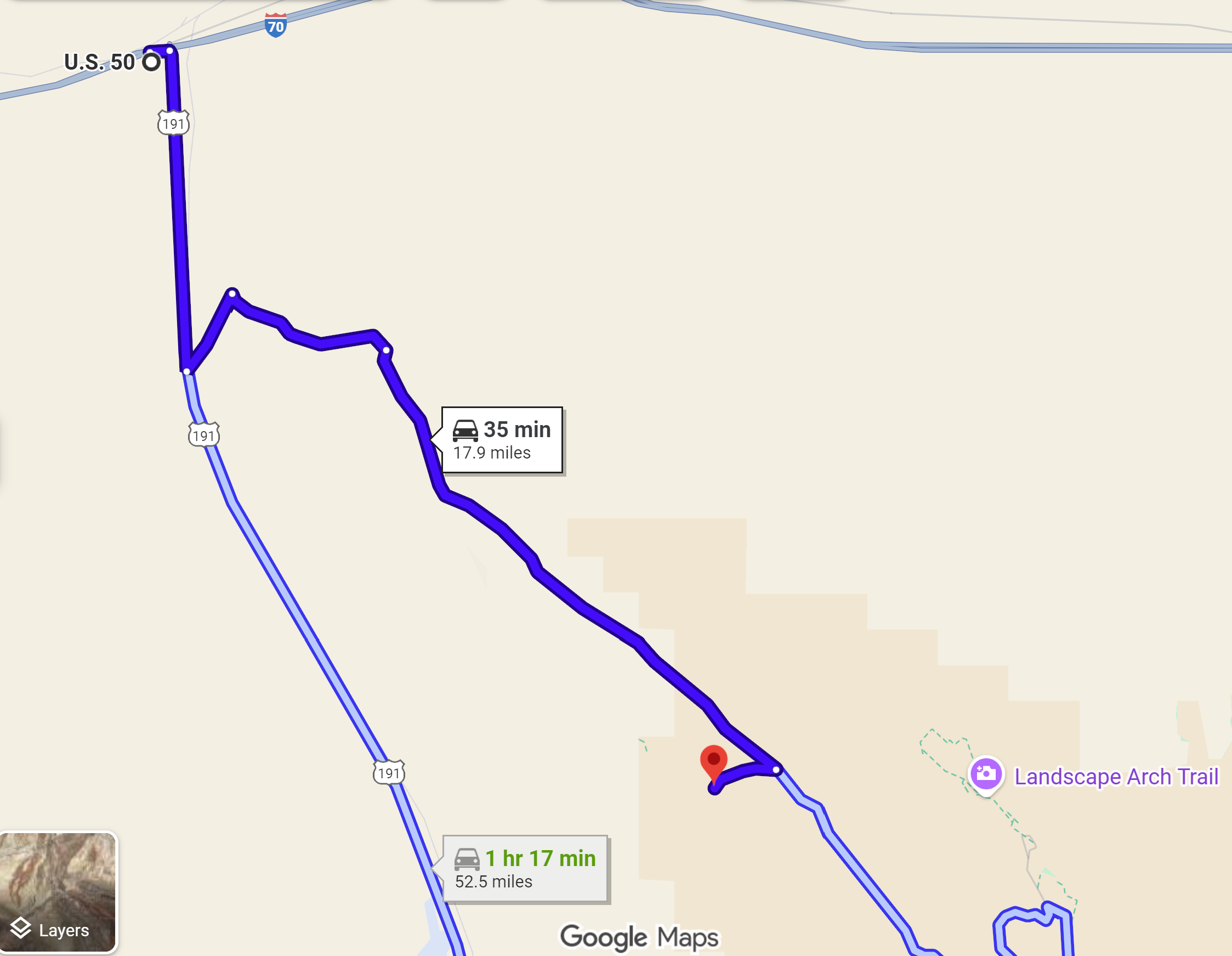
Two Ways to Get to Moab, Utah
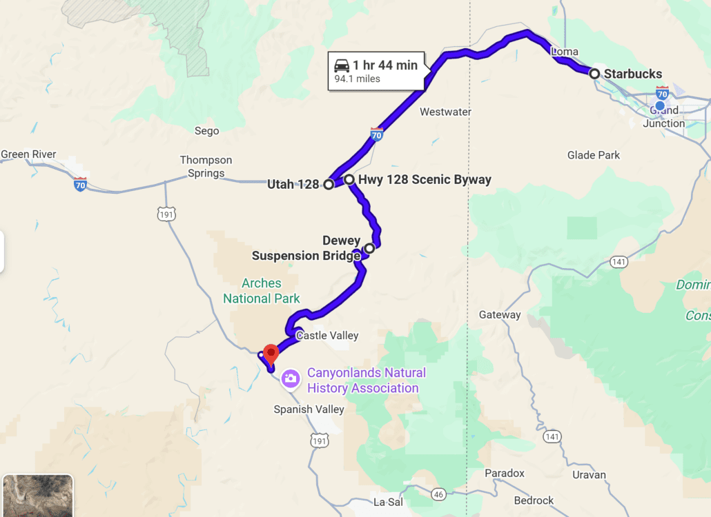
The Fastest Route
 Fruita, CO is the last stop in Colorado on I-70 before entering a long stretch of NO SERVICES exits on the way west to Moab. So get your drinks and go to the bathroom before you leave the area. There is one pit toilet as you cross the border and a rest stop with just bathrooms and a short hike up a hill if you need a little exercise.
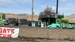
Stay on I-70 until Exit 182/Hwy 191. Go south on Hwy 191 about 32 miles and you will arrive in Moab. There are two gas stations at exit 182, the funky one with the Mystery Machine from Scooby Doo parked out front, and a new Golden Gate gas station.
The Scenic Route
If you want the most scenic entrance into Moab from Grand Junction, take the earlier Exit 204 on I-70 near Cisco. Look for Hwy 128 Scenic Byway and go South. There are two exits on I-70 to get onto Hwy 128, the first one is very bumpy gravel road with lots of dips and potholes, but it does go through “the town” of Cisco (it has a General Store and that’s about it). We prefer the second exit, #204, and backtrack a little. Once on Hwy 128 it’s beautiful. You are approaching the La Sal mountains as you drive along shore of the Colorado River. We did a river float into Moab that left from a landing in Cisco. Hwy 128 intersects with Hwy 191, turn left, and you’ll be in the town of Moab.
Things to Do in Moab, Utah
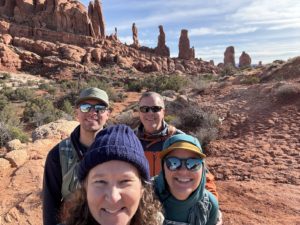
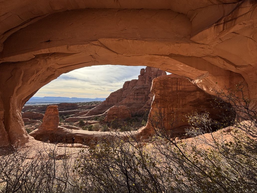
Josh, Paul, Emma and Michelle hiking to Tower Arch in Arches National Park
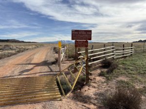
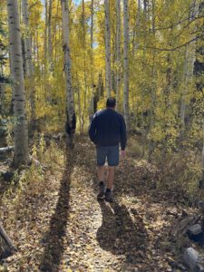
1 – The most popular thing to do in Moab is to experience Arches National Park. We have been there several times. An easy drive in, drive out on the same road. It’s 18 miles from the Visitor Center to the end. Lots of trails and arches along the way, many very close to the road. For 2026, now you don’t need timed-entry reservations!
See our post about the time we took the 4×4 back door into Arches to hike to Tower Arch.
If you want to read about more moderate and difficult hikes in Arches, I suggest you read the advanced guide to hiking in Arches National Park, written by our daughter, Emma Aspelin. On her blog, Emma Gets Outside, she goes into depth describing multiple hikes in Arches, including the hike to the iconic Delicate Arch, which we have not done. She writes about easy, moderate, and difficult hikes. You won’t find us writing about difficult hikes on this blog. She’s way more experienced than we are.
Tip: Did you know the second largest concentration of arches is in Colorado? Yup, you don’t need to drive to Utah to see them, check out Rattlesnake Arches Trail on the All Trails app, we did the hike, it was stunning! It’s in the McInnis Canyons National Conservation Area.
2 & 3 – Second most popular is Canyonlands National Park. Looking down over a 1000 feet or more to the river below is outstanding. There are many cool sites and overlooks that will take your breath away. Our daughter got married near Canyonlands. THAT was incredible! Here’s how the National Park Service describes Canyonlands…
“The Colorado and Green rivers wind through the heart of Canyonlands, cutting through layered sandstone to form two deep canyons. In stark contrast to the hot, sunny desert above, the river corridors are remarkably green, shady, and full of life. Both rivers are calm upstream of The Confluence, ideal for canoes, kayaks and other shallow watercraft. Below The Confluence, the combined flow of both rivers spills down Cataract Canyon with remarkable speed and power, creating a world-class stretch of whitewater.”
Dead Horse Point State Park is near Canyonlands and is worth the drive too. Amazing views, especially the night sky! Read more on that below.
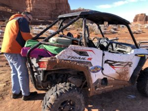
Muddy November ride near Moab
4 – After that, I imagine it’s all of the mountain bike and ATV/jeep trails that attract most people to experience adventures near Moab. We rented a side-by-side ATV and followed the trails one day, stopped for lunch, got a little muddy as it was in November, but we had a blast! I highly recommend doing that. We mention this experience in our Day Trips from Grand Junction post too.
“Jeep Week” is a 9-day event in the spring known as Easter Jeep Safari that attracts thousands of 4×4 enthusiasts. Thankfully, there is a lot of BLM land around Moab for free camping and overlanding to accommodate the influx of jeep owners. We were there once during this event; the town was super busy!
Tip: You do need to go online and take a safety test and get a certificate before you can drive an ATV in Utah. It’s called a Non-Resident OHV permit, here’s the link for more information, Utah Division of Outdoor Recreation. https://recreation.utah.gov/off-highway-vehicles/ohv-registration-and-permits/non-resident-ohv-permits/
5 – The town of Moab itself is full of unique shops, gear for purchase or rental, ATV/UTV/mountain bike rentals for all your adventure needs. There are plenty of hotels, motels and campgrounds. Lots of dining options, Pasta Jays is one of our favorites for Italian food. We had a delicious traditional Thanksgiving meal on Thanksgiving at the Moab Brewery. A good time for ATVing because it’s not so hot. Lots of guide services for a variety of adventures near Moab.
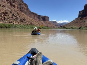
Paul and I floating down the Colorado River approaching the La Sal Mountains
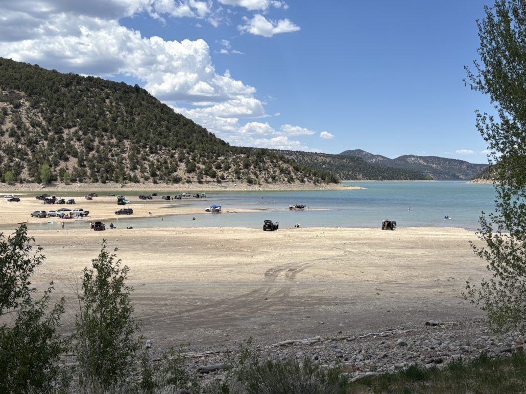
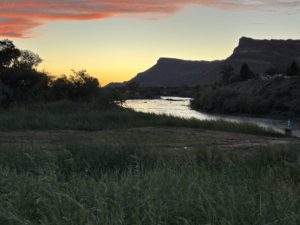
6 – The Colorado River is another top attraction. There are river boat guided trips you can take or launch your own paddle board, canoe, or kayak and float down the river through calm waters or rapids. There are river cruises day and night, and a couple of jet boat outfitters too if you’d like a fast ride on your vacation in Moab. We launched our rubber rafts, called duckies, near Cisco and paddled towards Moab, pulling out near the campgrounds along Hwy 128 Scenic Byway.
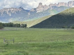
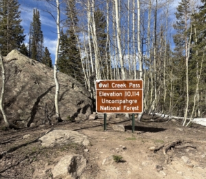
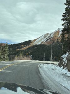
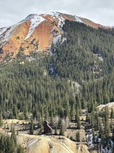
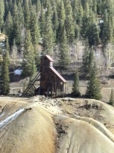
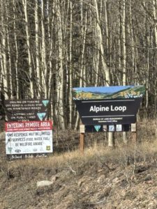
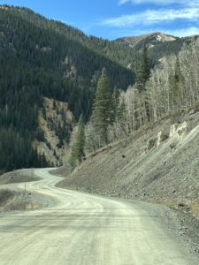
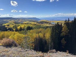
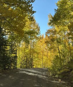
7 – If you’re going to be in the area for a few days, I highly recommend you drive the loop up into the La Sal Mountains. A “cool” adventure near Moab because the temps are normally lower in the mountains. It’s a 60-mile scenic drive from red-rock canyons to alpine peaks with breathtaking views year-round.
From Moab, head south on Hwy 191 approximately 8 miles and turn left at the Ken’s Lake/La Sal Mountain Loop Road sign. Take a right at the T-intersection and follow La Sal Mountain Loop Road up into the mountains. The road winds through the mountains and descends via switchbacks towards Castle Valley. At the intersection with Forest Road 207, take a left to get to Castle Valley and continue for about 10 miles. Take another left at the Hwy 128 intersection to return to Moab.
Plan about 3 hours to drive the stunning loop, depending on the number of stops you make to soak it all in. We saw some cool mountain cabins up there. It would be fun to rent one of those on a future trip to the Moab area.
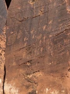
Petroglyphs near “Wall Street” Moab, UT
8 – Canyoneering and rock climbing are very popular in Moab too. We’ve noticed climbers several times on our trips. When you drive past Wall Street Climbing Area on Potash Road there are usually climbers there. We stopped there along that stretch of road to see the Petroglyphs. You get on Potash Road from the main Hwy 191. It’s the same road that takes you to the trailhead of the Corona Arch hike I mention below. There are several places that offer horseback riding too.
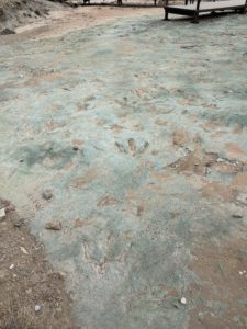
Dinosaur Tracks!
9 – Dinosaur Tracks. We went to the Mill Canyon Dinosaur Tracksite twice. I was amazed that the dinosaur tracks are just there, out in the open. Sure, there is a little fence to keep the critters out, but otherwise there is a simple boardwalk that takes you right up to the tracks. It is amazing and an easy side trip just 15 miles north of Moab off Hwy 191. Go there when you want to see something very cool, and it’s free.
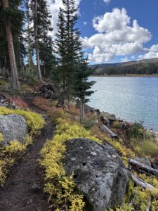
10 – If you want to do some hiking away from the crowds, consider hiking Corona Arch. It’s a scenic hike with views of a large arch at the end. There’s quite an elevation gain at the beginning, and a few challenges like climbing a metal ladder and holding a safety chain along a ledge. We went slow and felt very proud of ourselves for doing the moderate 2.4 mile out and back hike. After our hike, we snagged a spot in the nearby campground under a tree to get some shade and had a picnic lunch. Bring plenty of water, there’s hardly any shade along the trail and it can get hot in the summer.
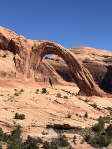
Corona Arch
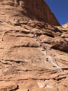
Corona Arch chain section
11 – There are several International Dark Sky Parks in Utah. In fact, the Dead Horse Point State Park Scenic Overlook is credited as one of the most photographed scenic vistas in the world! Moab is home to some of the darkest night skies anywhere. Get amazing views of the stars and the milky way. Arches and Canyonlands are International Dark Sky Parks too. Both Arches and Dead Horse Point offer ranger-led night sky activities.
We haven’t stayed here, but it’s on our list. Under Canvas Moab is one of the world’s first Dark Sky resorts where you can experience the wonders of the night sky. Glamping at this upscale, outdoor hospitality location is available generally March through October in their amazing safari inspired canvas tent accommodations. Located just 7 miles north of Moab. Here’s more info: https://www.undercanvas.com
Your Moab Adventure Awaits
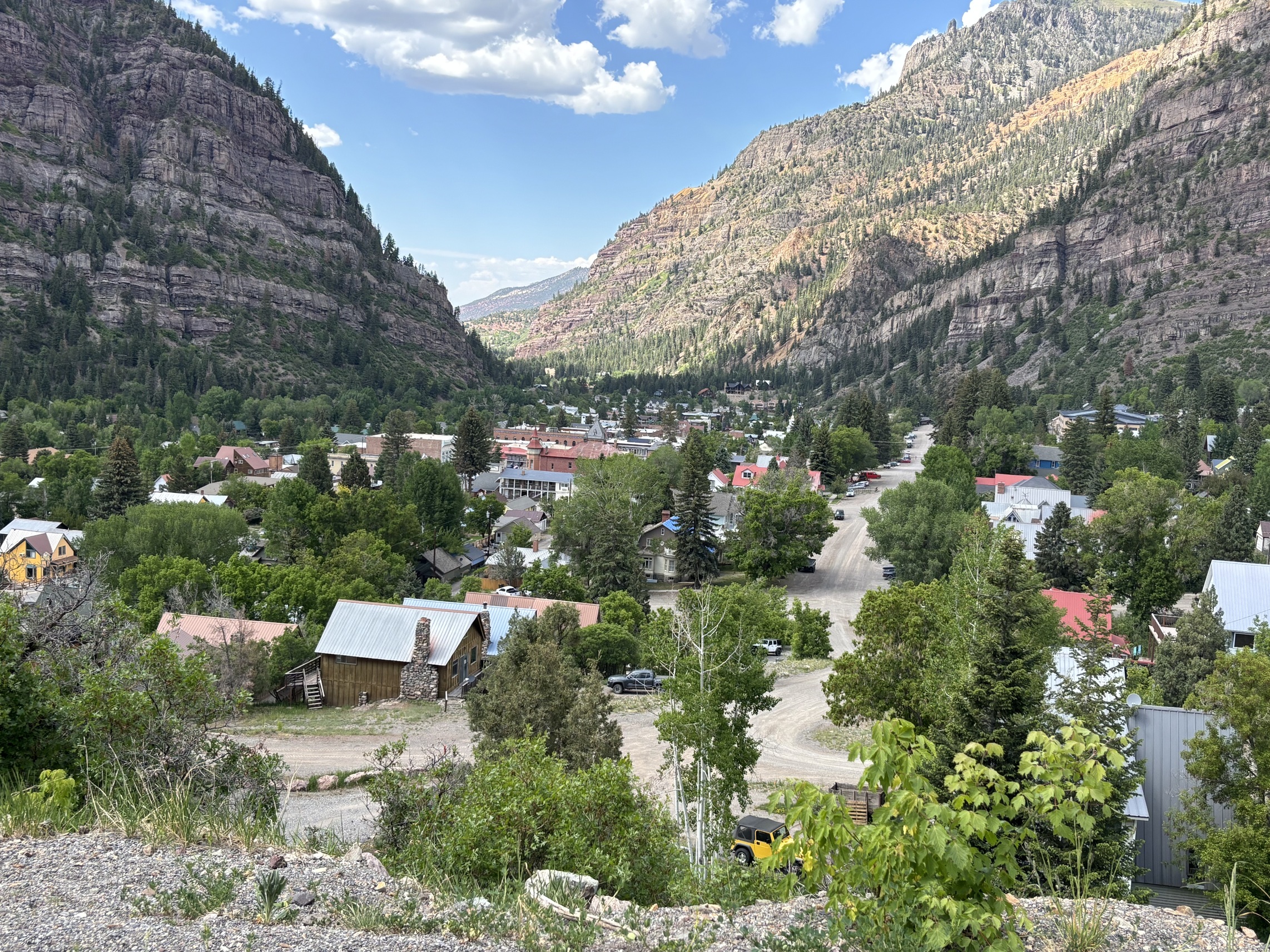
Every time we go to Moab, UT we find something new to do. There are so many adventures near Moab for every skill level and adrenaline desires. On our return trip one time, we headed south out of town, turned east and went over the La Sal Mountains, then ventured on to Telluride, then back to Grand Junction. That was a cool drive. It was November, light snow, the mountains were gorgeous.
Day Trips from Grand Junction
We have written about many day trips from Grand Junction. Going to Moab, Utah is one we do frequently because it’s so close and usually I-70 doesn’t get shut down west of here! We feel like we are living a vacation all the time. People spend a lot of time and money to travel to destinations that, for us, are just a 1–2-hour drive from Grand Junction.
If you want us to write about local attractions or other areas of interest, let Paul know. There is so much to see and do in Grand Junction and the surrounding mountain and desert communities. Paul has lots of stories he can share.
If you are considering moving to Grand Junction, Paul will give you a tour when you visit the Grand Valley. Learn more about Paul and how he’s been serving his clients since 2001. Email Paul.

Thanksgiving Dinner at Moab Brewery
Live Your Vacation in Grand Junction!
Follow us on Facebook: https://facebook.com/LiveYourVacationinGrandJunction
Connect on Instagram: https://www.instagram.com/liveyourvacationingj
Guest Post by Michelle Aspelin
growyourmindshare.com
Connect with Michelle on LinkedIn
© 2026 Paul Aspelin, REALTOR® MovetoGrandJunction.com and Michelle Aspelin. Copyright protected. All Rights Reserved.
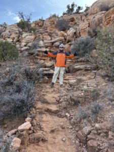
 The first ¼ mile is the hardest. I was intimidated when I saw “rock scramble” in the reviews. Yes, we needed our hands, but we did it as novice hikers. We had Emma and Josh with us (daughter and son-in-law), and they were very encouraging and patient while we did our first scramble.
 Move to Grand Junction and Live Your Vacation Every Day!
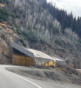

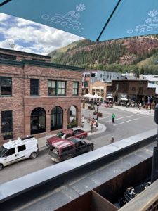
 What an amazing day trip to Telluride! What started out as just a Last Dollar Road day trip also included discovering where Last Dollar Ranch was, the house in the John Wayne movie True Grit, Ralph Lauren’s Double R Ranch, Last Dollar Pass, Tom Cruise’s old neighborhood, the Telluride one runway regional airport and drinks on the roof of the Last Dollar Saloon. Oh yes, and an indescribable experience of a Mushroom Parade down the main street in Telluride! So unexpected, it left us speechless.
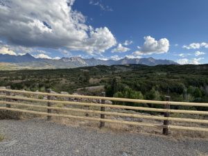
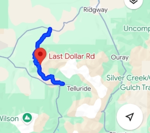
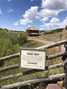 After the scenic overlook near Ridgway, we took a left onto CR-58P. There’s a sign for Last Dollar Road. The road is closed from January to May due to snow. This is where our Last Dollar Road day trip officially begins. The unpaved county road was wide and well maintained. Our first photo op was at Mattie Ross’ Ranch from the True Grit movie with John Wayne. True Grit was filmed in 1969 and begins and ends at the family ranch of young Mattie Ross (Kim Darby), which was filmed at a historic home on Last Dollar Road above Ridgway. In the final scene, John Wayne jumps his horse over a fence and rides off into the distance. The ranch house has been restored and remains private property. The scenery around it hasn’t changed much and is as gorgeous as it was then.
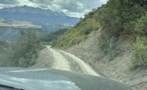
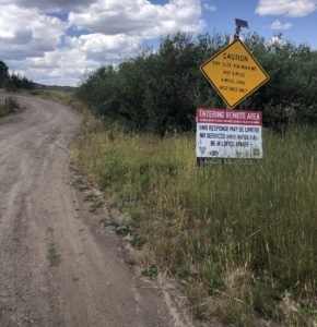 We left the county road and that’s where it got narrower, steeper, and rockier. We chuckled when we saw this warning sign. Luckily, we chose to drive the Last Dollar Road during dry conditions in August. It was amazing. We went through aspen groves, spruce-fir forests and open meadows with sweeping views. The road is very rutted due to snowmelt run-off down the mountain side. We drove about 5-10 miles per hour, sometimes using 4-wheel-drive Low to climb some steep slopes. We waited for cows to move off the road once. Didn’t pass any cars on the way up, up, up to Last Dollar Pass. Each bend in the road delivers jaw-dropping scenery.
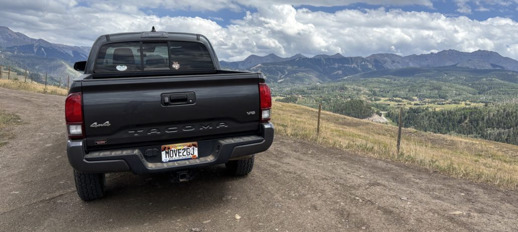
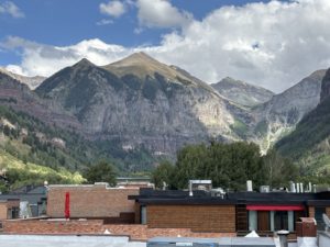
 After this we started our decent into Telluride. We hit a narrow stretch, wide enough for just one vehicle on this two-way shelf road. A few minutes later we passed a Jeep, and they rolled down their window to ask, “What road is this?” I answered the Last Dollar Road. The 75-year-old driver smirked and said, “I’m glad to hear you say that. We weren’t sure we were on the right road!” He drove off with his lovely wife. We smiled. They were more clueless that we were, but they were “doing it” at their age. That is why we take these trips while we can. While we are healthy and able to appreciate this beautiful state.
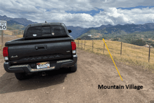 We continued our decent and popped out right at the
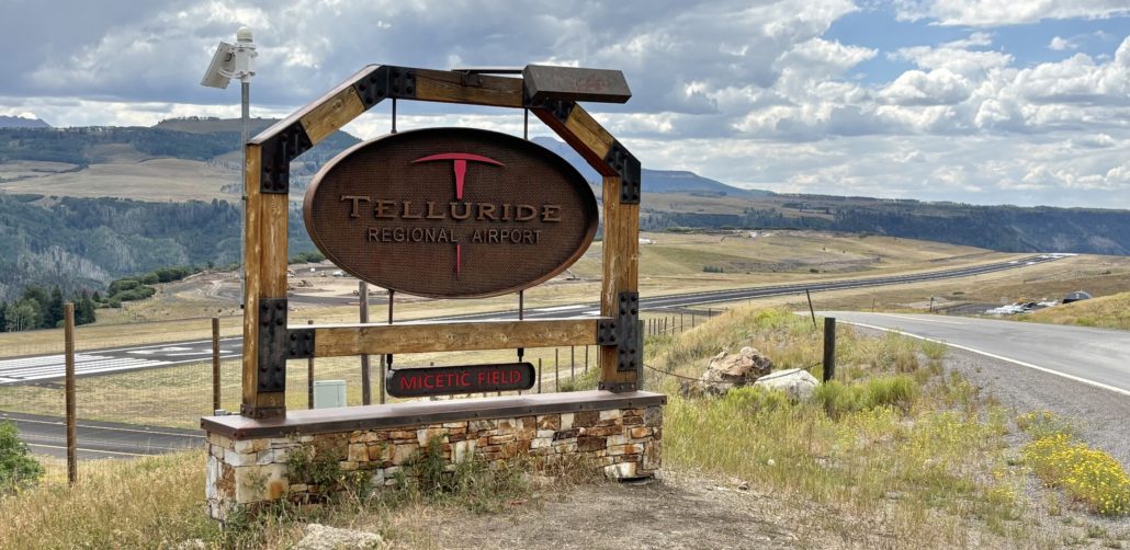
 The Mushroom Festival was unexpected and eye-opening. People were dressed up as mushrooms, wearing mushroom hats and other unique costumes. It’s a weekend festival described on their website as “A weekend of mushroom love, community connection and fungi everything. You can expect expert hosted forays to ID mushrooms in the great San Juan Wilderness, talks from world renown mycologists, a foundation of the fest rooted off psychedelics and its current resurgence, large community gatherings, culinary delights, dozens of mushroom vendors and of course the world renown Telluride Mushroom Festival parade. Every year the festival attracts 1000’s of fungi fans from across the world.”
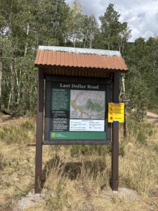 We sure loved our Last Dollar Road day trip. I think we will be talking about everything we experienced for years to come. We loved the gorgeous aspen forest with unobstructed views of Sneffels Mountain Range and Wilson Peak. The range of colors from brown, green, and red against the bright blue sky was so beautiful. I forgot to mention that we noticed some forest service road camp sites on the Telluride side of the pass. There were no bathrooms, water or other services along the trail. It’s as rustic as it gets. We loved seeing the large ranches on the Ridgway side and the views from the Last Dollar Pass at an elevation of 10,663 feet. If we had family or friends in town, we might drive to Telluride on the highway and just go up to the Last Dollar Pass from Telluride and back down again. That would take less time and still offer spectacular views. Until next time!
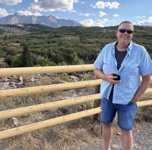
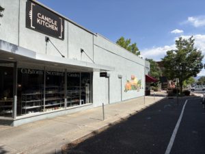
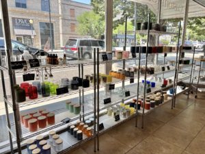
 I wanted to make small candles, so I went to Goodwill and bought a variety of small drink glasses for about $1.12 or $1.59 each. We also had some small fruit mason jars on hand. I took all 13 to Candle Kitchen GJ on a Saturday morning and made candles for my mom, sisters, nieces and nephews, my kids, and, of course, a couple for myself. It was a blast!
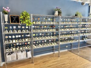
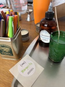 I started with the Margarita scent because it seemed like a great candle scent. From there I made candles with mountain smells like juniper, fir, spruce, pine, and sage. I made some with Palisade peach, pear, mango, eucalyptus, goji berry, jasmine, lavender, and lavender fields (slightly different). I used some unique scents like green tea too.
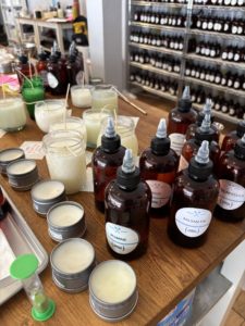
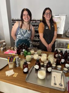 Nikki and Teagan were working that day and both were absolutely terrific. Helping me determine what might make a good blend. Nikki instructed me on the process, how I measure out my essential oils, checking the smell as I went along, then adding it to the hot wax in my jar and stirring it for a minute to make sure it blends with the wax.
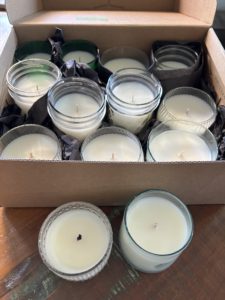 I came back two and a half hours later to pick up my hardened candles. They had cleaned the edges to make them look nice, straighten the wicks, and put a final glaze on the top to finish them off. Nikki applied the handwritten labels I had made to the bottom of each candle.