612-306-9558
  • Home
  • About Paul Aspelin
  • Blog
  • Day Trip Collection
  • Why Grand Junction?
  • Get Started
  • Featured Listings
  • Homes For Sale
  • Contact
  • Menu Menu
Move to Grand Junction CO
  • Link to LinkedIn
  • Link to Youtube
  • Link to Facebook
  • Link to Instagram
  • Link to Pinterest
  • Link to X

Day Trips from Grand Junction. Places to visit when you live in Grand Junction, Fruita, Palisade or anywhere in the Grand Valley. We share what to see, where we ate, how to get there, and some cool things along the way.

Day Trips, Local or Nearby Attractions

Crawford State Park: Day Trip from Grand Junction

A Wonderful Day at Crawford State Park

I highly recommend you take a day trip to explore Crawford State Park. It’s about 75 miles SE of Grand Junction. Crawford is on the West Elk Loop, a Scenic and Historic Byway. (See map at the end of this post.) It takes about 1.5 hours to get there via Delta and Hotchkiss. It sits at 6600’ elevation so it’s a great place to escape to when Grand Junction summers get hot. We will definitely go back and do some fishing, and maybe rent a boat or jet ski too!
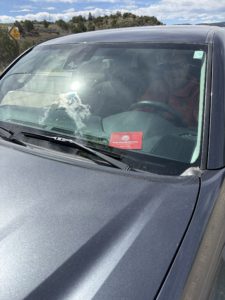
Toyota Tacoma showing the red sleeve holding our vehicle registration card with our Colorado State Park pass inside itThankfully, we have a Colorado State Park Pass. We got our pass when we renewed our license tabs for our Toyota Tacoma. It’s less expensive to get your state park pass with your car tabs.

We learned something new that day too. When we entered, the Visitor Center Park Ranger gave us a red sleeve to put our Vehicle Registration Card into and we were told to place it on the dashboard, Registration side face down to protect our privacy. This lets the Rangers know we have paid for a pass. They can also look up our license plate number. There is not a “park pass” to display in your car window or sticker for your vehicle.
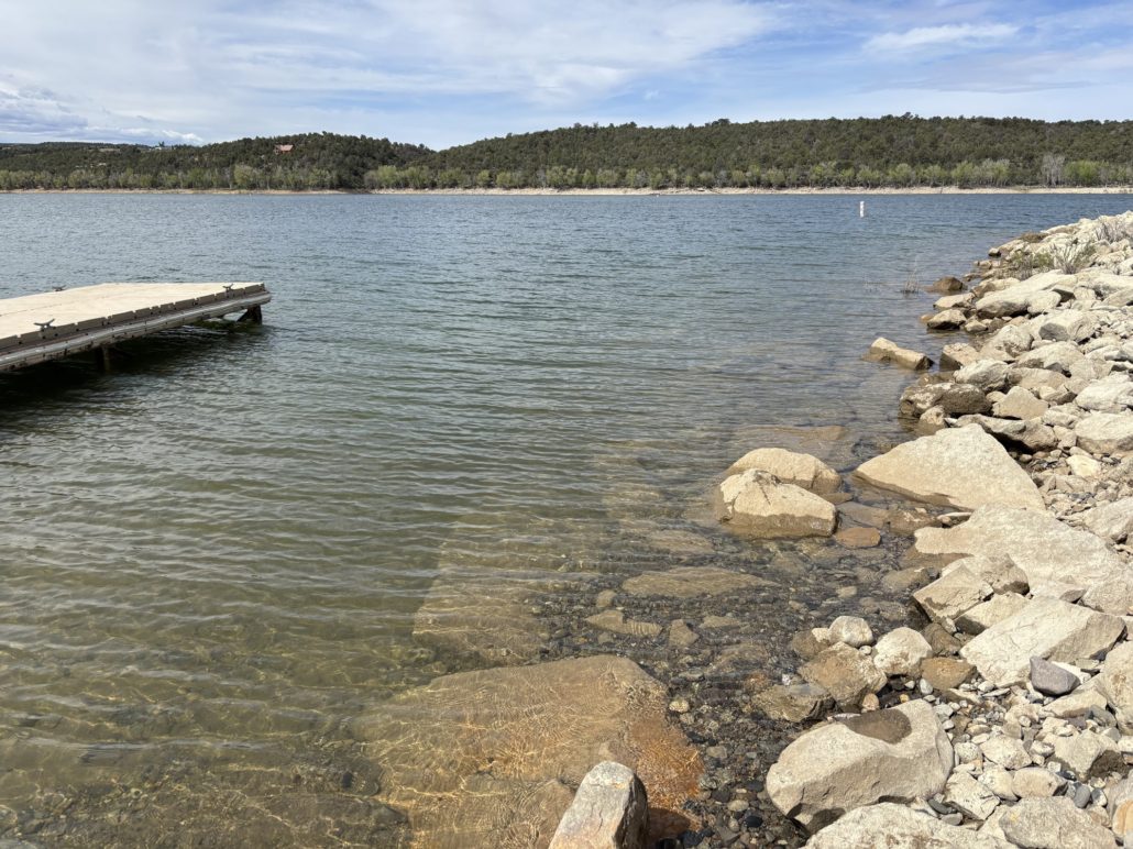
Crawford Reservoir Boat Ramp near Visitor Center shows rocky shoreline and floating dock

Visitor Center

There are three campgrounds in Crawford State Park along the north and east sides of Crawford Reservoir and three boat launches. We toured the North Shore Day Use section and then went to the Visitor Center. We sat in the picnic area to watch the people boating and fishing. Tubers were being towed behind ski boats, we saw some wake borders and others using stand up paddle boards (SUPs). We went in May just to see what the park has to offer. I am sure this is a very popular spot as the weather warms up. An excellent recreational and boating area for the locals in the area and everyone with a Colorado State Park Pass! Crawford Reservoir is the main attraction of the Crawford State Park. Scuba divers are welcome here too!

Fishing Crawford Reservoir
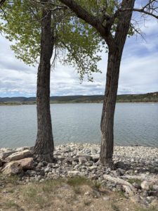
Crawford State Park shoreline of Crawford Reservoir

Crawford State Park shoreline of Crawford Reservoir near the Visitor Center

There were lots of people fishing from shore or fishing from kayaks and boats. While at the picnic area an older couple came down to fish from the shore near us. We asked what he was fishing for, and he said he catches some very large perch from the lake. Best he’s ever had. He doesn’t like fishing for trout here because they are farm raised (stocked) vs wild trout. The meat is white and not as good as wild trout’s red meat. Good to know! I haven’t gotten my Colorado Fishing License yet.

A winter visit to the park would provide opportunities for ice fishing and Nordic (cross-country) skiing. This would be a great spot for waterfowl hunting as well.

Trails at Crawford State Park

There are a limited number of trails along the 400-acre reservoir. We drove to Iron Creek Campground and had a picnic lunch near the boat launch. From here you can take a trail to the west side of the lake that leads to another overlook and day use area. You can take Black Canyon Road to the west side. This is the road we took to get to the North Rim of the Black Canyon of the Gunnison.

Lodging

If you want more than a day trip, there are several unique lodges, a hotel and an inn in the town of Crawford in addition to the three campgrounds in Crawford State Park. The Last Frontier Lodge sites up high on the north side of the lake and I imagine would have some spectacular views of the Elk Mountains to the east.

It’s a small state park, 337 acres, but offers some excellent options and, of course, exceptional views. I bet it’s a popular place come elk hunting season too.

An Amazing Stretch of Road South of Crawford, CO
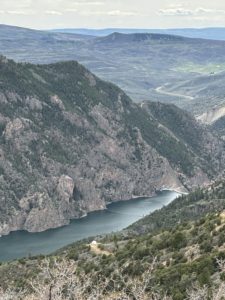
Gunnison River view from CR-92 south of Crawford State Park

Gunnison River view from CR-92 south of Crawford State Park

We got some excellent advice from the volunteers working that day at the Visitor Center. Instead of driving back to GJ the way we came, we drove south on CR-92 following the Gunnison River canyon. It was stunning! You can read more about this section of our trip on my post about the North Rim of the Black Canyon of the Gunnison National Park.

Taking this route, you drive along the top of the Blue Mesa Dam to cross the Gunnison River. This is in the Curecanti National Recreation Area. It also gives access to the very popular Blue Mesa Reservoir. Once over the river, you take CR-50 West through Cimarron and over the Cerro Summit at 8042’ and on to Montrose, then Grand Junction. Very pretty scenery, but then again, all of Colorado is scenic!

I have several other posts about day trips from Grand Junction, check them out! Grand Junction makes an exceptional base camp for you to experience this amazing region of the country. We love living in Grand Junction!

Take the Scenic Route and to Move to Grand Junction!
Paul Aspelin sitting on a bench in Crawford State Park in front of the Crawford Reservoir

Paul Aspelin in Crawford State Park in front of the Crawford Reservoir.

If you are considering moving to Grand Junction, please give me a call. I’d love show you round Grand Junction, Fruita, and Palisade.

Get notifications about new posts and watch my short videos on my Facebook page called Live Your Vacation in Grand Junction.

PAUL ASPELIN, your Grand Junction Real Estate Expert
REALTOR®, GRI, SRES®, CNE
Text/Call (612) 306-9558

Connect with me on LinkedIn or send me an email.
Serving Mesa County and the Grand Valley of Colorado.


West Elk Loop Scenic and Historic Byway Map
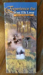
West Elk Loop Brochure Cover

This map comes in handy, we have referenced it for several trips. Thankfully, we have been to Glenwood Springs, Carbondale, Aspen, Redstone, and Marble. The climb over the stunning McClure Pass (ask to see one of my favorite pictures from the pass), Paonia, Hotchkiss, Crawford, and Gunnison too. Discovered Kebler Pass during an August trip (gravel road not open in winter) to Crested Butte and stayed in Mount Crested Butte. We have also been to the North and South rims of the Black Canyon of the Gunnison National Park.

The Fruita Visitor Center has the best selection of brochures and information for things to do in Grand Junction, Fruita, Palisade, Mesa County and the entire state of Colorado and eastern Utah. We picked this one up there and have had it in the car with us on several trips. See cover on the right.

© 2025 Paul Aspelin, REALTOR®. MovetoGrandJunction.com Copyright protected. All rights reserved.
by Paul Aspelin, Relocation & Listing Expert
https://movetograndjunction.com/wp-content/uploads/2025/06/Crawford-Reservoir-3.jpg 769 1411 Paul Aspelin, Relocation & Listing Expert https://movetograndjunction.com/wp-content/uploads/2024/09/Move-to-Grand-Junction-logo-wide-Mesa-County-1030x167.png Paul Aspelin, Relocation & Listing Expert2025-06-11 10:58:342026-09-28 11:52:02Crawford State Park: Day Trip from Grand Junction
Day Trips, Local or Nearby Attractions

Day Trip from Grand Junction: Goblin Valley State Park Utah

Day Trip to Goblin Valley State Park Utah

Looking for more Day Trips from Grand Junction? Consider Goblin Valley State Park in Utah. It’s about 2.25 hours west of Grand Junction. I published a post called Day Trips from Grand Junction CO that has more ideas. You can read it next if you haven’t read it already. I’ll be posting more day trips in the future too!

We like taking day trips from Grand Junction and we did this one on a Saturday in May. It was about 85 degrees and sunny. A great time of the year to hike and be outdoors.

What to know about Goblin Valley State Park in Utah before you go

GETTING IN AND PARKING

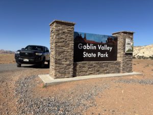
Goblin Valley State Park entrance sign with TacomaThe park is small, and it gets busy. They don’t offer official timed entry management, so you can’t reserve an entrance time in advance. We arrived on a Saturday at about 9:30am and waited in line behind 2-3 cars to get in. We went right to the Valley of the Goblins parking lot and there were about 5 spots left. The park entrance waiting line started to build by 10am and cars were told to wait. They would be let in after current visitors left. The line was long. We ran into a couple on a hike later. They waited in line for an hour before giving up and choosing a hike outside of the state park and come back later in the day.
PARKING PASS

They want you to get the pass online ahead of your visit to speed things up when you enter. When you do, the pass is good for that day and until 10pm the following day. We bought ours the night before we left. If you wait to do it online when you get to the area, you may not have internet service, we didn’t.

RESEARCH THE AREA

Since the park is relatively small, I recommend you research other attractions in the San Rafael Swell area before you go. There is a lot to see in this beautiful area of Utah. Goblin Valley State Park info.

Goblin Valley State Park Experience

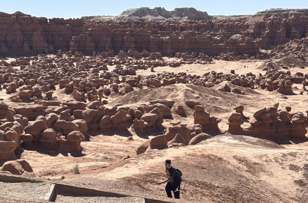
We planned for just one day in this beautiful and unique area. Once we got the park map, we went straight to the Valley of the Goblins and parked there by the big pavilion. The parking lot overlooks the Goblins. We walked down several flights of stairs to get down and walk around among them. That was very cool. An open area to roam. After about 30 minutes of that, we headed out and stopped at the entrance because that’s where the Gift Shop is but it was closed. I think they were short staffed because the gift shop was open when we entered.

Goblin Valley State Park Utah goblins


Little Wild Horse Canyon – Our first slot canyon experience

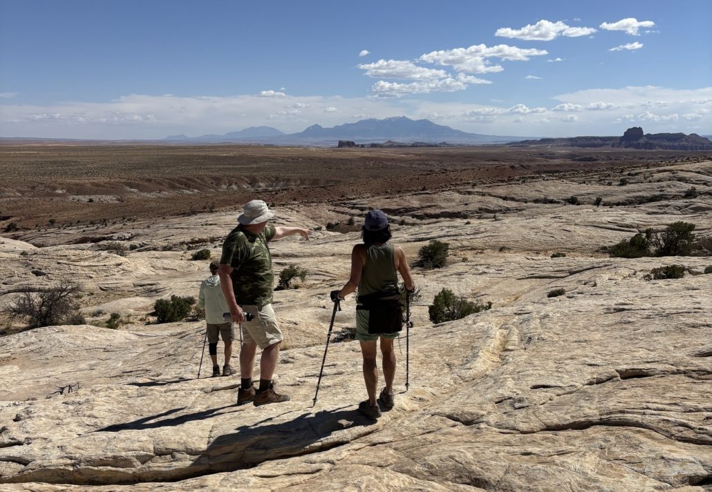
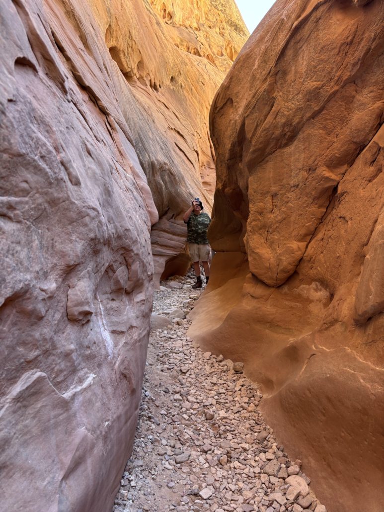
This hike was very impressive! According to All Trails map app, the loop trail is 8.1 miles through two canyons. We knew we couldn’t do the full 8 miles, it would be too much for us. So, we chose the Little Wild Horse Canyon side of the loop. It starts out wide then narrows, the smallest section was about 5 inches at the ground and about shoulder width at your shoulders. Sometimes we turned sideways to continue.

There were a few spots to “scramble” or climb over large rocks—nothing too strenuous for us beginners. It was our plan to stop and turn around when we reached the 6–8 ft “dryfall” because we didn’t feel we could climb back up once we went down. However, we ended up turning around earlier due to the crowd and difficulty passing people in such a narrow space. We went about 1.3 miles on the trail before turning back and thought it was fantastic for our first time in a slot canyon. The beauty was truly amazing. Keep in mind, this canyon can experience a flash flood if there has been rain upstream, so be aware.

Little Wild Horse Slot Canyon narrow bath between walls of rock

It got much narrower than this but we were so overwhelmed we didn’t take enough pictures. We were living in the moment!

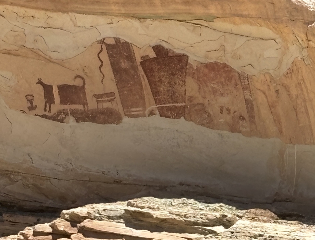
Temple Mountain Wash Pictograph Panel

Just off the side of the road we saw some of the largest prehistoric painted figures in Utah. The sign near the panel in the San Rafael Swell explains that the featured pictographs were created by early inhabitants during the Archaic Period (8000 to 2000 BC) and later by the Fremont culture (300 to 1300 AD). It’s amazing that they are still around for us to see! Pictographs are wall paintings done with pigments; petroglyphs are wall carvings, both are commonly called rock art. We are just learning the difference too!

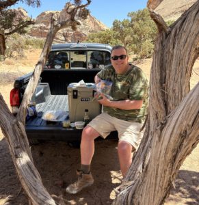
After this, we pulled into one of the campgrounds nearby and had a picnic lunch under the shade of a tree. There are no services in the immediate area for food, so we packed a cooler with snacks for lunch.

pictograph paintings by the ancients of animals and humans

Wild Horse Window

The last short hike was the Wild Horse Window. Technically it’s accessed from within Goblin Valley State Park boundaries, near the main entrance sign, but the trailhead was hard to find. Our GPS wasn’t working because we had no internet connection, but we finally found it after wandering back behind a camping area. I’m glad we persisted because it was amazing! We met a very nice couple from Denver who was just starting the hike when we were, so we hiked together. What a great time chatting and wayfinding with them on the trail. There were only two other couples in the 2 or so hours we were there!

Time to consult AllTrails

The AllTrails app says it’s 1.8 miles out-and-back but our trip was 2.3 miles. The app said it takes 51 minutes on average; it took us 1.5 hours. It was sandy, rocky or you were walking on slanted slickrock. Thankful for our supportive hiking books as it was rough on the ankles. It wasn’t technical, just had to watch your step. Hiking poles would have made it easier, but we don’t have those yet. Elevation gain was about 384 ft. Uphill there, downhill back. I was thankful there were many cairns to follow, especially over the slick rock because you didn’t have footprints to follow and couldn’t exactly tell where to go. Cairns (pronounced Karens) are stacks of rocks used for marking trails.

The end of the trail offered a spectacular view: two natural bridges formed by wind and erosion. One featured a hole at the top, probably about 50’ wide and 50’ tall, with moss growing in a few spots. More pictographs could be seen in the “cave,” and the cool shade was a welcome relief. After a snack, the scenery was fully absorbed before the hike back to the truck. Doing this hike second proved challenging, as the 2.3 miles felt much more strenuous than the first 2.6 miles in the slot canyon. Listed as “moderately challenging,” it certainly lived up to that rating.

Hiking back from Wild Horse Window Natural Bridge over slickrock following piles of rock to mark the trail

Hiking back from Wild Horse Window Natural Bridge over slickrock following piles of rock that marks the trail

One Final Stop for Dinner in Green River, Utah

After hiking in this beautiful San Rafael Reef area, the next city on our way back was Green River, so we stopped there for dinner. A lot of the restaurants and businesses in Green River are boarded up. They must be struggling as a small rural community. We found Tamarisk Restaurant overlooking the Green River. They have been in business since 1979, and I know why. The food and service were outstanding! We got there around 5-6pm, before the dinner rush. There were 20 people in the waiting area when we left. I highly recommend this place to eat. We didn’t find many other cafes or restaurants, but there was a sub shop. After a long day of hiking and being outdoors, we just wanted a cool place out of the sun to dine and relax a bit before the 90-minute drive home. We loved it.

I love that we can do Day Trips from Grand Junction like this. We left about 7:30am and were home about 8pm to sleep in our own bed. There are so many amazing places to see within 2 hours of Grand Junction, in all directions!

If you are considering living in Grand Junction, moving here from another state, please reach out to me. I’d be happy to show you around when you come to town to “check it out”.

Get notifications about new Move to Grand Junction posts and watch my short videos about Day Trips from Grand Junction on my Facebook page called Live Your Vacation in Grand Junction.

Picnic in campground under the shade of a tree

We ate a picnic lunch in a campground under the shade of a tree

Live Your Vacation in Grand Junction!

Follow me on Facebook: Live Your Vacation in Grand Junction

Text or Call (612) 306-9558

PAUL ASPELIN, REALTOR®
GRI, SRES®, CNE

Grand Junction Real Estate Expert
Connect with me on LinkedIn or send me an email.
Learn more about my experience and how I serve my clients 

© 2025 Paul Aspelin, REALTOR® MovetoGrandJunction.com. Copyright protected. All rights reserved.

by Paul Aspelin, Relocation & Listing Expert
https://movetograndjunction.com/wp-content/uploads/2025/05/Goblin-Valley.jpg 1021 2016 Paul Aspelin, Relocation & Listing Expert https://movetograndjunction.com/wp-content/uploads/2024/09/Move-to-Grand-Junction-logo-wide-Mesa-County-1030x167.png Paul Aspelin, Relocation & Listing Expert2025-05-20 10:48:342026-09-28 16:27:31Day Trip from Grand Junction: Goblin Valley State Park Utah
Day Trips, Local or Nearby Attractions

Divide Road and Unaweep Canyon Experience

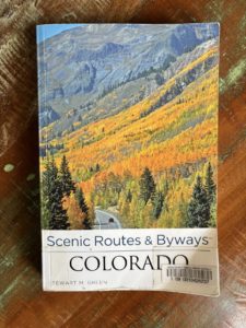
Scenic Routes & Byways Colorado by Stewart M. Green

Scenic Routes & Byways Colorado by Stewart M. Green from the Palisade Library

Divide Road and Unaweep Canyon Experience

Guest post written by Michelle Aspelin, Grand Junction resident

I’m excited to tell you about our Divide Road and Unaweep Canyon experience. It was very cool, like a treasure hunt for us. A great idea on a long list of things to do in Grand Junction and the surrounding area.

I like to read books about Colorado. I check them out from the Mesa County Libraries or buy them from the Friends of the Mesa County Libraries book sales. I have purchased a few from our local Barnes & Noble too. A lot of what we do in Grand Junction is because I read about it in a book and want to see it in person.

Get notifications about new posts and watch Paul’s short videos on our Facebook page called Live Your Vacation in Grand Junction.

Divide Road on the Uncompahgre Plateau Inspiration

One of the books I discovered while browsing through the Mesa County Library in Palisade is called Scenic Routes & Byways Colorado by Stewart M. Green. It’s so good I may purchase it. My version is from 2013 and there’s an updated version.

In the section about Unaweep Canyon the author talks about Divide Road. I have seen it on maps before and am aware of where it is on the high plateau. But when I read this passage, I said, “Let’s go!” Unaweep Canyon is supposedly the only canyon in the world drained by two creeks. A divide in the mid-canyon separates the East Creek and West Creek drainages. The Ute Indian name Unaweep means “Canyon with Two Mouths.”

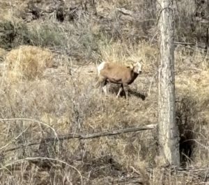
Big Horn Sheep

Big Horn Sheep on CR-141

To get there, drive south out of Grand Junction on Hwy 50. In Whitewater, turn right onto CR-141 towards Gateway. Go about 25 minutes and turn left onto Divide Road, it’s well marked. CR-141 is a beautiful drive through the Unaweep Canyon. We saw bighorn sheep along the side of the road before we turned onto Divide Road.

If you get a chance, drive all the way to Gateway near the Utah border. You will see some of the most incredible 2-billion-year-old granite walls and lush green valleys. Just beyond Divide Road, you can stop in a small parking area to see rock climbers on the 500’ steel grey cliffs of Mothers Buttress, Television Wall, and Quarry Wall. We saw people stopped with binoculars watching climbers on the sheer cliff walls. The land they climb is owned by The Access Fund, a national advocacy organization that leads and inspires the climbing community. Along CR-141 is some of the most impressive granite we’ve seen since the Black Canyon of the Gunnison National Park.

Here’s the passage in the book that inspired us to go there in March.

“Divide Road begins just past a ranch. This gravel road twists more than 100 miles down the spine of the Uncompahgre Plateau, giving access to a vast swath of remote backcountry. Take a left turn here for a short drive up Divide Road to a stunning viewpoint above Unaweep Canyon. The gravel road climbs a couple of miles up to the site of the abandoned Taylor Granite Quarry, a rock quarry that operated in 1928. Park before a cattle guard and walk down to the cliff edge for one of western Colorado’s most spectacular overlooks, Unaweep Canyon stretches westward. The highway below uncoils like a long snake up the sagebrush valley floor. Gentle slopes, forested with scrub oak, pinon pine, and juniper, slant upward to abrupt, towering granite cliffs. Above, steep slopes lean back to the valley’s sandstone rim high above the floor.”

Divide Road and Unaweep Canyon switchbacks along the way showing steep elevation

Switchbacks on Divide Road near CR-141

We left about 11am and packed our hiking backpack with hats, gloves, snacks, water, and the bear spray, you never know.

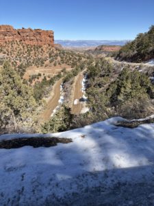
Divide Road is beautiful, lots of switchbacks and elevation gain right away. There was some recent snow still on the road in some parts. Other parts were muddy or dry gravel. We are used to driving in snow being from Minnesota, but when the road is narrow, and you look down over 1000’ feet with no guard rail, it can be a bit intimidating! We went slow. See the photo.

I read the passage again once we were past the steep part. We saw the cattle guard and a little parking lot off to the left at the trailhead of BLM Trail #23. We thought, “That could be it.”  We weren’t sure and decided to go further on Divide Road. We got to a spot with a lot more snow and decided to turn around. We headed back to the first spot to see if that was it. This area is called Cactus Park in the Dominguez-Escalante National Conservation Area.

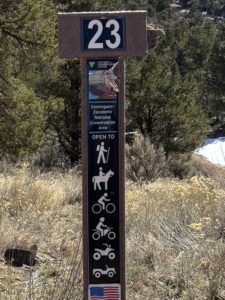
BLM trail 23 sign post with icons for walking, horses, bikes, motor bikes, ATVs and vehicles

We later learned that the last icon on the post that looks like a jeep or ranger is actually for full size vehicles. Now we know!

There was another 4×4 truck in the tiny lot. We ate a quick snack. We weren’t sure how to read the signpost (see right) that marked the trail, wondering if we could drive it or if it was only for motorized bikes and UTVs, so we walked. I hadn’t looked up the trail before we left so we weren’t sure how far we had to walk to find the overlook. The book didn’t mention a BLM trail, but this was right next to the cattle guard. After about a half mile uphill all the way, we came to an opening and walked to the edge. We saw spectacular views of the Grand Mesa, West Elk Mountains, and the San Juan Mountains. It was amazing! Definitely a great view of western Colorado!

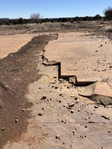
After that, we turned around to walk back and realized we were walking on the granite of the Taylor Granite Quarry! That was cool too. We had never been right on top of a quarry like that, they skimmed the surface, it wasn’t a big hole. We took more pictures.

Taylor Granite Quarry showing granite being skimmed off the surface

Taylor Granite Quarry

But the book said the view would be of the Unaweep Canyon. We realized this wasn’t it. Just then, a guy on a dirt bike stopped for a break near us. We explained what we were looking for and determined that the place we wanted to go might be further up Divide Road. He told us about another cattle guard and a road that veered right to a popular overlook. Since we had already gone further on Divide Road and saw the snow, we said we’d have to come back in April or May and try again.

The biker shared that there are a lot of elk in the area, trophy bull elk. We heard something in the thickets while on the trail, but we think it was just a mule deer. We never saw it. He said there are bears in the area, but they are small and they leave you alone. Ha! Small but they leave you alone. We had our spray just in case. We’ve never encountered a bear in Colorado. There are several BLM campsites along Trail 23. Camping on BLM land is free. We got in the truck and headed back.

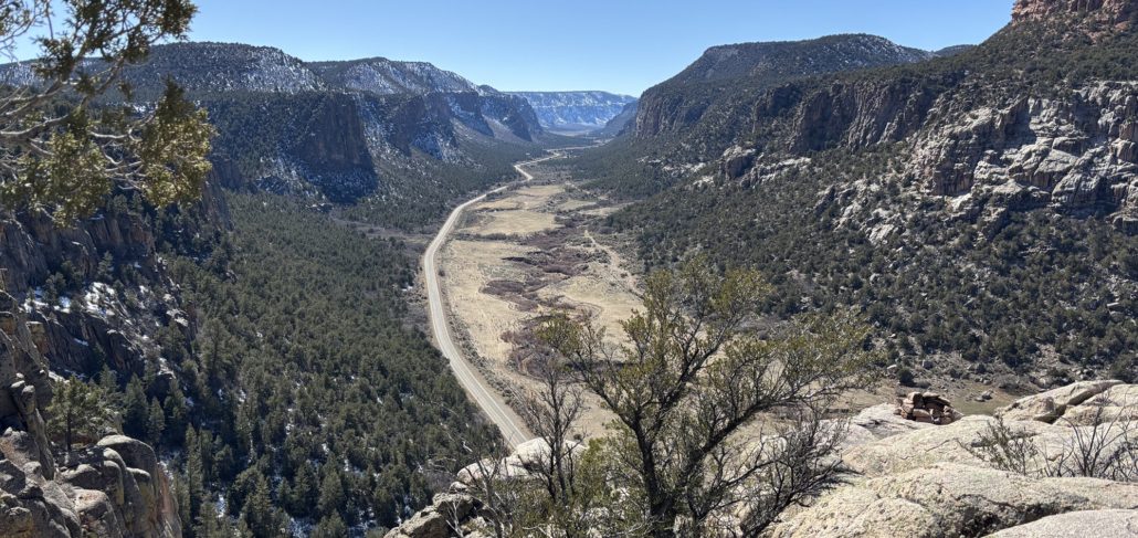
Still wondering where the overlook was, we passed over the first cattle guard again and right next to it was a small pull-off we hadn’t noticed before. We could see the canyon in the distance. Maybe this was it? We parked and got out of the Tacoma. Sure enough, we walked about 50 feet over rocks and sand, past bushes, to the opening and boy, it was stunning! Huge drop-off beyond the boulder outcroppings. We walked up to the edge, like the book said, near the fence of the property owner. We were giddy. We found it!

We looked out onto the ledge, and someone had built a fire ring from stones in the area at the very edge of the overlook. You can see it in the photo below. What a way to watch the sun set over the canyon.

Divide Road and Unaweep Canyon Overlook View

We soaked it all in, took more pictures and said, “We need to put this one on ‘the list’ and bring our guests here.” It was so amazing and only about 30 miles from our place. Yet being in the wilderness like that, up so high, we felt like we were in another world. So thankful to see it.

If you’d like to live near trails and adventures like this, Get Started!

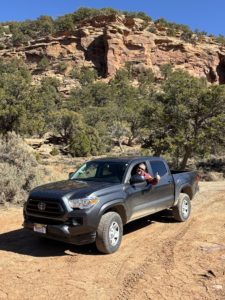
Paul Aspelin in the Tacoma at the Unaweep Canyon Overlook

Paul Aspelin in the Tacoma at the Unaweep Canyon Overlook

We had such a good time on our hike and happy we found the overlook. When we got back into GJ we went to REI to get a book on the Dominguez-Escalante National Conservation Area. This would be a very cool place to rent an ATV and go four-wheeling, and maybe camp in the future. They didn’t have a book or map with that much detail about each of the BLM trails.

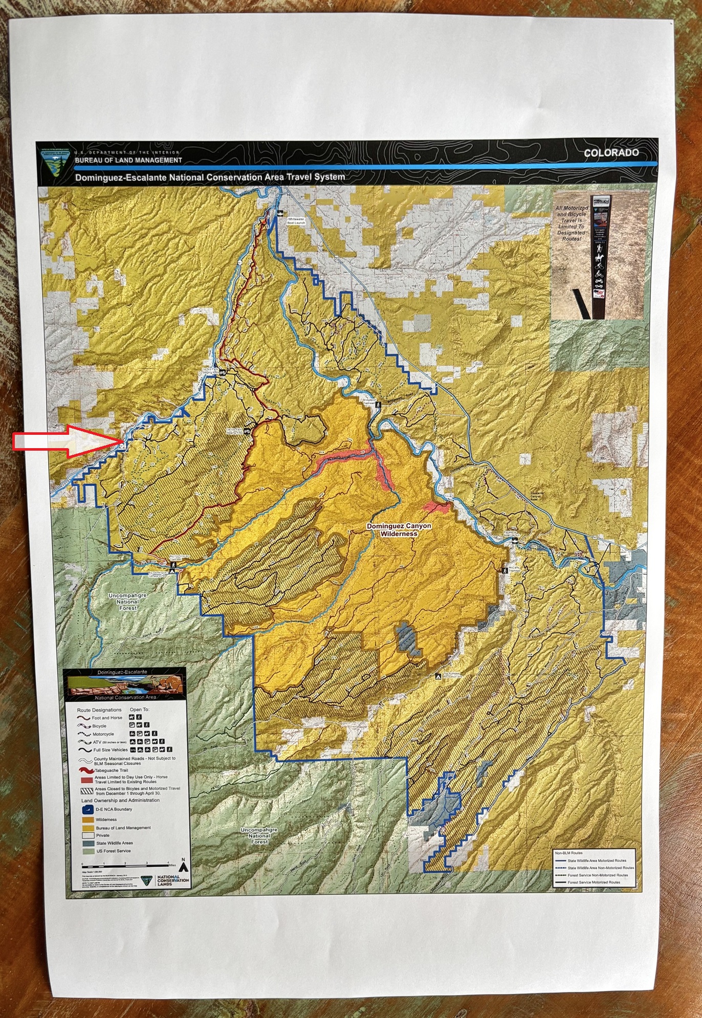
Later, after we got the mud washed off the taco (what the locals call a Toyota Tacoma), I looked it up online and was able to print out an 11”x17” map of the conservation area trail system, see below. We will definitely go back. Going in March was great, no bugs, but a bit of snow. The guy at REI didn’t know the road we were on was open again after winter. Oops, we didn’t realize it ever closed. Always learning!

We left with great memories, photos and stories of our experience, and the desire to explore more. If you are looking for things to do in Grand Junction, we highly recommend Divide Road and Unaweep Canyon. There are many pull-offs along Hwy 141 to stop and take in the beauty.

See Paul’s posts about our trip to Crawford State Park and the North Rim of the Black Canyon of the Gunnison National Park. We did both of those as one day trip from Grand Junction. Top Day Trips from Grand Junction is another great post.

Guest post written by Michelle Aspelin

© 2025 Paul Aspelin, REALTOR®. MovetoGrandJunction.com and Michelle Aspelin Copyright protected. All rights reserved.

Dominguez Canyon Wilderness BLM Map

by Michelle Aspelin
https://movetograndjunction.com/wp-content/uploads/2025/03/Header-Unaweep-Canyon-141.jpg 946 1999 Michelle Aspelin https://movetograndjunction.com/wp-content/uploads/2024/09/Move-to-Grand-Junction-logo-wide-Mesa-County-1030x167.png Michelle Aspelin2025-03-13 13:19:102026-09-28 11:52:21Divide Road and Unaweep Canyon Experience
Day Trips, Local or Nearby Attractions, Relocating to Grand Junction

Top Day Trips from Grand Junction, Colorado

Top Day Trips from Grand Junction, Colorado

Use this area as a base camp to experience the top day trips from Grand Junction Colorado. When you visit Grand Junction, you’ll find so many wonderful things to do and see in the Grand Valley. It would be a challenge to list them all from here. Instead, I’d like to share some of the top day trips from Grand Junction, Colorado that I have done with family and friends and would go again in a heartbeat. I’ll include some tips and insights for each location. As a reminder, I post short videos and announce new website posts on my Facebook page called Live Your Vacation in Grand Junction.

We’ve also been documenting our actual day trip adventures. Visit our Day Trips from Grand Junction page, a curated list of adventures, and browse all of our latest day-trip posts.

I will warn you, cell service is spotty in this region, so be sure to download Google maps, bring a paper map, or know where you are going. And always pack snacks and plenty of water to drink. Read my post about avoiding altitude sickness if this is your first time at elevations of 5,000-10,000 feet. We took some of these top day trips from Grand Junction Colorado before we moved to the area and wouldn’t hesitate to go back with friends and family that visit.

Top Day Trips from Grand Junction, Colorado

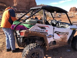
ATVing can get messy on Moab, UT, especially when you ride the day after it snows!

Moab, Utah

Great for mountain biking, ATVing, “jeeping”, yes, that’s a thing in Moab. Exceptional trails for all sorts of outdoor activities. Plus, access to Arches National Park and Canyonlands National Park. We’ve stayed in Moab twice now for Thanksgiving to use the ATV trails. Once we rode on a friend’s ATV and the second time, we did a full day rental with a trailer. It was expensive, but worth it, we had so much fun on the trails. One of our favorite restaurants there is Pasta Jay’s, exceptional Italian food! Check out the Corona Arch hike, the petroglyphs along “wall street” as the local climbers refer to it, and the many dinosaur track locations. The town has great shopping and a very laid-back vibe with an array of off-road vehicles lining the streets. There is always something to do and see in Moab! We really enjoyed seeing real dinosaur tracks just west of Moab.

Read our post called the Many Adventures Near Moab for more ideas.

Dinosaur National Monument

Top Day Trips from Grand Junction, Colorado

Dinosaur bones at Dinosaur National Park

Drive 2 hours north to see a pile of actual dinosaur bones still intact from inside the museum that was built around it. It’s pretty cool. The bones traveled down a river, and many came to a final resting place together. I have been to the museum and am planning to go back to hike the trails and see more fossils in the area. We stopped here on a drive back to Minnesota and it didn’t disappoint. On that trip we also hit nearby Flaming Gorge on our drive north, a beautiful area too! This route helped us avoid the I-70 closure due to a forest fire in Glenwood Canyon.

Telluride

2.5 hours south, Telluride is known for its winter skiing and snowboarding, but it’s an exceptional day trip for summer activities like hiking, biking, shopping, concerts and more. Standing on the street and looking at the town feels majestic with the towering mountains surrounding you.

Top Day Trips from Grand Junction, Colorado

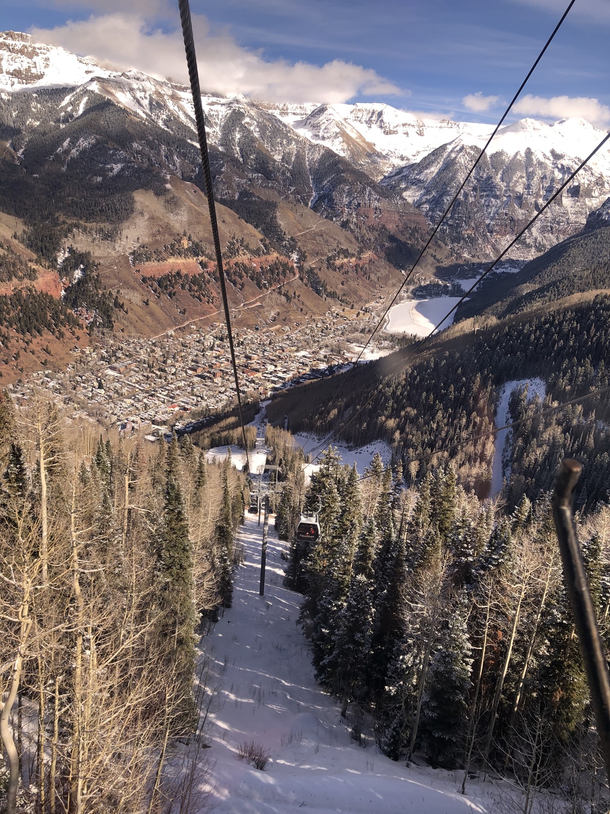
View of Telluride from the Gondola

In Telluride, you can ride the gondola in town to the top of the mountain, for free, and onward to Mountain Village. Our first time there was in November and my wife said, “If there was such a thing as the North Pole, its Mountain Village”.

You’ll find plenty of shopping and dining at the foot of the ski mountain and in the downtown area of Telluride. While enjoying the scenery from the gondola, look for the tiny runway at the Telluride airport. Don’t know how those planes can take off and get high enough before they run out of runway at the end of the cliff! There isn’t any specific parking for the gondola, but you can hunt for a spot on the street or parking ramp and walk to the entrance. There is just something magical about a visit to Telluride any time of year.

Ouray

Ouray is pronounced (yur-ay). These are beautiful mountain towns in the San Juan Mountains with so much history and allure. It takes 2 hours to get to Ouray and then you can take the famous “million dollar highway” to Silverton. A scary, but beautiful road. I don’t recommend driving it in the winter with its many 15 mph hairpin curves and lack of guardrails. Avalanches kept knocking down the guardrails and they got tired of replacing them, so they just don’t have any. And the shoulder is about 10 inches until the 1000-foot drop off, no kidding! It’s an adventure just to drive that stretch of highway.

Top Day Trips from Grand Junction, Colorado

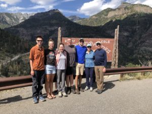
Ouray at the “Switzerland of America” sign

Ouray, also referred to as the “Switzerland of America” offers an incredible quaint, historic mountain town experience with views you won’t soon forget. While in town, enjoy a soak at one of the local hot springs, or take a short hike to see the Box Canyon Waterfall, or just enjoy watching the ice climbers in the winter. Be prepared to be amazed.

Silverton

Continue your scenic journey South, 24 miles to Silverton, which offers great shopping, dining, breweries, and lots of trails. Be warned, there is a tourist sightseeing train that travels between Durango and Silverton which can make for extended wait times at some restaurants depending on the timing of its arrival. We ate at the Lacey Rose Saloon located in the Grand Imperial Hotel in Silverton. The atmosphere was 100% Old West! Exactly what we came to experience. We enjoyed a great lunch listening to a live ragtime piano player and found out there was still a bullet in the woodwork behind the bar from a prior “shootout”. You can literally feel the Old West and mining history as you stroll the main street.

Read my post called Day Trip to Ouray for more about Ouray, CO.

Top Day Trips from Grand Junction, Colorado

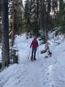
Snowshoeing on the Mesa

Grand Mesa

The world’s largest flat-top mountain is just 45 minutes from Grand Junction. There are 300+ lakes with miles and miles of hiking, ATV, snowmobiling, and cross-country ski trails. You can ski at Powderhorn Mountain Resort with much shorter wait times for the chair lifts. We attended their Octoberfest celebration with German food and beer while we were driving through looking at the stunning fall leaves.

On the Grand Mesa, there are rental cabins, lodges, and campgrounds available for overnight stays. We drove up there once in June when it was 99 degrees in Grand Junction. Up near Mesa, CO it was only 89 degrees and at the top it was 69 degrees, a thirty degree difference in temperature. Grand Junction is at about 4,483′ elevation and we went to up near 10,300′ to Island Lake.

Be warned, the visitor center on the main road across “the Mesa” isn’t always open. Oh, and using the bathroom spurred my post about what I learned in the first 3 months of living in Grand Junction, always have toilet paper in your car as rest stops, pit toilets and visitor centers are often out of toilet paper!

Read my post about what its like to live on the Grand Mesa.

Gunnison and Crested Butte

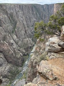
North Rim Exclamation Point view to Gunnison River

Black Canyon of the Gunnison National Park is very picturesque and is only 1.5 hours SE of Grand Junction. You drive through Delta and Montrose, cute small towns to get to the Gunnison River gorge and the Black Canyon of the Gunnison National Park. Here’s how the National Park Service describes it… “Big enough to be overwhelming, still intimate enough to feel the pulse of time, Black Canyon of the Gunnison National Park exposes you to some of the steepest cliffs, oldest rock, and craggiest spires in North America. With two million years to work, the Gunnison River, along with the forces of weathering, has sculpted this vertical wilderness of rock, water, and sky.” We were impressed. We stopped here on our way back from a trip to Ouray.

Read my post about our visit and an awesome hike in the North Rim of the Black Canyon of the Gunnison National Park.

We have been to Crested Butte a couple of times and absolutely love it. We took Kebler Pass, a 4WD only road that’s open during the summer and fall. We stayed in a condo up on Mount Crested Butte ski resort area. We hiked to a waterfall and drove a (scary to us) backroad up to the stunningly beautiful Emerald Lake. We mention it in the Leaf Peeping post but we will have to write a special post about that area!

Glenwood Springs

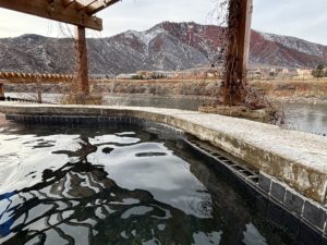
Iron Mountain Hot Springs in Glenwood Springs in December with a little snow on the mountains

Iron Mountain Hot Springs in Glenwood Springs in December with a little snow on the mountains

If you drive East on I-70 right to Iron Mountain Hot Springs from Grand Junction, it’s about an hour and 20 minutes. However, our first time there we went onto the Mesa first to do some snowshoeing near Mesa Lakes Lodge and then drove to Glenwood Springs specifically to soak in the hot springs.

Iron Mountain Hot Springs offers a 3-hour soaking “appointment” and that was just the right amount of time. They have a changing room with showers and lockers. We spent time in pretty much every pool they offered with a range of temperatures from 96-108 degrees. It was our first hot spring experience. It’s right next to I-70 so there was a little road noise. But you also viewed the Colorado River, so that was nice. We watched the sun set over the mountain.

There’s another hot spring there too, Glenwood Hot Springs, also along the river and the interstate. We will be checking out other hot springs in Colorado, but this is definitely a great option for a day trip from Grand Junction.

If you’d like to live near places like this in western Colorado, Get Started!

Maroon Bells Aspen/Snowmass Area

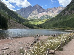
Maroon Bells Aspelin Snowmass shows trail, lake and maroon capped mountains in the distance

Maroon Bells Aspen Snowmass area

You can drive to the Maroon Bells Visitor Center just outside of Aspen, CO. There is a parking ramp (not cheap!) and you can take the Maroon Bells Shuttle to Maroon Lake. I recommend you make a reservation and pay ahead of time or it might be full.

Supposedly this is one of the most photographed places in Colorado. We paid for the shuttle and once at Maroon Lake took the Crater Lake Trail. That trail is moderate with lots of rocks to avoid while walking on the trail, but it was stunning. A great experience.

We did this hike with our daughter. She’s done it before and wrote more details about the experience on her blog Emma Gets Outside, Maroon Bells Crater Lake Trail. If you go to downtown Aspen, we recommend John Denver Sanctuary. A nice stroll through nature accessed right from downtown. It was crowded but peaceful too.

For more Day Trip ideas, use the search box on the right to search for “day trips from Grand Junction”. I have made many more posts since this one of various places to go and sites to see!

Care for Colorado Leave No Trace Principles

https://www.colorado.com/articles/leave-no-trace-care-colorado The Care for Colorado Leave No Trace Principles were created in partnership between the Colorado Tourism Office and the Leave No Trace organization to address recreation-related impacts in Colorado. Read their tips of what to know before you go, sticking to the trails, and other topics like trash, fire and wildlife.

Living in Grand Junction

If you fly into the Grand Junction airport to visit Mesa County, let me know. I’d love to share what it’s like to move to Grand Junction AND living in Grand Junction now as a full-time resident. We relocated to the area in 2023. As a licensed REALTOR® I can show you some properties while you are here too! Read my posts about moving to Grand Junction, Fruita, or Palisade. Ask me about any town in Mesa County!

Read the Two Day Itinerary for Grand Junction Visit post for more ideas or Things to Do in Grand Junction: Easy Hikes.

Happy travels! Live your vacation in Grand Junction!

Connect with me on LinkedIn

Call/text me with your questions! 612-306-9558

Paul Aspelin, Realtor®
GRI, SRES®, CNE
Serving Mesa County, licensed in Colorado.

© 2024 Paul Aspelin, REALTOR® MovetoGrandJunction.com. Copyright protected. All Rights Reserved.


by Paul Aspelin, Relocation & Listing Expert
https://movetograndjunction.com/wp-content/uploads/2024/01/Ouray-Switzerland-of-the-US.jpg 1209 1612 Paul Aspelin, Relocation & Listing Expert https://movetograndjunction.com/wp-content/uploads/2024/09/Move-to-Grand-Junction-logo-wide-Mesa-County-1030x167.png Paul Aspelin, Relocation & Listing Expert2024-01-05 17:50:552026-09-28 16:43:00Top Day Trips from Grand Junction, Colorado
Page 2 of 212
30 Best Colorado Blogs 2026
Search Search

Follow us on Instagram

Follow us on Facebook

Logo image
Click to load facebook widget
Join our Facebook community

Google

Find us on Google Maps

Write a Review on Google

PAUL ASPELIN, REALTOR®

Paul Aspelin standing on a trail in the Colorado National Monument

Paul Aspelin Reviews and Recommendations

Read Paul Aspelin Reviews and Recommendations-personal notes and survey results from happy clients not found online.

“Paul went above and beyond in our home search, we looked at 17 homes in 2 days! Was very thorough with our search parameters and coordinating showings, even provided a book of all the listings he had scheduled for us. I would wholeheartedly recommend Paul!”

-Jeff Alexander, Grand Junction, CO (originally published on my Zillow profile)

loader-image
Today’s Weather
Grand Junction, CO
5:10 pm, Sep 28, 2026
temperature icon 62°F
overcast clouds
71 %
1012 mb
18 mph
Wind Gust: 0 mph
Clouds: 96%
Sunrise: 6:07 am
Sunset: 6:02 pm

Get the 7-Day Forecast for Grand Junction and 20+ cities from local KKCO Weather. Read about Grand Junction Monthly Weather

Post Categories

  • Day Trips (14)
  • Featured Properties (2)
  • Fruita (7)
  • Grand Junction (13)
  • Grand Junction Real Estate (26)
  • Local or Nearby Attractions (33)
  • More to Know (15)
  • Palisade (6)
  • Property Taxes and Land Ownership (6)
  • Relocating to Grand Junction (26)
  • Retire in Grand Junction (6)
Popular
  • Paul Aspelin sitting in his winter jacket on the fishing dock while it's snowing
    Move to Colorado: No Need to Hunker Downin: Relocating to Grand Junction
  • Uhaul trailer and our Rav4 driving to Colorado
    Establish Residency in Coloradoin: More to Know, Relocating to Grand Junction
  • Retire in Grand Junction Coloradoin: Retire in Grand Junction
  • map of Grand Junction area
    Property Tax Programs for Colorado Seniorsin: Property Taxes and Land Ownership, Retire in Grand Junction
  • Relocating to Grand Junction with towable moving trailer
    Essential Steps for Relocating to Grand Junctionin: Relocating to Grand Junction
  • Custom Painted Mailbox by Emma Aspelin
    Wealth is Where Your Friends Arein: More to Know, Relocating to Grand Junction
  • 11 Reasons to Move to Fruita Coloradoin: Fruita, Local or Nearby Attractions
  • Move to Palisade Coloradoin: Local or Nearby Attractions, Palisade
Recent
  • Marble CO day trip from Grand Junction showing our 4Runner parked in front of the Marble quarry entrance
    Get Your Marble in Marble, CO: Day Trip from Grand Junc...in: Day Trips, Local or Nearby Attractions
  • Realty One Group Western Slop office interior showing conference room and lobby
    Why I Chose Realty ONE Group Western Slopein: Grand Junction Real Estate
  • Ashley Elliott Insurance Agent
    Advice From a Grand Junction Insurance Agent: Before You...in: Grand Junction Real Estate
  • Grand Junction adventure vehicle - Paul in our new Toyota 4Runner in Marble, CO
    What’s Your Adventure Vehicle?in: More to Know
  • Overland Expo Mountain West vendors
    Overlanding from Grand Junction: Our Visit to Overland Expo...in: Local or Nearby Attractions
  • Rocky Mountain National Park on Trail Ridge road above tree line with mountains in the background
    Just Driving Through: Rocky Mountain National Parkin: Local or Nearby Attractions
  • Top 30 Colorado Blogs photo of Maroon Bells mountains with lake near Aspen CO
    Top 30 Colorado Blogs—MoveTo GrandJunction.comin: More to Know
  • Red Mountain Mining Area and Yankee Girl Mine near Ouray CO
    Driving the Red Mountain Mining Area 4×4 Only Trai...in: Day Trips, Local or Nearby Attractions

Paul Aspelin, Realtor®

(612) 306-9558

Based in Grand Junction and serving Fruita, Palisade, and all of Mesa County

Member of the:

Grand Junction Area REALTOR® Association

Colorado Association of REALTORS®

National Association of REALTORS®

Categories

  • Day Trips
  • Featured Properties
  • Fruita
  • Grand Junction
  • Grand Junction Real Estate
  • Local or Nearby Attractions
  • More to Know
  • Palisade
  • Property Taxes and Land Ownership
  • Relocating to Grand Junction
  • Retire in Grand Junction

Search Properties

Start your search on the Realty ONE Group Western Slope website.

Relocation & Listing Expert with Realty ONE Group Western Slope

734 Main Street
Grand Junction, CO 81501

map

Follow us on Facebook

Logo image
Click to load facebook widget
Join our Facebook community

Follow us on Instagram

© 2023-2026 PAUL ASPELIN, REALTOR®. Aspelin Real Estate LLC. MovetoGrandJunction.com. All rights reserved. Licensed in Colorado FA100103754.
  • Link to LinkedIn
  • Link to Youtube
  • Link to Facebook
  • Link to Instagram
  • Link to Pinterest
  • Link to X
  • Privacy Policy
  • Accessibility
  • Code of Ethics and Equal Housing
Scroll to top Scroll to top Scroll to top