612-306-9558
  • Home
  • About Paul Aspelin
  • Blog
  • Day Trip Collection
  • Why Grand Junction?
  • Get Started
  • Featured Listings
  • Homes For Sale
  • Contact
  • Menu Menu
Move to Grand Junction CO
  • Link to LinkedIn
  • Link to Youtube
  • Link to Facebook
  • Link to Instagram
  • Link to Pinterest
  • Link to X

Day Trips from Grand Junction. Places to visit when you live in Grand Junction, Fruita, Palisade or anywhere in the Grand Valley. We share what to see, where we ate, how to get there, and some cool things along the way.

Day Trips, Local or Nearby Attractions

Get Your Marble in Marble, CO: Day Trip from Grand Junction

A Surprise Drive Right Up to the Marble Quarry Entrance

One of our favorite things about living in Grand Junction is that you can leave the desert landscape of the Grand Valley in the morning and be surrounded by spectacular Colorado mountains and cooler temps by lunchtime.

Marble is only one example of the small mountain communities, scenic drives, historic sites and outdoor adventures within reach of Grand Junction. We were amazed as we drove right up to the working quarry entrance!

Where is Marble, CO?
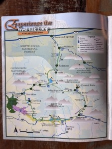
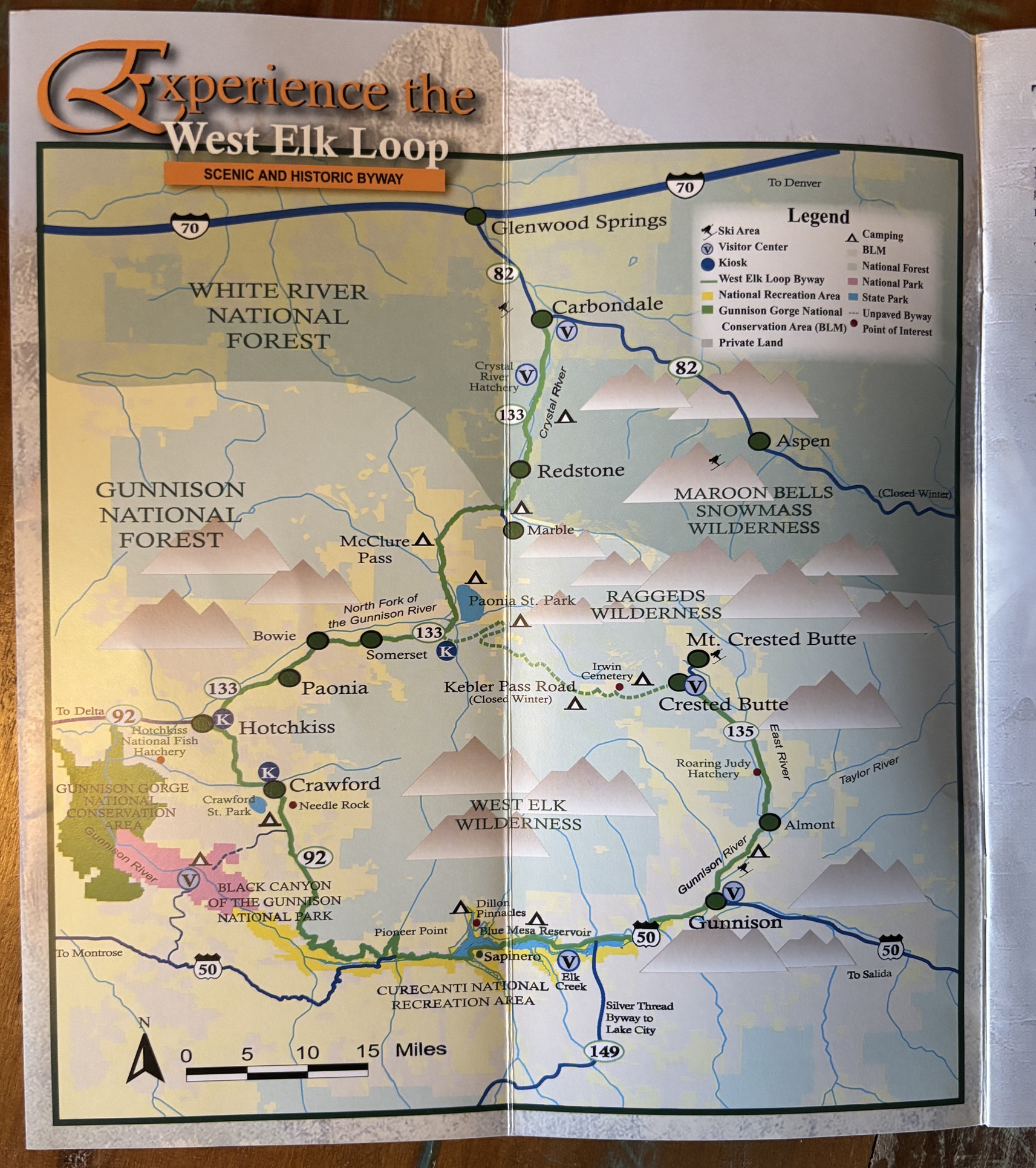
map showing the West Elk Mountain Loop for a Marble CO day trip from Grand Junction mapMarble sits at an elevation of nearly 8,000’ in Gunnison County, within the beautiful Elk Mountains along the Crystal River, on the West Elk Loop.

In general, Marble CO is south of Glenwood Springs. You can easily get there from I-70. However, we like to take the scenic route. From Grand Junction we drove south to Delta, east through Hotchkiss and Paonia, then northeast on Hwy. 133. We went over one of the most beautiful passes, McClure Pass, and dropped down into the Crystal River Valley.

From Highway 133, the 6.5 mile road to the town of Marble is paved. You drive past the historic jailhouse, through the town and end at the edge of Beaver Lake on the east side of town. Once you turn off the main road though, to navigate the grid of houses, the local art galleries, or get to the campground, you will be driving entirely on dirt and gravel. Most people drive out the same way you drove in. Unless you are headed for adventure!

Any route continuing past town immediately turns into rugged, unpaved dirt paths. This includes County Road 3C (Quarry Road) heading up to the marble mine (which we took), and Crystal River Road leading out to the iconic Crystal Mill and Schofield Pass, both of which transition into highly technical, rocky 4×4 only terrain. One day we will rent side-by-sides and drive to the famous Crystal Mill.

About Marble, CO
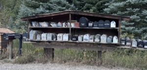
Marble Mailboxes lined up along with free books

We saw this cool lineup of mailboxes that also houses free books!

Marble is tiny. Really tiny. There isn’t a gas station or grocery store in town, so make sure you have what you need for the day. I suggest you make a stop at the super small “visitor center”. It’s not what you might expect. It’s called The Marble Hub.

It’s a coffee shop, with packaged ice cream bars, a gift shop, and the only place in town you can get free Wi-Fi service. Really. While you’re there, check out the old bank vault behind the counter. The Hub is in the historic 113-year-old former Marble City State Bank building. Because Marble is completely off the grid for cell service, this cozy building functions as an essential lifeline for travelers. We looked at the map on the wall and that’s how we got to the quarry. They have physical trail maps and crucial local safety warnings (like reminders that the rugged road to the famous Crystal Mill absolutely requires a 4-wheel-drive vehicle). Exploring small Colorado towns is so fun.

The town of Marble is mostly residential homes. There’s a small lake nearby, Beaver Lake. It is a popular stop that gives access to the Crystal River for fishing, and it’s close to historic Redstone too. This was our second time visiting Marble. We mention it in the Leaf Peeping From Grand Junction post.

Marble, Colorado has been described as “an isolated mountain hamlet tucked away in the Elk Mountains with a year-round population fluctuating between 130 and 150 residents.” There’s only one full-service restaurant, the highly rated Slow Groovin’ BBQ (more on that below). There is a café we have yet to try, we will go there next time.

Folks choose to live in this geographically isolated pocket of Gunnison County for its profound sense of tight-knit community and immediate access to rugged outdoor recreation. A lot of artists and marble sculptors live there too! You can watch a cool Colorado PBS documentary on Marble, CO that just came out in August 2026. It’s called Made in Marble.
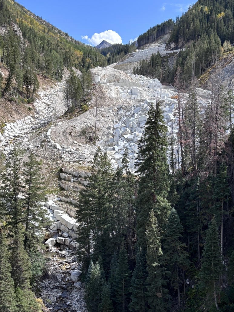
viewing the Marble quarry up the mountainside

Driving to the Marble Quarry

Marble Quarry Road

Driving on the Quarry Road with steep drop offs at times

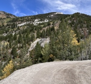
When you visit this tiny Colorado mountain town, allow time to drive 4 miles up Quarry Road to see the marble quarry. It was absolutely amazing. From the base looking up, the marble on the mountain top looked like a glacier! So white and bright against the green and brown backdrop of nature. We were totally amazed. And we could get right up to it!

We were there on a Saturday this time. The narrow dirt shelf road that goes up to the quarry entrance was open. Last time it was closed. We drove as far as visitors can currently go to an active Colorado quarry with an incredible history.

The quarry is now owned by Colorado Stone Quarries, an Italian company. They extract marble year-round and send it to their state-of-the-art marble processing and finishing facility in Delta, CO. You can see it right along Hwy 50.
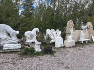
Marble Gallery photo of marble sculptures for sale

Sculptures for sale at The Marble Gallery.

Marble from Marble was selected for the Lincoln Memorial in 1916, and in 1931 stone from the quarry was used to create the Tomb of the Unknown Soldier. Pretty cool!

There are no public tours available for the active quarry. However, at the entrance, there is a pile of marble for the community. It’s free, if you can pick it up. I got a few tiny pieces. I also bought a larger piece from The Marble Gallery in town. Next time, I want even something bigger that we can display outside.

Marble around Marble
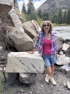
Michelle standing next to a chunk of marble by the Crystal River

Michelle standing next to a huge chunk of marble along the Crystal River

Here’s one thing you won’t see in other mountain towns, huge chunks of marble used for functional purposes, like erosion control near bridges and rivers. You’ll see most yards have marble statues or huge 2’ x 3’ chunks of marble by the driveway. We thought it was the strangest thing to use marble for such things. Only in Marble, CO!

Next time, we want to visit the local Marble Museum housed inside the historic two-story 1912 schoolhouse built with a distinct marble foundation. It originally served up to 200 students during the peak of the town’s mining boom before closing in 1948.

It was raining when we left so we didn’t get a chance to walk through the Marble Mill Site Park either. That looked cool. To stand where the marble was cut, sanded, and polished to make the Lincoln Memorial. That would be amazing.

Eating at Slow Groovin’ BBQ
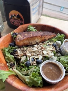
Slow Groovin BBQ Salad

Slow Groovin BBQ sandwichThis was a highlight on our Marble CO day trip from Grand Junction…

After a short 15-minute wait, we were seated on the deck overlooking the main road at this popular establishment. We watched the stream of side-by-sides, motorcycles, campervans, trucks, cars, bikes, and hikers parade by while we dined. We saw people running into friends and giving hugs. Everyone is so friendly and welcoming.

The food was absolutely amazing! Michelle had a nut and berry salad with a huge piece of smoked salmon. I had the best pulled pork sandwich (with all the fixin’s) that I have ever had. Everything was so fresh and delicious. They are open seasonally, so plan accordingly so you don’t miss a meal here.

Discovered Black Bridge Winery on the Way Home
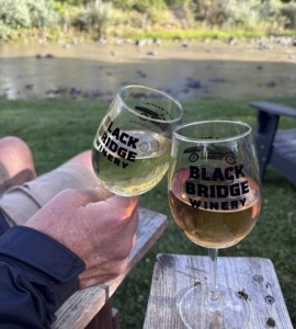
Black Bridge Winery near Paonia, sitting in chairs, with wine, by the river

Relaxing along the North Fork of the Gunnison River near Paonia

On our way home we decided to make one more stop. Michelle did some quick research to see who was still open and she picked the Black Bridge Winery and Orchard Valley Farm and Market on the east side of Paonia. We got a glass of wine and sat in Adirondack chairs overlooking the North Fork of the Gunnison River and the cool looking black bridge that the winery is named after.

We sampled their tasty balsamic vinegars and brought two home with us. I have already used the peach balsamic vinegar to make homemade BBQ sauce. They have a large assortment of infused olive oils, salsa, syrups, sauces, dressings, and produce along with pottery, jewelry and wine in the tasting room. We will bring friends back here. They have a huge farm and orchards, open Memorial Day through Halloween. People were picking fresh raspberries and blackberries while we were there and their watermelon looked delicious.

This is the kind of day we have come to appreciate living in Grand Junction. We can have breakfast at home, get in the 4Runner, drive into the mountains, explore a tiny historic community, have lunch, discover a new winery, and be home the same day. Making memories and sharing the story and videos of our journey with family, friends and future clients.

I posted a short video about this Marble CO day trip from Grand Junction on social media.

Read more on our new Day Trips from Grand Junction page, a collection of adventures!

Live Your Vacation in Grand Junction

Follow Live your Vacation in Grand Junction on Facebook and Instagram
Follow Move to Grand Junction on YouTube
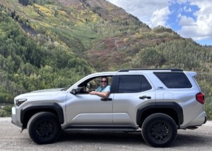
Paul Aspelin on the way to the Marble Quarry

Paul Aspelin on the way to the Marble quarry

PAUL ASPELIN, your Grand Junction Relocation and Listing Expert
REALTOR®, GRI, SRES®, CNE

Call or Text (612) 306-9558 (locally based)

Connect with me on LinkedIn or send me an email.
Serving Mesa County and the Grand Valley in Colorado.

© 2026 Paul Aspelin, REALTOR® MovetoGrandJunction.com. Copyright protected. All Rights Reserved.
by Paul Aspelin, Relocation & Listing Expert
https://movetograndjunction.com/wp-content/uploads/2026/09/Marble-Quarry-Entrance-scaled.jpg 1015 2560 Paul Aspelin, Relocation & Listing Expert https://movetograndjunction.com/wp-content/uploads/2024/09/Move-to-Grand-Junction-logo-wide-Mesa-County-1030x167.png Paul Aspelin, Relocation & Listing Expert2026-09-28 16:21:332026-09-28 16:24:33Get Your Marble in Marble, CO: Day Trip from Grand Junction
Day Trips, Local or Nearby Attractions

Driving the Red Mountain Mining Area 4×4 Only Trail

Read more
by Michelle Aspelin
https://movetograndjunction.com/wp-content/uploads/2026/08/Yankee-Girl-Mine-and-the-Taco.jpg 1878 2142 Michelle Aspelin https://movetograndjunction.com/wp-content/uploads/2024/09/Move-to-Grand-Junction-logo-wide-Mesa-County-1030x167.png Michelle Aspelin2026-08-03 13:17:452026-09-28 12:02:14Driving the Red Mountain Mining Area 4×4 Only Trail
Day Trips, Local or Nearby Attractions

The Many Adventures Near Moab Utah

What’s Moab?

Before we can talk about the many adventures near Moab, first you might be asking “Where is Moab, Utah?” I can still remember the first time we heard the word “Moab”. We were standing at the Colorado Mesa University booth at the College Fair at our local high school in Chanhassen, MN. The 2 representatives were raving about going to Moab for the weekends and all they had access to in relation to outdoor activities. Then went on and on — our eyes got wide, so did our oldest daughter’s. She eventually attended CMU for college, and then we moved to Grand Junction. Needless to say, what those representatives said that day changed the course of our lives, for the better.

At first, we thought Moab was some adventure park, an entertainment venue to visit. We slowly realized it’s the name of the popular adventure town in a remote area of SE Utah, but only 90 miles from Grand Junction. My daughter jokes it’s just an hour away. The speed limit on I-70 in Utah is 80 mph…

Two Ways to Get to Moab, Utah

The Fastest Route

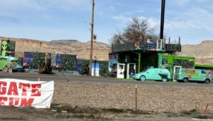
I-70 gas station with Scooby Doo Mystery Machine parked out frontFruita, CO is the last stop in Colorado on I-70 before entering a long stretch with NO SERVICES on the way west to Moab. So get your drinks and go to the bathroom before you leave the area. There is one pit toilet as you cross the border and a rest stop with just bathrooms and a short hike up a hill if you need a little exercise.
Stay on I-70 until Exit 182/Hwy 191. Go south on Hwy 191 for about 32 miles and you will arrive in Moab. There are two gas stations at exit 182, the funky one with the Mystery Machine from Scooby Doo parked out front, and a new Golden Gate gas station.

The Scenic Route

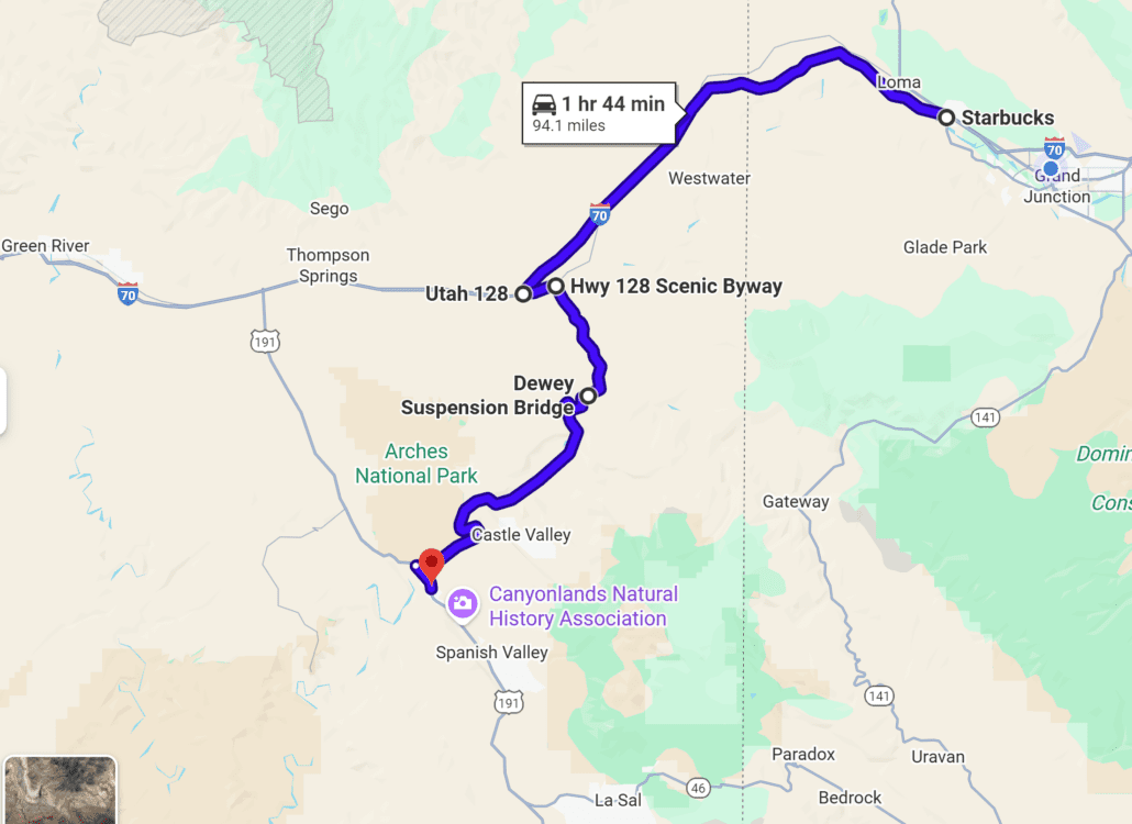
If you want the most scenic entrance into Moab from Grand Junction, take the earlier Exit 204 on I-70 near Cisco. Look for Hwy 128 Scenic Byway and go South. There are two exits on I-70 to get onto Hwy 128, the first one is very bumpy gravel road with lots of dips and potholes, but it does go through “the town” of Cisco (it has a General Store and that’s about it). We prefer the second exit, #204, and backtrack a little. Once on Hwy 128 it’s beautiful. You are approaching the La Sal mountains as you drive along shore of the Colorado River. We did a river float into Moab that left from a landing in Cisco. Hwy 128 intersects with Hwy 191, turn left, and you’ll be in the town of Moab.

Google map image Fruita to Moab via the Colorado River

Things to Do in Moab, Utah

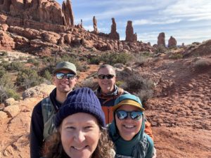
Josh, Paul, Emma and Michelle hiking to Tower Arch in Arches National Park

Josh, Paul, Emma and Michelle hiking to Tower Arch in Arches National Park

1 – The most popular thing to do in Moab is to experience Arches National Park. We have been there several times. An easy drive in, drive out on the same road. It’s 18 miles from the Visitor Center to the end. Lots of trails and arches along the way, many very close to the road. For 2026, timed-entry reservations are no longer required!

See our post about the time we took the 4×4 back door into Arches to hike to Tower Arch.

If you want to read about more moderate and difficult hikes in Arches, I suggest you read the advanced guide to hiking in Arches National Park, written by our daughter, Emma Aspelin. On her blog, Emma Gets Outside, she goes into depth describing multiple hikes in Arches, including the hike to the iconic Delicate Arch, which we have not done. She writes about easy, moderate, and difficult hikes. You won’t find us writing about difficult hikes on this blog. She’s way more experienced than we are.

Insight Tip: Did you know the second largest concentration of arches is in Colorado? Yup, you don’t need to drive to Utah to see them, check out Rattlesnake Arches Trail on the All Trails app, we did the hike, it was stunning! It’s in the McInnis Canyons National Conservation Area.

2 – The second most popular adventure near Moab to explore is Canyonlands National Park. Looking down over a 1000 feet or more to the river below is outstanding. There are many cool sites and overlooks that will take your breath away. Our daughter got married near Canyonlands. THAT was incredible! Here’s how the National Park Service describes Canyonlands…

“The Colorado and Green rivers wind through the heart of Canyonlands, cutting through layered sandstone to form two deep canyons. In stark contrast to the hot, sunny desert above, the river corridors are remarkably green, shady, and full of life. Both rivers are calm upstream of The Confluence, ideal for canoes, kayaks, and other shallow watercraft. Below The Confluence, the combined flow of both rivers spills down Cataract Canyon with remarkable speed and power, creating a world-class stretch of whitewater.”

3 – Dead Horse Point State Park is near Canyonlands and is worth the drive too. Amazing views, especially the night sky! Read more on that below.

Top Day Trips from Grand Junction, Colorado

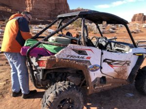
Muddy November ride near Moab

4 – After that, I imagine it’s all of the mountain bike and ATV/jeep trails that attract most people to experience adventures near Moab. We rented a side-by-side ATV and followed the trails one day, stopped for lunch, got a little muddy as it was in November, but we had a blast! I highly recommend doing that. We mention this experience in our Day Trips from Grand Junction post too.

“Jeep Week” is a 9-day event in the spring known as Easter Jeep Safari that attracts thousands of 4×4 enthusiasts. Thankfully, there is a lot of BLM land around Moab for free camping and overlanding to accommodate the influx of jeep owners. We were there once during this event; the town was super busy!

Tip: You do need to go online and take a safety test and get a certificate before you can drive an ATV in Utah. It’s called a Non-Resident OHV permit, here’s the link for more information, Utah Division of Outdoor Recreation. https://recreation.utah.gov/off-highway-vehicles/ohv-registration-and-permits/non-resident-ohv-permits/

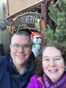
5 – The town of Moab itself is full of unique shops, gear for purchase or rental, ATV/UTV/mountain bike rentals for all your adventure needs. There are plenty of hotels, motels and campgrounds. Lots of dining options, Pasta Jays is one of our favorites for Italian food. We had a delicious traditional Thanksgiving meal on Thanksgiving at the Moab Brewery. A good time for ATVing because it’s not so hot. Lots of guide services for a variety of adventures near Moab.

Michelle and Paul floating down the Colorado River near Moab Utah

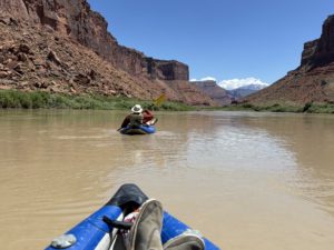
Paul and I floating down the Colorado River approaching the La Sal Mountains

6 – The Colorado River is another top attraction. There are river boat guided trips you can take or launch your own paddle board, canoe, or kayak and float down the river through calm waters or rapids. There are river cruises day and night, and a couple of jet boat outfitters too if you’d like a fast ride on your vacation in Moab. We launched our rubber rafts, called duckies, near Cisco and paddled towards Moab, pulling out near the campgrounds along Hwy 128 Scenic Byway.

7 – If you’re going to be in the area for a few days, I highly recommend you drive the loop up into the La Sal Mountains. A “cool” adventure near Moab because the temps are normally lower in the mountains. It’s a 60-mile scenic drive from red-rock canyons to alpine peaks with breathtaking views year-round.

From Moab, head south on Hwy 191 approximately 8 miles and turn left at the Ken’s Lake/La Sal Mountain Loop Road sign. Take a right at the T-intersection and follow La Sal Mountain Loop Road up into the mountains. The road winds through the mountains and descends via switchbacks towards Castle Valley. At the intersection with Forest Road 207, take a left to get to Castle Valley and continue for about 10 miles. Take another left at the Hwy 128 intersection to return to Moab.

Plan about 3 hours to drive the stunning loop, depending on the number of stops you make to soak it all in. We saw some cool mountain cabins up there. It would be fun to rent one of those on a future trip while exploring new adventures near Moab.

Petroglyphs near Moab

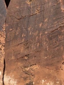
Petroglyphs near “Wall Street” Moab, UT

8 – Canyoneering and rock climbing are very popular in Moab too. We’ve noticed climbers several times on our trips. When you drive past Wall Street Climbing Area on Potash Road there are usually climbers there. We stopped there along that stretch of road to see the Petroglyphs. You get on Potash Road from the main Hwy 191. It’s the same road that takes you to the trailhead of the Corona Arch hike I mention below. There are several places that offer horseback riding too.

dinosaur tracks near Moab Utah

Dinosaur Tracks!

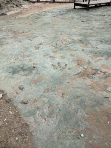
9 – Dinosaur Tracks. We went to the Mill Canyon Dinosaur Tracksite twice. I was amazed that the dinosaur tracks are just there, out in the open. Sure, there is a little fence to keep the critters out, but otherwise there is a simple boardwalk that takes you right up to the tracks. It is amazing and an easy side trip just 15 miles north of Moab off Hwy 191. Go there when you want to see something very cool, and it’s free.

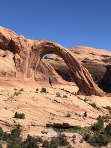
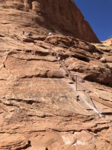
10 – If you want to do some hiking away from the crowds, consider hiking Corona Arch. It’s a scenic hike with views of a large arch at the end. There’s quite an elevation gain at the beginning, and a few challenges like climbing a metal ladder and holding a safety chain along a ledge. We went slow and felt very proud of ourselves for doing the moderate 2.4 mile out and back hike. After our hike, we snagged a spot in the nearby campground under a tree to get some shade and had a picnic lunch. Bring plenty of water, there’s hardly any shade along the trail and it can get hot in the summer.

Corona Arch west of Moab

Corona Arch

Corona Arch chain section

11 – There are several International Dark Sky Parks in Utah. In fact, the Dead Horse Point State Park Scenic Overlook is credited as one of the most photographed scenic vistas in the world! Moab is home to some of the darkest night skies anywhere. Get amazing views of the stars and the milky way. Arches and Canyonlands are International Dark Sky Parks too. Both Arches and Dead Horse Point offer ranger-led night sky activities.

We haven’t stayed here, but it’s on our list. Under Canvas Moab is one of the world’s first Dark Sky resorts where you can experience the wonders of the night sky. Glamping at this upscale, outdoor hospitality location is available generally March through October in their amazing safari inspired canvas tent accommodations. Located just 7 miles north of Moab. Here’s more info: https://www.undercanvas.com

Thinking about living this close to places like Canyonlands, Arches and Moab? Explore homes for sale in Grand Junction.

Your Moab Adventure Awaits

Every time we go to Moab we find something new to do. There are so many adventures near Moab for every skill level and adrenaline desires. On our return trip one time, we headed south out of town, turned east and went over the La Sal Mountains, then ventured on to Telluride, then back to Grand Junction. That was a cool drive. It was November, light snow, the mountains were gorgeous.

Day Trips from Grand Junction

We have written about many day trips from Grand Junction. Going to Moab, Utah is one we do frequently because it’s so close and usually I-70 doesn’t get shut down west of here! We feel like we are living a vacation all the time. People spend a lot of time and money to travel to destinations that, for us, are just a 1–2-hour drive from Grand Junction.

Looking for more ideas? Check out our Day Trips from Grand Junction page for more of the places we’ve explored from our home base in the Grand Valley.

If you want us to write about local attractions or other areas of interest, let Paul know. There is so much to see and do in Grand Junction and the surrounding mountain and desert communities. Paul has lots of stories he can share.

If you are considering moving to Grand Junction, Paul will give you a tour when you visit the Grand Valley. Learn more about Paul and how he’s been serving his clients since 2001. Email Paul.

Michelle and Paul Aspelin at the Moab Brewery

Thanksgiving Dinner at Moab Brewery

Live Your Vacation in Grand Junction, but don’t forget the adventures near Moab!

Follow Live Your Vacation in Grand Junction on Facebook and Instagram
Follow Move to Grand Junction on YouTube

Guest Post by Michelle Aspelin

Growyourmindshare.com
Connect with Michelle on LinkedIn

© 2026 Paul Aspelin, REALTOR® MovetoGrandJunction.com and Michelle Aspelin. Copyright protected. All rights reserved.

by Michelle Aspelin
https://movetograndjunction.com/wp-content/uploads/2026/01/Moab-ATV-riding.jpg 1344 2016 Michelle Aspelin https://movetograndjunction.com/wp-content/uploads/2024/09/Move-to-Grand-Junction-logo-wide-Mesa-County-1030x167.png Michelle Aspelin2026-01-27 16:45:132026-09-28 16:57:11The Many Adventures Near Moab Utah
Day Trips, Local or Nearby Attractions

Back Door into Arches National Park

Day Trip to Arches National Park in Moab, Utah

Did you know that there is a back door into Arches National Park? If you take this route into Arches, you can get quick access to a wonderful hike to Tower Arch and avoid the crowds! Some call it a secret back door entrance into Arches National Park, but it’s not really a secret if you just look at a map. It’s just a different way to enter the park. We’ve been to Arches several times since we moved to Grand Junction and were very excited to take this new route in our Toyota Tacoma. It was an amazing adventure!

If you do not have your National Park Pass already, then you need to enter through the main gate and pay the park fee. If you already have your National Park Pass, then you can use the back door into Arches National Park. There is a gate, but no gate keeper. For 2026, they have removed the timed-entry reservation requirements for peak season. Avoid the long line and go in the back way! Be sure to display your pass in your windshield in case a ranger comes to the parking lot. You should check the weather too, more below.

Antelope along the 4x4 road into Arches National Park

Antelope along the 4×4 road into Arches National Park

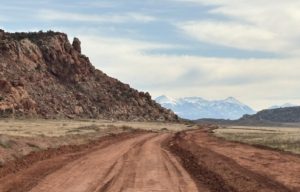
The “back door” entrance into Arches National Park is an unpaved, high-clearance road route primarily used for off-road recreation. A standard park map does not detail this route for navigation so download Google maps before you go. Yes, I said download the map ahead of time because you probably will not have cell service for an active Google Map. A high-clearance vehicle, preferably with four-wheel drive (4×4), is strongly recommended. This fun route includes soft sand, rock ledges, and steep sections that are impassable for most standard passenger cars. Really, don’t drive your car on this road. It is not a typical “gravel road.”

Tip: During the busy times of year, we’ve waited in line for up to 45 minutes just to enter the park from the main entrance. Entering through the back door (weather permitting) will give you more time to enjoy the park!

Check the Weather First

4x4 back road into Arches National Park

4×4 back road into Arches National Park

I recommend you check to see if it has rained or snowed in the days leading up to the day you want to try this route. Because of the deep sand and clay, the road can have some severe ruts and if it’s wet, I imagine it will be very muddy and slippery and you can easily get stuck. We could see the deep ruts when we drove it. They do pass through with a road grader but still, if it’s wet, that changes things. Water runs down from Klondike Bluffs. I wouldn’t go this way if it’s wet, way too much sticky mud.

Directions for the back door into Arches National Park

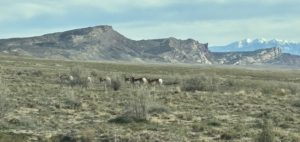
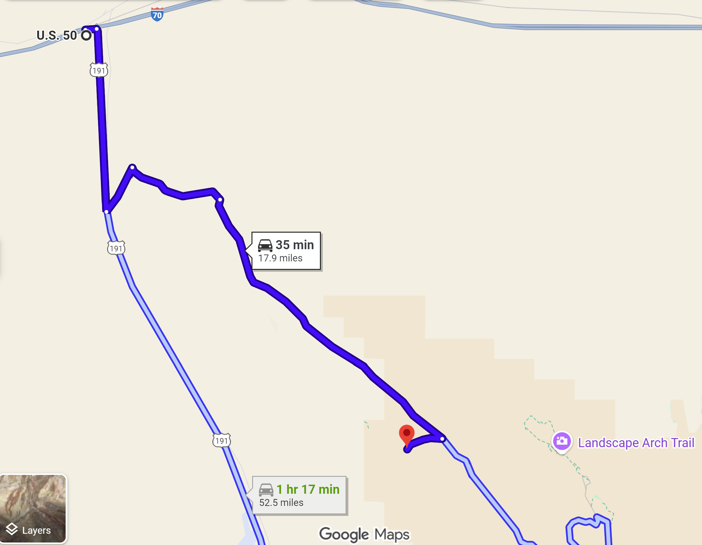
If you are coming from Moab, take Hwy 191 North, go right onto Willow Springs Road (BLM Road 378) approximately 13 miles north of Moab. The entrance to Utahraptor State Park is also along this road. Follow Google’s instructions to the Tower Arch Trailhead parking lot. This is NOT the way we took as we were coming from the north via I-70. We saw a lot more back-country on our route and I highly recommend it. At one point we came across twenty antelope resting next to the side of the road. Here’s the route we took.

Map to Tower Arch Trailhead - back door into Arches National Park Google Map

From Interstate 70, take the Moab exit onto Hwy 191 south, but only drive 4.5 miles. Turn left onto BLM 144 (Valley City Road). After a short distance, turn right onto BLM 145 (Salt Valley Road). This is where we saw the huge herd of Antelope basking in the sunshine.

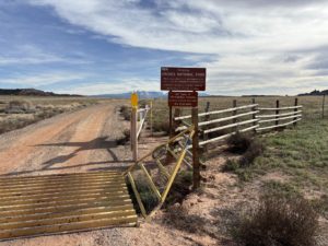
Back entrance gate into Arches National Park

Back Entrance Gate to Arches

Continue along BLM 145 admiring the Klondike Bluffs area. It’s beautiful. When you come to a “T” in the road, go right to stay on BLM 145. From here, drive about 9 miles. The name changes to Arches Salt Wash before you reach the entrance gate. The gate was open because we chose to enter Arches from the back door when the park was open. If the park is closed, this gate is probably closed.

Past the gate, you are almost there. Turn right at the sign for the Tower Arch trailhead. There’s a parking area with a nice pit toilet. Prepare for your hike and enjoy!

Leaving Tower Arch

When you leave, you can turn right onto Arches Salt Wash Road, and it will lead you to the main road in Arches National Park. Turn right onto Arches Scenic Dr. Then drive 16 miles through the park to the Arches Visitor Center and the park exit. Explore the many arches, scenic pull-offs, and hikes along the way!

Tip: Coming through the back door allows you to drive through Arches National Park, once. Coming from the main entrance you drive through the park, then you need to back-track at the end of your visit. Between saving time to get in and not having to back-track, you easily save 90 minutes of car time.

Thinking about living this close to places like Canyonlands, Arches and Moab? Explore homes for sale in Grand Junction.

Tower Arch Trail

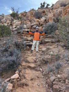
Paul at the rock scramble part of the Tower Arch hike

Paul at the rock scramble part of the Tower Arch hike

This hike was AMAZING! Challenging, beautiful, and very diverse. One of our favorite hikes so far. The All Trails app rates it as a “moderate” trail and I would agree. It is 2.5 miles out and back with an elevation gain of 626 feet because it’s a lot of up and down along the trail. It’s quite a large, secluded arch hidden behind the Klondike Bluffs that is ninety-two feet wide! And since it’s off the main park road, it doesn’t get nearly the same number of visitors. We only saw a handful of people when we hiked it in November with our daughter and son-in law.

Tip: To prepare for this hike, I would bring plenty of water. And I would pack it in a backpack, so your hands are free. You don’t need trekking poles but if you do bring them, make sure you can secure them to your body, so you have your hands-free. Wear layers, a hat, and remember your sunscreen no matter the time of year. Notice I said “hands-free” twice?

At the beginning of the trail there is a rock scramble that can look a bit daunting from the parking lot but go for it! We needed our hands to help balance us as we climbed the pile of boulders. It was tricky, and we were nervous, but we did it! The trail descends into a valley, a bit more up and down, then a final climb up a deep sand dune to the arch opening. It was impressive! The views along the way are spectacular. You can see so far at the top!

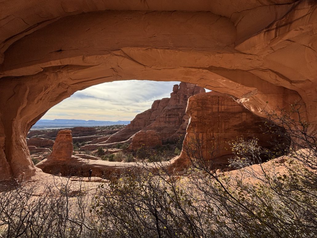
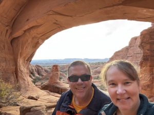
We climbed up under the arch itself and looked back through the Arch into Moab and beyond. We sat for a while to soak it all in and ate a snack.

Tip: Climbing into and under the arch itself allows for an incredible “framed” photo opportunity for a memorable picture you’ll want to share! Never climb on top of an arch.

Back door into Arches National Park to Tower Arch pictured hereThe first ¼ mile is the hardest. I was intimidated when I saw “rock scramble” in the reviews. Yes, we needed our hands, but we did it as novice hikers. We had Emma and Josh with us (daughter and son-in-law), and they were very encouraging and patient while we did our first scramble.
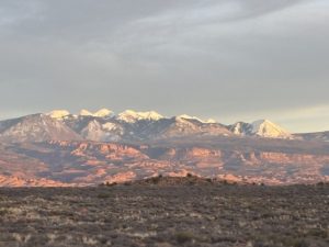
setting sun reflecting on the mountains in Arches National Park

The setting sun reflecting on the La Sal mountains in Arches National Park as we departed the park

After our hike, we went into Moab for dinner at Pasta Jay’s and drove back to Grand Junction. You can do this adventure as a day trip from Grand Junction, CO. However, I would stay in Moab and do more exploration of the entire area, like seeing dinosaur tracks! And if you don’t want to enter Arches from the back door, you can always get to Tower Arch from the main park road. For that stretch you can probably make it in a standard car, but the last few miles are dirt road.

Read our related post about the Many Adventures Near Moab Utah for more ideas!

If you are considering a move to Grand Junction, Paul would love to give you a relocation tour of the Grand Junction, Fruita and Palisade area when you come for a visit. Learn more About Paul and how he’s been serving his clients since 2001.

We have a lot of posts about other day trips so check them out on the Day Trips from Grand Junction page – a collection of curated adventures! There is so much to do in just a short drive from GJ. We feel like we are on vacation every weekend.

Michelle and Paul Aspelin sitting under Tower Arch in Arches National Park in Utah

Live Your Vacation in Grand Junction!
Follow us on Facebook and Instagram:
https://facebook.com/LiveYourVacationinGrandJunction

@liveyourvacationingj

Guest Post by Michelle Aspelin
growyourmindshare.com
Connect with Michelle on LinkedIn

© 2026 Paul Aspelin, REALTOR® MovetoGrandJunction.com and Michelle Aspelin. Copyright protected. All rights reserved.

by Michelle Aspelin
https://movetograndjunction.com/wp-content/uploads/2026/01/Arches-Tower-Arch-approach.jpg 1087 1498 Michelle Aspelin https://movetograndjunction.com/wp-content/uploads/2024/09/Move-to-Grand-Junction-logo-wide-Mesa-County-1030x167.png Michelle Aspelin2026-01-06 12:23:532026-09-28 16:49:22Back Door into Arches National Park
Day Trips, Local or Nearby Attractions

Silverton Day Trip from Grand Junction

Silverton Day Trip from Grand Junction

It was late October when we took our most recent Silverton day trip from Grand Junction. We have been there two other times and always enjoyed this calm, scenic mountain town.

Our first experience in Silverton, CO was in 2021 when we drove from Arizona to Grand Junction to see our daughter on our way back to Minnesota. From Grand Junction we drove south along Hwy 550 to Durango. We hit many small towns in Colorado before turning north to Minnesota. That trip included our first experience on the Million Dollar Highway.

The Million Dollar Highway

We didn’t do much research about the Million Dollar Highway our first time to Silverton. I thought it was all about the “million-dollar views”. Boy, were we surprised! Paul drove with white knuckles while I could barely look out the side window down the 1000’ cliff. We both watched the road as we twisted and turned along the side of the mountain and the cliff. No guardrails. Speed limit gets down to 15 mph because of the tight curves. Once we made it safely to Durango, I looked it up online and the first website to pop up was “Most Dangerous Roads” … gulp! I texted our daughter’s boyfriend at the time, Josh, and asked him about people dying on that road. And his reply, I remember to this day, “Yeah, about a dozen people die each year on that road but it’s mostly during the winter so you don’t really need to worry.”  What?!?!?!

The second time we drove it was to give our relatives a chance to see Silverton and the Road while they were visiting. I sat behind the driver vs in the passenger seat, and it went much smoother. The most recent time was in October 2025 and this time we stopped along the way and really took in the experience. We are more comfortable driving on the mountain roads now. It was much more enjoyable. We went on a Sunday when the Broncos were playing, so there was hardly any traffic on the road which made a huge difference. The first time we drove it a semi carrying logging timber came around the corner and Paul practically came to a stop in his lane (we were only going about 15 mph anyway) until the semi passed and we both gave a sigh of relief.

Where is the Million Dollar Highway?

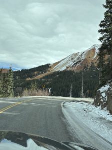
The Million Dollar Highway is officially the stretch of Hwy 550 between Ouray and Silverton, part of the larger San Juan Skyway that makes a big loop in SW Colorado. About halfway, you go over Red Mountain Pass (10,899 ft. elevation). It’s very beautiful. There are only parts of the road with the steep drop-offs and absolutely no shoulder. Other times it flattens out and gets wide as you go through a valley closer to Silverton. I think it’s something everyone should experience once. Just go slowly and only go in good weather without snow on the ground or rain so you can enjoy it. I feel like every day trip we take is like a mini vacation. We get so lost in the experience of it all, it’s a great break.


Red Mountain Pass and Yankee Girl Mine

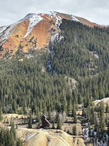
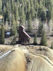
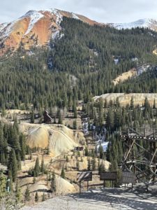
This is a stunning part of Hwy 550. There are actually 3 Red Mountains, named 1, 2 and 3 that stand out against the deep blue sky. There is a pullout near the top, on the north side of the pass that explains the multitude of mines in this area. It is there that we learned that the Yankee Girl Mine was one of the most profitable silver mines in the United States.

The Yankee Girl mine went nearly straight down to a depth of 1200 vertical feet. The remaining structure serves as a relic of the area’s rich mining history, and it was fun to photograph it. It was in operation from 1882 to 1890. The Yankee Girl Mine helped bring attention to the Red Mountain Mining District, which eventually became a significant mining area known around the world.


Silverton Durango Narrow Gauge Railroad

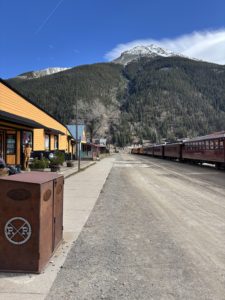
Another way to get to Silverton is to take the train north from Durango. The train drops passengers off in the downtown business district. There was a train at the station when we last visited. You can start your adventure when the train drops you off and visit the many shops, galleries, and restaurants. They offer a round trip from Durango with a 2-hour layover in Silverton or trips with an overnight stay in Silverton. There’s a special Polar Express experience during the holiday season. Get your tickets and more information at https://www.durangotrain.com.

Silverton Mountain Backcountry Ski Area

Paul gets asked a lot by clients coming in from out of state about the closest place to downhill ski. We tell them about Powderhorn Mountain Resort on the Grand Mesa or Telluride Ski Resort. But did you know that Silverton has a chairlift? It’s at Silverton Mountain about 6 miles out of town. This is no ordinary resort, in fact, there is no resort at all. Just a chairlift.

Silverton Mountain describes the experience like this. “Imagine a place where the average total snowfall of over 400 inches exceeds the amount of daily visitors. Advanced and expert only riding, no groomers, no clearcut runs and a real mountain experience with plenty of adventure on tap. All thrills, no frills.” That’s right, we saw the chairlift but no clearcut ski runs through the trees. They offer heliskiing where a helicopter drops you off, up to six times in one day, to ski Silverton’s backcountry. Be sure to bring your own food and water. They rent ski and snowboard equipment suitable for the area. It’s open to the public Thursday-Sundays during the winter and spring ski season. Private heliskiing is available 7 days a week, including Monday through Wednesday when mountain operations are closed. Learn more at https://silvertonmountain.com.


The Town of Silverton, Colorado

Ok, enough about getting to Silverton, let’s talk about what you can do while you are there for your Silverton day trip from Grand Junction. Silverton is a tiny, historic mountain town with a little over 700 residents. There are miles of ruggedly beautiful mountains surrounding the town that serve as their playground with great jeeping, hiking, biking, mountaineering, fishing, ATVing, and river running. It’s an official Colorado Creative District offering a vibrant arts community. They have outdoor music and many festivals and events during the summer months, including a farmers market in July, August and September.

The buildings are mostly classic Victorian era including the notorious Blair Street, home to bars, brothels and bunkhouses for the miners. It’s now home to shops, art galleries and restaurants, some with funky names.  The main street is called Greene Street, and I think it’s the only paved road through town. It’s small but charming and welcoming. We ate at a saloon on Greene Street that still had a bullet in the wall behind the bar from the “wild west” days. The Silverton Cemetery attracts visitors during the day and even at night to experience some paranormal activities. Some buildings are said to be haunted as well. There are museums and mine tours to learn about the rich mining history.

We saw a small grocery store. There are hotels and RV Parks with cabin rentals if you want to stay the night and continue your adventure. Maybe rent an ATV and do the Alpine Loop? There are loads of small creeks that lead into the Cement Creek, Animas River and Mineral Creek. The scenery is stunning everywhere you look, just like most of Colorado.

Access the Alpine Loop

You can stay in Silverton and access the 63-mile Alpine Loop. From Silverton, the Alpine Loop connects with Lake City and there’s another access from Hwy 550 on the Million Dollar Highway that takes you to Ouray. ATVs are no longer allowed to drive through town, so you’ll need to trailer them up to a staging area or have someone drop you off for your adventure. Plan on a full day, or more, to drive the loop. The Alpine Loop is demanding, and you need to be prepared. The two 12,000-foot passes (Cinnamon and Engineer) require a high-clearance four-wheel-drive vehicle, but the well-prepared traveler reaps the rewards: pristine mountain views, abundant wildflowers, hiking and biking trails, great camping opportunities, and ample solitude in the heart of the San Juan Mountains.

These rocky roads were first used by 19th-century miners, who carted their ore to Silverton, Ouray, and Lake City in mule-drawn wagons. They weren’t built for automobiles. There are seven ghost towns along the loop. We’d like to see Animas Forks Ghost Town someday. Make sure someone knows your travel plans and do your homework before you start your trip. Be sure you have a full tank of gas and ample food and water supplies as there are no services along the Alpine Loop itself. Oh, and it’s closed in winter. We haven’t driven the loop, we just drove a small portion from Silverton and we went a few miles on it from Lake City.  Someday we will rent ATVs and experience the full loop.

In Silverton, you can rent ATVs, golf carts, e-bikes, mountain bikes, go horseback riding and participate in guided hikes. There are all sorts of outdoor adventures you can take advantage of on a Silverton day trip from Grand Junction. I really enjoyed strolling the main street and going into the shops and galleries.

If you’d like to live near aventures like this in Silverton, Get Started!

Book Recommendation

If you want to experience the 4×4 and jeeping backcountry roads in Colorado, I highly recommend the book by Charles A. Wells called “Guide to Colorado Backroads & 4-Wheel Drive Trails” and there is a “Northern” version for roads north of I-70. I was able to snag the book at a Friends of the Library book sale, and I purchased the northern version, a spiral bound book, but we haven’t ventured north of I-70 yet. The San Juans keep pulling us south.

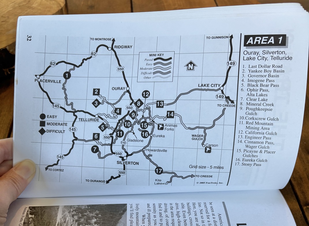
The books categorize the trails by easy, moderate, or difficult. They include photos, detailed maps, and descriptions about what to expect at what mile point along the trail. It helps keep us out of trouble. We stick to the “easy” roads. However, we took one 4×4 only trail in our Tacoma, Washington Gulch, to get us to Emerald Lake from Crested Butte. THAT was amazing but we got lucky. That particular road wasn’t in the book, and I think it was definitely a moderate trail. Not good for our first experience! Ask Paul to tell you the story about our trip and what the lady at the Visitor Center advised us to do! Lesson learned, do your own homework first and know your limits.

There are plenty of adventures beyond a Silverton day trip from Grand Junction that you can enjoy within 2–3 hours of the Grand Valley — and the journey is always stunningly scenic. I hope you enjoyed this post about our Silverton day trip. If you want us to write about other Grand Junction day trips, let Paul know. There is so much to see and do in Grand Junction and the surrounding mountain and desert communities. Paul has lots of stories he can share.

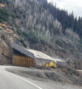
Red Mountain Pass mining district overlook

If you are considering moving to Grand Junction, Paul will give you a tour when you first come for a visit. Learn more About Paul and how he’s been serving his clients since 2001.

Live Your Vacation in Grand Junction!
Follow us on Facebook:

https://facebook.com/LiveYourVacationinGrandJunction

Guest Post by Michelle Aspelin
growyourmindshare.com
Connect with Michelle on LinkedIn

© 2025 Paul Aspelin, REALTOR® MovetoGrandJunction.com and Michelle Aspelin. Copyright protected. All Rights Reserved.

by Michelle Aspelin
https://movetograndjunction.com/wp-content/uploads/2025/11/Silverton-Town-scaled.jpg 1375 2560 Michelle Aspelin https://movetograndjunction.com/wp-content/uploads/2024/09/Move-to-Grand-Junction-logo-wide-Mesa-County-1030x167.png Michelle Aspelin2025-11-03 14:39:442026-09-28 11:50:58Silverton Day Trip from Grand Junction
Day Trips, Local or Nearby Attractions

Leaf Peeping from Grand Junction

Leaf Peeping from Grand Junction

When fall comes and you want to go leaf peeping from Grand Junction, you have a huge advantage over people who live on the Front Range. Here on the Western Slope, we can easily get to Telluride, Ouray, Crested Butte, and of course, the Grand Mesa. We don’t need to sit in traffic for long hours due to congestion on I-70. In fact, we don’t have to get on I-70 at all! If you are not from Colorado and you have never driven our East/West Interstate, please read my post called “I-70: What it’s really like to drive it.” And be prepared to be entertained!

Crested Butte Leaf Peeping

We decided on a day trip the last weekend in September to go leaf peeping from Grand Junction to Crested Butte. We drove Kebler Pass, which is only open during the summer months. It was stunning. Of course we stopped at our favorite spot for tea/coffee, Rumors, and ate at McGill’s Restaurant. Both are located on the main drag, Elk Ave. Supposedly the largest Aspen grove is found along Kebler Pass. The leaves were amazing, and while the pass was popular, there wasn’t any “traffic” to contend with.

We left Grand Junction and drove to Paonia, then the Kebler Pass to and from Crested Butte. On our way back, we drove through Redstone and had a picnic dinner along the river, then to Glenwood Springs and came back I-70 to Grand Junction. But we could have come back via Paonia and stayed off I-70 if we wanted to. But we like making a loop to see different things vs coming back the same way. Marble is next to Redstone, read the post called Get Your Marble in Marble to learn more about that area.

Fall leaves from Kebler Pass with ferns and aspen trees with yellow leaves

Kebler Pass on the way to Crested Butte

Fall leaves along Kebler Pass with mountains and blue sky

Kebler Pass view while driving to Crested Butte

bright orange and yellow fall leaves and Michelle and Paul Aspelin

Crested Butte last week of September

Eating picnic dinner along the river in Redstone showing mountains and park

We sat at a marble picnic table and ate dinner along the river in Redstone


Grand Mesa Leaf Peeping

We took another day trip the very next day. This time we went leaf peeping from Grand Junction to the Grand Mesa. We did that day trip twice this fall. The second trip was the last weekend of September, the leaves were in their peak colors. We drove up to Powderhorn Mountain Resort during their special “Color Day” celebration and took the chairlift up to the top of the mountain. That was Michelle’s first time on a chairlift. We hiked a part of the West Bench Trail at the top of the mountain and came back to the resort for a snack and listened to the music on the outdoor deck.

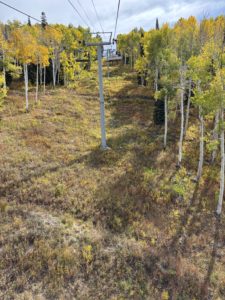
Yellow and green aspen leaves viewed from the chairlift at Powderhorn Mountain Resort

View from the chairlift at Powderhorn Mountain Resort

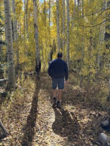
walking the West Bench Trail among the yellow aspens at the top of Powderhorn

Walking the West Bench Trail among the yellow aspens at the top of Powderhorn

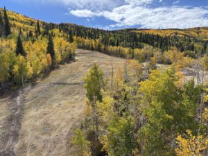
View of the mountain biking trail below the chairlift at Powderhorn

View of the mountain biking trail below the chairlift at Powderhorn


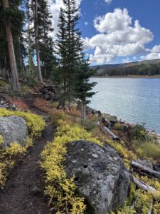
On a different trip up to the Mesa, we kept going on Hwy 65 and stopped at Mesa Lakes Lodge for lunch. After stopping at the Grand Mesa Visitor Center, we  hiked Ward Lake. It has a great section that goes through a beautiful forest. Continuing on with our day, we hiked Land O’ Lakes, a short .5 mile out and back with the best views! It’s a paved trail that’s very high. We could see Craigs Crest, tons of lakes, of course, and even the Elk Mountains and the San Juans in the distance. That short hike is on the list for the next time we have friends or family in town. We took Michelle’s sisters there in mid October and it was still stunning. Easily one of the best viewpoints on the Mesa!

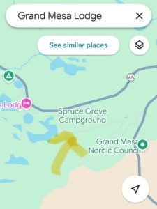
map showing the dirt road we took along Hwy 65 on the Grand Mesa

This map shows the dirt road we took along Hwy 65 on the Grand Mesa

View from the Land o' Lakes trail overlook showing mountains, aspen leaves, and Indian Lake

View from the Land O’ Lakes trail overlook

Dirt road through the woods showing bright yellow aspen leaves on our leaf peeping from Grand Junction trip up the Grand Mesa

View from the dirt road – the aspen trees were glowing!

Hiking trail around Ward Lake on the Grand Mesa showing rocks, green and red ground cover and the lake

Hiking around Ward Lake


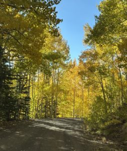
At the end of our day we relaxed and had drinks outside on the deck at nearby Grand Mesa Lodge. We were enjoying ourselves so much we ended up eating dinner there too. On our way back, we took a small bypass down a gravel road and past a campground, then back onto Hwy 65. THAT was amazing! The beautiful aspen leaves covered the road like a tunnel. Again, the Mesa was busy this time of year, but there was no traffic, no waiting in line, just great views!

Facebook post showing traffic congestion for leaf peeping from the front range

Skip the I-70 Traffic: A Better Way to Enjoy Fall in Western Colorado

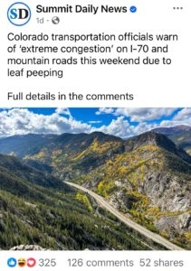
Online we saw several news reports of vehicles being so backed up on I-70 for leaf peeping from the Front Range that they actually had to close an exit near Georgetown. That’s not fun. Last year we stayed overnight in Denver with friends who were in town from Wisconsin to attend a concert at Red Rocks.

On our way back to GJ, we drove west to Evergreen, then to Fairplay and up to Breckenridge passing The Colorado Trail near Kenosha Pass. It was so backed up it took us an hour to go just a few miles. We vowed to never get stuck like that again! However, we did see a moose and her baby, that was cool!

When you go leaf peeping from Grand Junction, you can plan your day as you’d like. You can live like you are on vacation every day with access to the mountains and all its glory. And after the leaves peek in the higher elevations in September, you can enjoy fall again when they peek in Grand Junction around mid to end of October.

See our Day Trip Collection of posts for more adventure inspiration!

I posted some leaf peeping videos on my Facebook page called Live Your Vacation in Grand Junction.

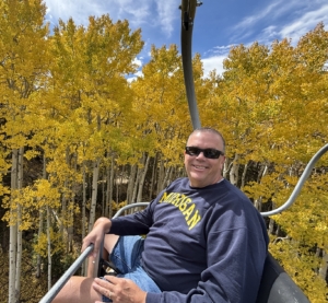
Paul Aspelin on the chairlift at Powderhorn showing the yellow aspen leaves

Paul Aspelin on the chairlift at Powderhorn Mountain Resort

Live Your Vacation in Grand Junction!

PAUL ASPELIN, your Grand Junction Relocation and Listing Expert
REALTOR®, GRI, SRES®, CNE

Call or Text (612) 306-9558 (locally based)
Connect with me on LinkedIn or send me an email.
Serving Mesa County and the Grand Valley in Colorado.

© 2025 Paul Aspelin, REALTOR®. MovetoGrandJunction.com Copyright protected. All rights reserved.

by Paul Aspelin, Relocation & Listing Expert
https://movetograndjunction.com/wp-content/uploads/2025/10/Fall-Leaves-Crested-Butte-header-scaled.jpg 1091 2560 Paul Aspelin, Relocation & Listing Expert https://movetograndjunction.com/wp-content/uploads/2024/09/Move-to-Grand-Junction-logo-wide-Mesa-County-1030x167.png Paul Aspelin, Relocation & Listing Expert2025-10-22 11:35:232026-09-28 16:47:01Leaf Peeping from Grand Junction
Day Trips, Local or Nearby Attractions

Telluride: Last Dollar Road Day Trip

The Last Dollar Road and Telluride Day Trip

What an amazing day trip to Telluride! What started out as just a Last Dollar Road Day Trip also included discovering where Last Dollar Ranch was, the house in the John Wayne movie True Grit, Ralph Lauren’s Double RL Ranch, Last Dollar Pass, Tom Cruise’s old neighborhood, the Telluride one runway regional airport and drinks on the roof of the Last Dollar Saloon. Oh yes, and an indescribable experience of a Mushroom Parade down the main street in Telluride! So unexpected, it left us speechless.
Why do a Last Dollar Road Day Trip?

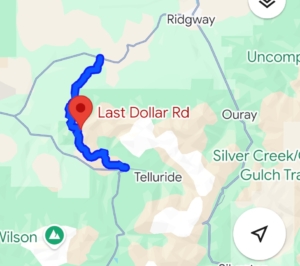
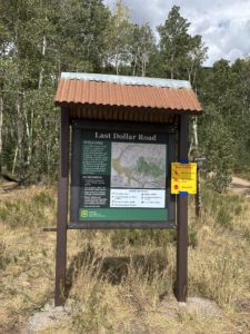
Last Dollar Road Day Trip map showing 4x4 roadsFirst, let’s start with why we planned a Last Dollar Road day trip to begin with. Michelle has this book called Guide to Colorado Backroads & 4-Wheel Drive Trails, and the first trail in the book is Last Dollar Road. It’s rated as an “easy” trail vs moderate or hard. We prefer to only do the easy trails in our Toyota Tacoma since we are new at this. The book describes the trail as…

“This scenic ranchland and forest backroad is a great alternative to the paved drive between Ridgway and Telluride. Enjoy abundant wildflowers through early summer, great fall color and stunning mountain views.”

It is a rutted dirt road suitable for high-clearance, 2-wheel-drive vehicles when dry. Slick clay makes it impassable when wet, even for 4-wheel-drive vehicles. We wanted to see the stunning views of this mining supply road built in the 1800’s so we added it to our list of places to see. Because the road is only open in the summer, we went in August.

Where is Last Dollar Road?

Double RL Ranch overlook with view of the San Juan Mountains

Overlook at Double RL Ranch near Ridgway, CO

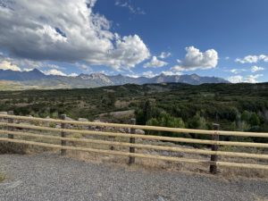
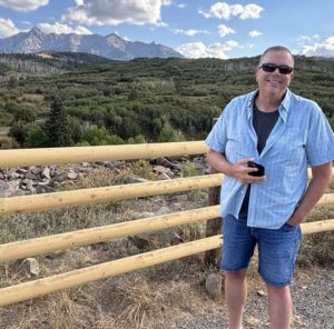
From Grand Junction, drive South on Hwy 50/550 to Ridgway, CO and turned right, or west. About 9 miles outside of Ridgway there is a scenic overlook we have stopped at many times to take photos of Mount Snuffles and Mount Wilson. It’s on Google Maps as “San Juan Mountains Scenic View”. See our most recent photo in this post.

What we didn’t realize until our return trip, is that fence you see, it goes on for about 20 miles, is the fence line for the Double RL Ranch, a rustic haven owned by American fashion designer Ralph Lauren and his wife Ricky. They own 17,000 acres and there’s an article online where Oprah describes her visit to the Double RL Ranch that includes some photos of his Americana themed ranch. Oprah also visited Tom Cruise’s old house in Telluride, which I will tell you about later, when we talk about the Telluride Airport. Plus, she has a home in Mountain Village!

The Amazing Drive Itself

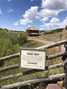
House and Ranch in the John Wayne Movie True Grit near Ridgway, shows mountains and historic wood homeAfter the scenic overlook near Ridgway, we took a left onto CR-58P. There’s a sign for Last Dollar Road. The road is closed from January to May due to snow. This is where our Last Dollar Road day trip officially begins. The unpaved county road was wide and well maintained. Our first photo op was at Mattie Ross’ Ranch from the True Grit movie with John Wayne. True Grit was filmed in 1969 and begins and ends at the family ranch of young Mattie Ross (Kim Darby), which was filmed at a historic home on Last Dollar Road above Ridgway. In the final scene, John Wayne jumps his horse over a fence and rides off into the distance. The ranch house has been restored and remains private property. The scenery around it hasn’t changed much and is as gorgeous as it was then.
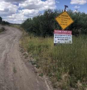
Last Dollar Road Caution SignDriving the Last Dollar Road: Narrow, Steep, and Stunning
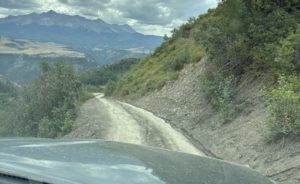
We left the county road and that’s where it got narrower, steeper, and rockier. We chuckled when we saw this warning sign. Luckily, we chose to drive the Last Dollar Road during dry conditions in August. It was amazing. We went through aspen groves, spruce-fir forests and open meadows with sweeping views. The road is very rutted due to snowmelt run-off down the mountain side. We drove about 5-10 miles per hour, sometimes using 4-wheel-drive Low to climb some steep slopes. We waited for cows to move off the road once. Didn’t pass any cars on the way up, up, up to Last Dollar Pass. Each bend in the road delivers jaw-dropping scenery.

At the top of the pass, we stopped at the popular overlook. I’m not sure what the spot is officially called but it was stunning. The views are unreal. There is a ramp where the road literally goes off a cliff, so we parked the Tacoma there too and took some photos! This is where we finally crossed paths with a Jeep and a couple of motorized dirt bikes.

Last Dollar Pass

Last Dollar Road shelf, narrow spot with drop-off on one sideA Thrilling Descent into Telluride

After this we started our descent into Telluride. We hit a narrow stretch, wide enough for just one vehicle on this two-way shelf road. A few minutes later we passed a Jeep, and they rolled down their window to ask, “What road is this?” I answered the Last Dollar Road. The 75-year-old driver smirked and said, “I’m glad to hear you say that. We weren’t sure we were on the right road!” He drove off with his lovely wife. We smiled. They were more clueless that we were, but they were “doing it” at their age. That is why we take these trips while we can. While we are healthy and able to appreciate this beautiful state.

Telluride Airport

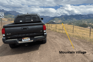
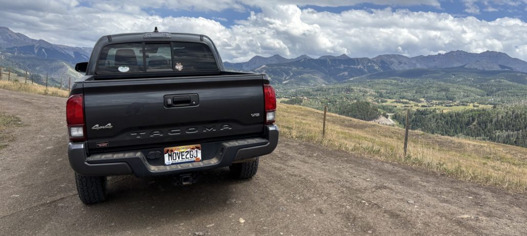
Parked near the Telluride airport with Mountain Village in the backgroundWe continued our descent and popped out right at the Telluride Regional Airport (TEX). It’s a one-runway regional airport and the end of the runway drops off into a deep canyon. We have seen the airport from the free Telluride Gondola that takes you from downtown Telluride up and over to Mountain Village. We joked at how short the runway is. Now, seeing it up close, it looks even shorter. It does curve upward at the end of the runway to give pilots a “lift” for takeoff. You can see Mountain Village behind the Taco in the photo we took at the airport entrance.
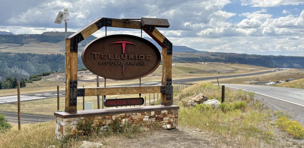
Flying into Telluride: Commercial and Private Options

The Telluride Regional Airport is open year-round to commercial flights from Denver and Phoenix via United and American Airlines. However, I bet most of the traffic is from private jets and charter services. There was construction going on when we were there. They might be adding another taxiway and more hangars for all those private jets. Their website has a page about Do’s and Don’ts for high altitude mountain flying and warnings about weather, wind events, and the potential to be rerouted to other airports, like the Montrose/Telluride Regional Airport located an hour and a half north of Telluride.

Telluride Regional Airport

A Few Famous People

Near Telluride Airport is the residential community called Aldasoro Ranch. In 1913, the Aldasoro family moved to this area from Northern Spain to raise sheep and provide lamb and wool to the nearby mining camps. Eventually they subdivided their land into individual home sites. The family still lives here and now runs Telluride Sleighs and Wagons, which offers sleigh rides and an event space with spectacular views.

I often joke with my friends about no longer being able to visit Tom Cruise in Telluride. Here’s a link to Tom Cruise’s old 298-acre mountain retreat. I say old because he sold it in 2021. Here’s a unique tidbit we also discovered while on our Last Dollar road day trip. When Tom Cruise was dating Penelope Cruz back in the early 2000’s, she would take a short trail called the Breckenridge Trail near his estate. It’s a 2-mile route above the Telluride Airport near the Aldasoro community. However, locals call the trail Penelope’s or Penelope’s Cruise. I assume she was spotted using the trail when she visited.

I mentioned Oprah Winfrey earlier when I was talking about the Double RL Ranch. You may or may not know that Oprah has a house here too. Oprah Winfrey’s Telluride House.

Downtown Telluride

Last Dollar Saloon view of Telluride box canyon mountainside

View from the roof of the Telluride box canyon

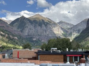
As you approach downtown, you drive in on Colorado Ave, the main street. Telluride is in a box canyon with steep slopes and rugged mountains surrounding the laid-back and unforgettable town. We drove to the end of the street before we found the last on-street parking spot. We paid for 2 hours of parking ($5) and started exploring the downtown area. As expected, there are many unique shops and boutiques, restaurants and breweries, adventure guide outfitters, museums and galleries. We spotted the historic Last Dollar Saloon and decided to go in, given the theme of the day! We had drinks on the roof with great views of the Gondola, downtown, and the picturesque mountainside. Their website touts that they were named “#1 Best Skier Dive Bar in the World”, it seems fitting.

Michelle commented about all the people gathering below on the street. We did notice a banner for the Mushroom Festival when we came into town, but had no idea what we were about to witness.

Thinking about living close to Telluride? Explore homes for sale in Grand Junction.

Mush Fest, formally known as the Mushroom Festival

Last Dollar Saloon roof looking down to Colorado AvenueThe Mushroom Festival was unexpected and eye-opening. People were dressed up as mushrooms, wearing mushroom hats and other unique costumes. It’s a weekend festival described on their website as “A weekend of mushroom love, community connection and fungi everything. You can expect expert hosted forays to ID mushrooms in the great San Juan Wilderness, talks from world-renowned mycologists, a foundation of the fest rooted off psychedelics and its current resurgence, large community gatherings, culinary delights, dozens of mushroom vendors and of course the world renown Telluride Mushroom Festival parade. Every year the festival attracts 1000’s of fungi fans from across the world.”
They sell tickets for their main event in the park. We just happened to witness the parade of mushroom lovers down Colorado Ave. Some looked, well, high on shrooms, and others just strolled down the street in their fancy costumes. The town of Telluride quite literally shuts down to 1000’s of mushroom people marching down Main Street to music, dancers, drummers and some pushed a mushroom vehicle known as Amanita-mobile down the street.

After the Mushroom Parade “experience” we got dinner at Steamies Burger Bar. While we didn’t have their specialty steamed burgers, we definitely enjoyed our food. Michelle had a cup of the Truffle Herb Mac-n-Cheese and I had a great chicken wrap sandwich. The Visit Telluride website has a list of events by season and a lot more.

An Unforgettable Last Dollar Road Day Trip

Last Dollar Road sign on the Telluride sideWe sure loved our Last Dollar Road day trip. I think we will be talking about everything we experienced for years to come. We loved the gorgeous aspen forest with unobstructed views of Sneffels Mountain Range and Wilson Peak. The range of colors from brown, green, and red against the bright blue sky was so beautiful. I forgot to mention that we noticed some forest service road camp sites on the Telluride side of the pass. There were no bathrooms, water or other services along the trail. It’s as rustic as it gets. We loved seeing the large ranches on the Ridgway side and the views from the Last Dollar Pass at an elevation of 10,663 feet. If we had family or friends in town, we might drive to Telluride on the highway and just go up to the Last Dollar Pass from Telluride and back down again. That would take less time and still offer spectacular views. Until next time!
I mention Telluride and Mountain Village in my post called Top Day Trips from Grand Junction with additional photos. This was the first time we visited Telluride without taking the Gondola up to Mountain Village. We won’t make that mistake again.

Looking for more ideas? Check out our Day Trips from Grand Junction page for more of the places we’ve explored from our home base in the Grand Valley.

Planning a move? Get my Grand Junction relocation guide or reach out and get your questions answered.

Move to Grand Junction and Do Day Trips Like This One!

Paul Aspelin standing at the Double RL Ranch fence overlooking the San Juan Mountains

Double RL Ranch fence overlooking the San Juan Mountains

Text or Call (612) 306-9558 (based locally)

PAUL ASPELIN, REALTOR®
GRI, SRES®, CNE

Grand Junction Relocation and Listing Expert
Connect with me on LinkedIn or send me an email.
Learn more about my experience and how I serve my clients 

© 2025 Paul Aspelin, REALTOR® MovetoGrandJunction.com Copyright protected. All rights reserved.

by Paul Aspelin, Relocation & Listing Expert
https://movetograndjunction.com/wp-content/uploads/2025/08/Last-Dollar-Road-Day-Trip.jpg 838 1612 Paul Aspelin, Relocation & Listing Expert https://movetograndjunction.com/wp-content/uploads/2024/09/Move-to-Grand-Junction-logo-wide-Mesa-County-1030x167.png Paul Aspelin, Relocation & Listing Expert2025-08-19 12:19:382026-09-28 16:55:38Telluride: Last Dollar Road Day Trip
Day Trips, Local or Nearby Attractions

Day Trip to Ouray CO

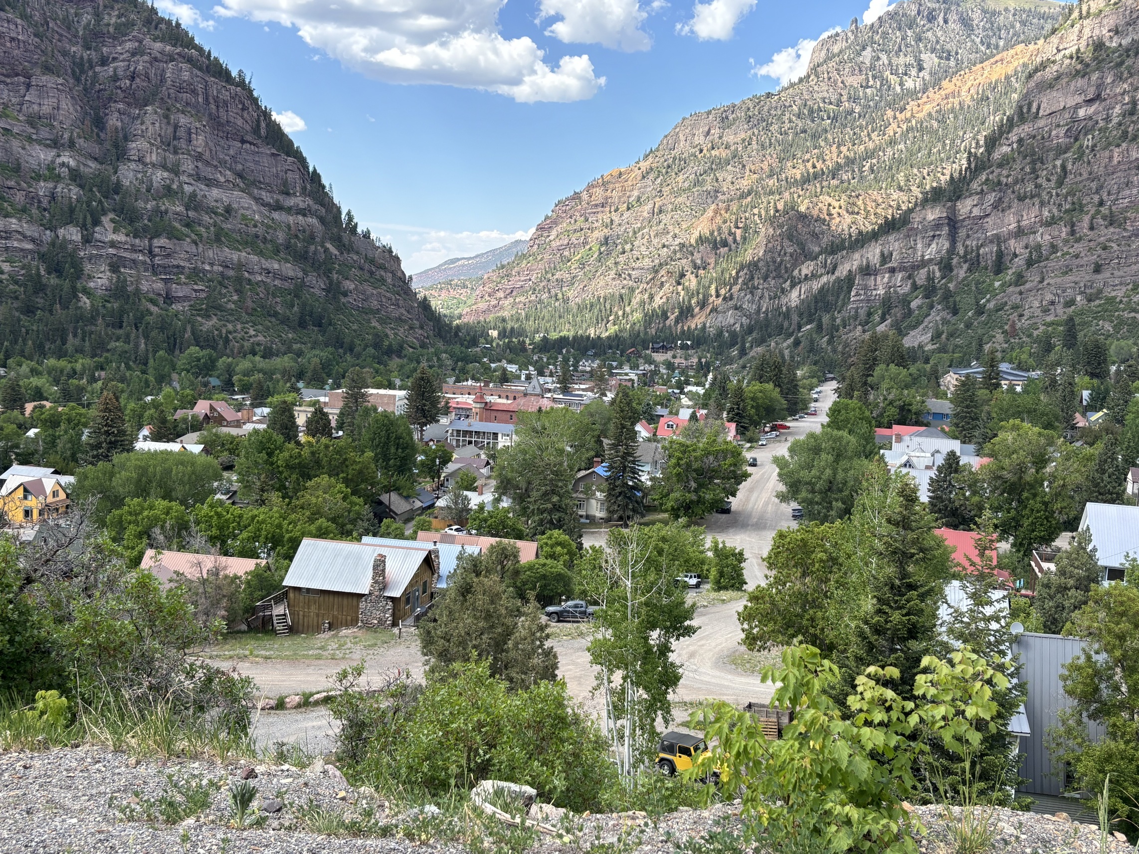
Ouray CO, A Beautiful Mountain Town

There are so many good things to say about a day trip to Ouray CO I don’t even know where to begin. We have gone there numerous times over the past couple of years and we are always discovering something new. What’s not to like about a mountain town nicknamed the “Switzerland of America”? It lives up to the hype!

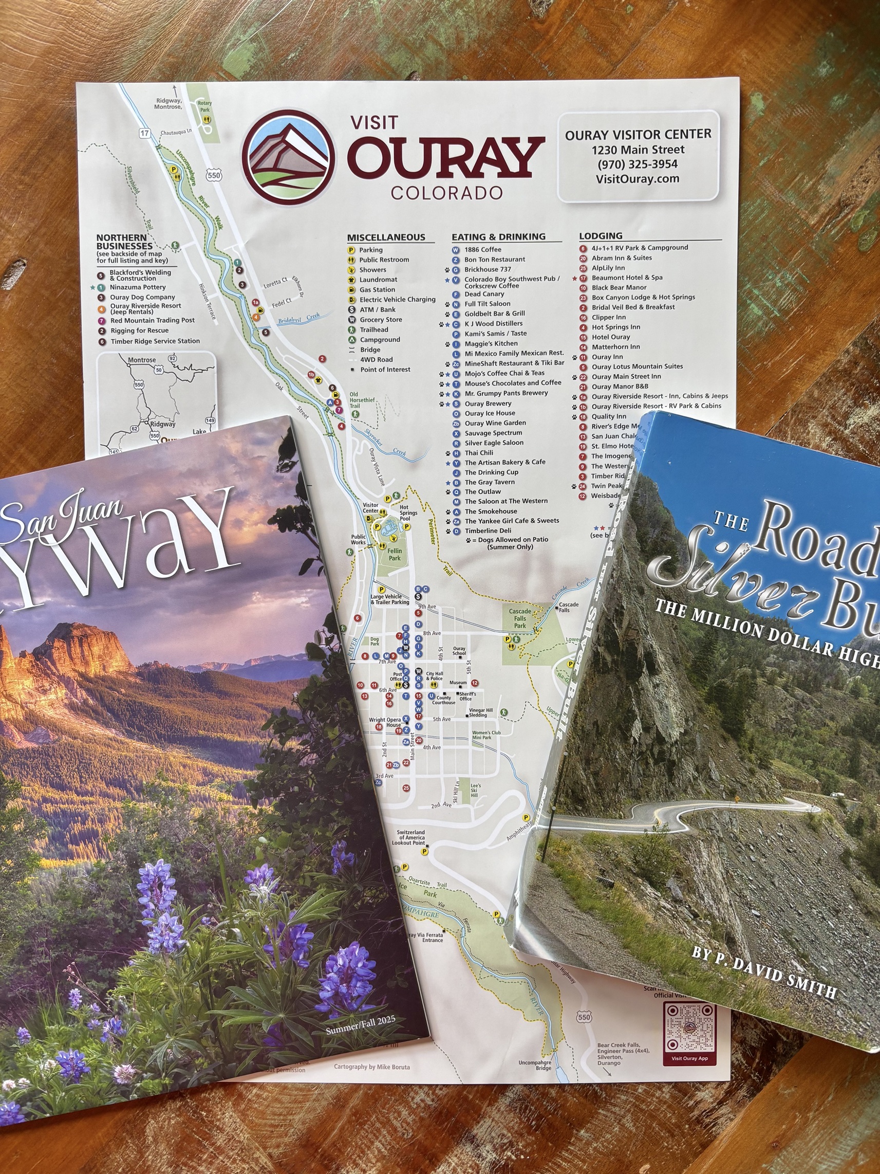
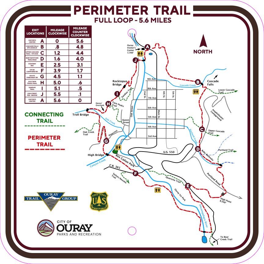
Ouray Perimeter Trail Map

You can read more about other day trips on the Day Trips from Grand Junction page – a collection of adventures!

Hiking in Ouray

“Ouray’s Perimeter Trail is a unique 5.6-mile hiking experience that features remarkably varied terrain, unmatched scenery, four waterfalls, six bridges, up-close geology, a hidden troll, and a rocktopus. Hiking it involves approximately 1,800 feet of elevation gain and loss and will typically take 4-5 hours to complete. Good footwear and trekking poles are highly recommended.”

Exploring the Perimeter Trail and Cascade Falls in Ouray

We started at the beautiful Cascade Falls. The trailhead is just .3 miles from town, accessed via 8th Avenue. We walked up to the falls and then hiked up further along the Perimeter Trail clockwise. Amazing views of the town below the whole time. The trail was in good shape, but lots of loose rocks and gravel made it sometimes feel a bit slippery. Thankfully we bought our new trekking poles, because they helped us keep our balance and gave us a boost when going uphill.

Ouray Perimeter Trail

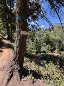
Ouray Perimeter Trail just after Cascade Falls going clockwise

After hiking about 3 miles and came back to town using the 5th Avenue connecting trail. We walked through town, got some lunch, and walked back to the car parked at Cascade Falls. That’s the nice thing about the Perimeter Trail, there are several connecting trails from town so you can hop on or off to make the hike as long or as short as you want. We really enjoyed it and plan to do a different segment next time we are in town or driving through.

Short but Stunning: Box Canyon Falls Hike

Another great hike is Box Canyon Falls. We did that one when we had family visiting from Minnesota. Very impressive! The water goes so fast, and it’s loud. Everyone should experience this short hike. Bring water and go slow as there are a lot of steps to climb. You might experience a little spray too so be prepared. There is a small fee for parking and access because it’s on private property.

Dining and Shopping in Ouray

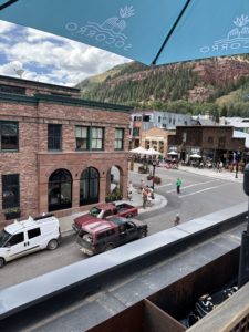
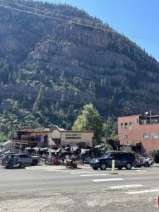
Goldbelt Bar and Grill in Ouray featuring outdoor patio dining

Goldbelt Bar & Grill outdoor patio dining

We ate on the outdoor patio at Goldbelt Bar & Grill. Excellent service. Good food and great views, of course. It’s a family-friendly place with burgers, pizza, sandwiches, salads and locally brewed beer.

We also enjoyed the Ouray Brewery with its fantastic, covered roof-top deck for outdoor dining. They serve typical pub-style American cuisine. I’m sure other places are great too, but those are the two we have been to. We also had excellent food at Mi Mexico, a family restaurant a couple blocks off Main Street. Large portions!

It’s fun to walk along Main Street and go into the many boutiques, shops, and galleries. We’ve bought a few things along the way for ourselves or as gifts for others. You can mosey along at a slow pace and just soak in all the beauty that surrounds you.

There are other in-town experiences like entertainment venues including the historic Wright Opera House, museums and art and culture.

Ouray Hot Springs

A day trip to Ouray CO should really include a soak in the Ouray Hot Springs Pool. There are sections with a water slide and obstacle course that attracts the kids. Adults 18+ have their own Overlook Pool to relax in a more peaceful setting too. The natural minerals in the sulfur-free water are beneficial for your body and your soul. We were there in summer and winter, during the day and after dark. Each experience is different and treasured. The Overlook Pool is about 102° – 106°. There are lockers in the changing rooms, but we just brought a bag for our stuff and set it next to the pool. Be sure to bring water shoes and a towel. Check out their website for rates and more information. Ouray Hot Spring Pool.

Adventure Trips

If you are looking for something a little more adventuresome here are several options:

  • Ouray Via Ferrata (climbing experience). There are more than 1500 Via Ferrata routes in the world, but currently less than 10 in North America!
  • Ouray Ice Park (winter ice climbing)
  • World renowned jeep/OHV trails allow you to experience the 4×4 only trails/roads through the scenic San Juan Mountains
  • Horseback riding
  • Backpacking
  • Camping
  • Mine Tours

Day trip to Ouray CO view from Perimeter Trail

Million Dollar Highway

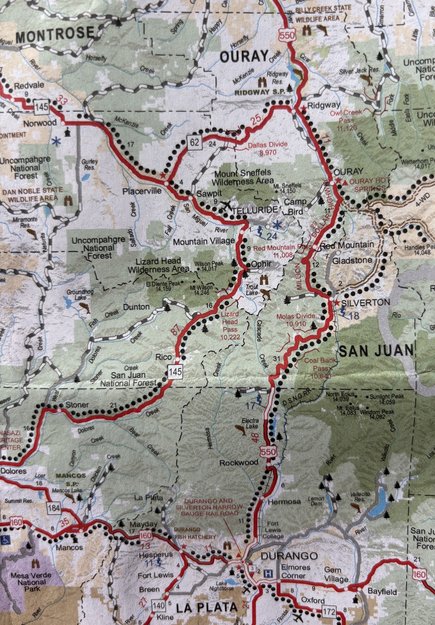
Map of Ouray, Silverton, Telluride area and Million Dollar HighwayYou can’t talk about a day trip to Ouray CO without mentioning the Million Dollar Highway. It’s part of the San Juan Skyway Colorado Scenic Byway. The Million Dollar Highway is the stretch of Hwy 550 that runs south out of Ouray, over Red Mountain Pass (elevation 11,018), and into Silverton. It is one of the most spectacular, scenic, and treacherous, drives in the US. Much of the time the speed limit is 15 or 20 miles per hour because of the sharp curves and drop-offs to the gorges below.

The shoulder is pretty much non-existent, and you won’t find standard guard rails either. Because of the steep slopes, this section gets a lot of avalanches that destroy the guard rails. They just stopped repairing them and removed them. It makes plowing easier because they can push the snow over the edge vs needing to blow it over a guard rail. I would never drive it in the height of winter.

First-Time Thrills on the Million Dollar Highway

Our first time driving the Million Dollar Highway we went south from Grand Junction to Durango. We had no prior knowledge of what to expect. Some think it’s called that because of the “million dollar views”. We knew it would be scenic, but we didn’t realize it was a white-knuckle kind of drive. Michelle could hardly look over the side as the passenger. As the driver I had to be laser focused on the road and could only glance over for a second. When there wasn’t oncoming traffic, I drove right down the middle of the two-lane road!

The worst was when we were approaching a sharp curve. We were in the “outside” lane with a steep 1000’ drop just about 10 inches from the white line. As we approached the curve, a section of the asphalt was sunk in, like it might give way, a semi-truck carrying logs comes around the corner barreling towards us. I pretty much came to a stop and held my breath! After he passed, we continued, thanking our lucky stars. As a first timer, it was incredible. We just wanted to get over the pass and to Durango. I guess there are pullouts along the road but obviously I didn’t see any because my eyes were glued to the road.

We have since been on the road two other times and had a much calmer experience.

If you’d like to live near adventure like this in Ouray, Get Started!

Roads and Mining in Western Colorado

Michelle has read many books about the history of Western Colorado. The most recent one was called “The Road that Silver Built: The Million Dollar Highway” by P. David Smith. When Ouray was first becoming a mining town, you got there from a wagon road from Lake City. There was no north/south road from Ouray to Silverton. Roads came from the east. The book explains how each segment was built and describes the numerous 4×4 only roads that were the first roads to access Ouray and Silverton.

The great Otto Mears built many of the first roads in the 1880s for wagons and carriages that eventually became roads for automobiles. Some were so steep, 14 percent grade, that they still remain as trails but never became part of Hwy 550. Mears also made the trails in the Colorado National Monument in Grand Junction.

Mining History and Scenic Peaks of Ouray

Of course, it was silver and gold that brought the prospectors to Ouray in the 1870’s. Some of the most profitable mines are in Ouray. Camp Bird Mine was the second largest gold producer in Colorado. It’s located in the Imogene basin on the way to Telluride. There are dozens of mines in Ouray County and lots of back country roads to get to them and the ghost towns that remain.

The town of Ouray was founded in 1875 along the Uncompahgre River where it runs north out of the stunning San Juan Mountains. Ouray County, CO, is known for several 14ers, including Mount Sneffels, Wilson Peak, Mount Wilson, and El Diente Peak. Plus, numerous more in the “Ouray, Lake City, Silverton triangle” which refers to the Alpine Loop Backcountry Byway, a 65-mile system of unpaved roads connecting the three mountain towns. It’s a popular area for off-road and backcountry recreation, offering stunning scenery and access to historic mining areas.

Plan Your Day Trip to Ouray, CO

If you’d like to take a day trip to Ouray CO, book it today! It is a unique mountain town with so much to offer. It’s about 90 miles south of Grand Junction, an hour and 45-minute drive. Read my post about Ridgway State Park because you might want to stop there along the way too!  And maybe take Owl Creek Pass on the way back.

Why Grand Junction’s Climate Might Be Perfect for You

If you are looking for a mild climate with all four seasons, consider moving to Grand Junction, CO. We are in the high desert (low humidity) with quick access to the Rocky Mountains. When it’s 95 degrees in Grand Junction, we can enjoy a Day Trip to Ouray, CO and it’s in the low 80’s. Perfect for outdoor activities! Read my post about Grand Junction weather to learn more.

Watch my short videos on Facebook: https://www.facebook.com/LiveYourVacationinGrandJunction

Live Your Vacation in Grand Junction!

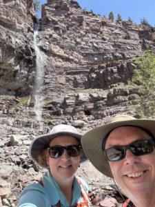
Ouray Cascade Falls Michelle and Paul Aspelin

Michelle and Paul Aspelin at Cascade Falls in Ouray, CO.

Text/Call 612-306-9558

PAUL ASPELIN, REALTOR®
GRI, SRES®, CNE

Grand Junction Real Estate Expert
Connect with me on LinkedIn or send me an email.
Learn more about my experience and how I serve my clients 

© 2025 Paul Aspelin, REALTOR® MovetoGrandJunction.com Copyright protected. All rights reserved.

by Paul Aspelin, Relocation & Listing Expert
https://movetograndjunction.com/wp-content/uploads/2025/08/Ouray-CO-town-photo.jpg 1713 2284 Paul Aspelin, Relocation & Listing Expert https://movetograndjunction.com/wp-content/uploads/2024/09/Move-to-Grand-Junction-logo-wide-Mesa-County-1030x167.png Paul Aspelin, Relocation & Listing Expert2025-08-07 15:18:452026-09-28 16:51:02Day Trip to Ouray CO
Day Trips, Local or Nearby Attractions

Ridgway State Park: Day Trip from Grand Junction

Ridgway State Park, Ridgway Reservoir, and a Surprise Drive Over Owl Creek Pass

We have driven from Grand Junction to Ridgway multiple times and have always admired Ridgway State Park and the Ridgway Reservoir from the road. We decided to make a point to go to the park for the day, visit the town of Ridgway, then drive back. Ridgway State Park is about 1.5 hours south of Grand Junction, 86 miles. It’s at the base of the San Juan Mountains.

Our day didn’t exactly go as planned but our surprise drive over Owl Creek Pass made the day trip even more memorable! I will explain the mistake we made in changing our plans, so keep reading!

Get notifications about new posts and watch my short videos on my Facebook page called Live Your Vacation in Grand Junction.

Ridgway Reservoir

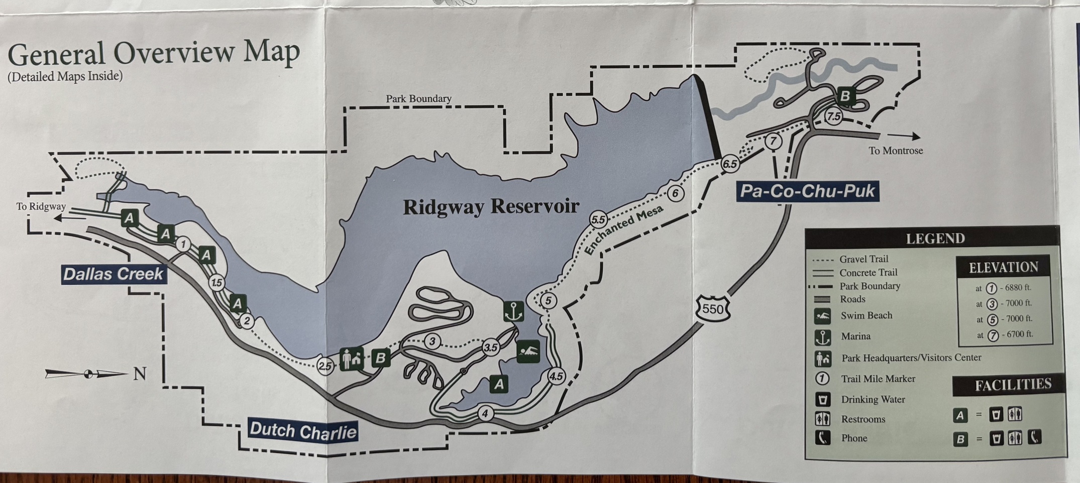
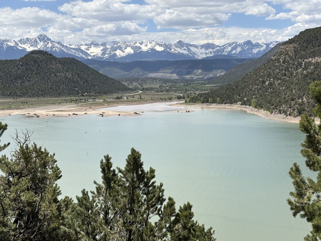
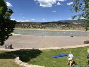
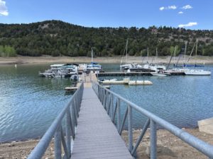
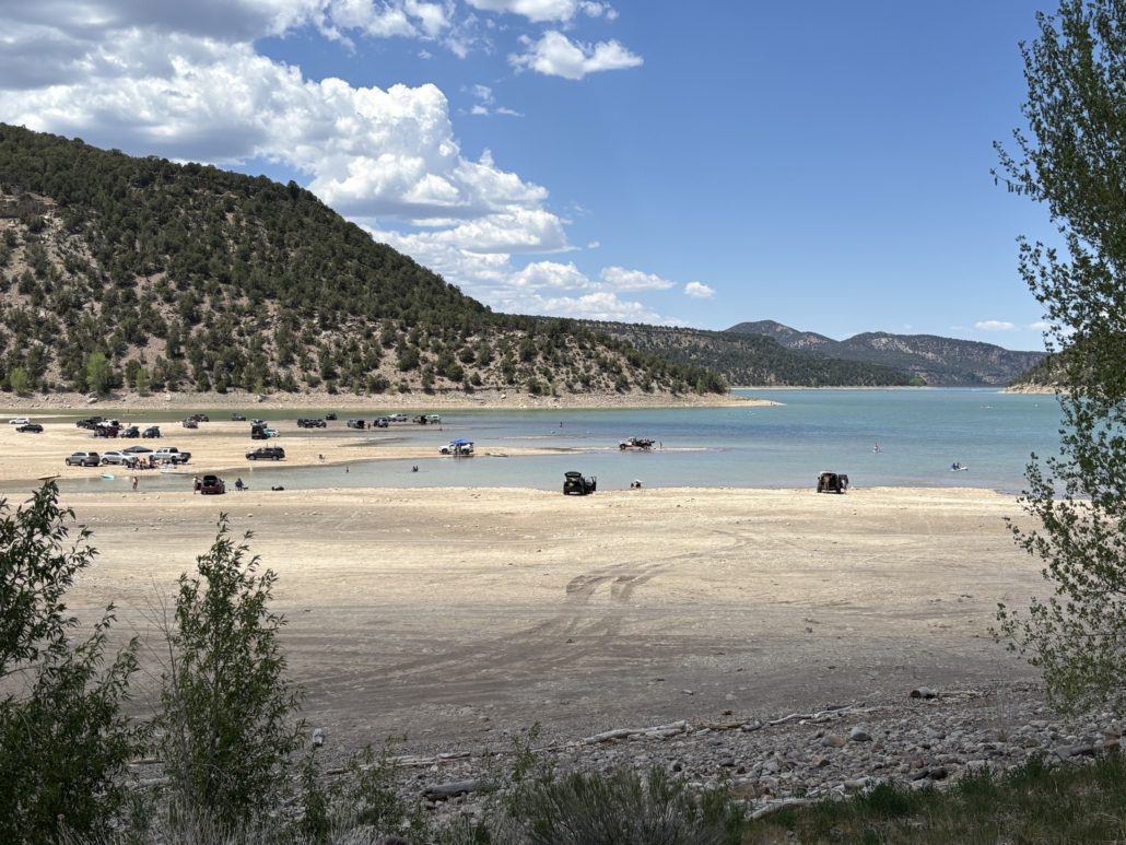
The 1,000-acre reservoir is so beautiful, a real haven for recreational activities year-round. Cars can drive right down the beach to the water’s edge and park for the day. There is a quiet bay area for swimming, and, of course, a dam that makes it all possible. All kinds of boats on the water, including sailboats and paddle boards. There are over 15 miles of hiking trails and three campground areas. We mainly visited the Dutch Charlie section with the Marina, Elk Ridge Campground and Dakota Terraces Campground. Then the Dallas Creek section.

Michelle scoped out a few hiking options for us before we left. Our first stop is always at the Visitor Center to pick up a paper map. Yes, maps on phones are nice but there’s still something special about looking at a map to determine your plans. Our plan was to hike the Forest Discovery Nature Trail, a short .6 mile loop, and the .1 mile Scenic Overlook Trail, then drive down to the beach and water itself.

Ridgway State Park Map

Ridgway State Park Map, click to enlarge

Hiking to the Scenic Overlook

We chose to start with the Scenic Overlook Trail. We were very excited to see the view from the top.  A fairly short trail led us right there, photos below. It was beautiful. The pinyon/juniper forest smelled so good! Hiking in the mountains is different than hiking in the desert.

Instead of going back to the Visitor Center and doing the Forest Discovery Trail, I saw a sign for another route called the Wapiti Trail that led to the Skyline Loop, which sounded fun. Michelle admitted she didn’t have the Wapiti Trail “saved” in her All Trails app as a route for us to take but we did it anyway. The first “change of plans” for the day turned out to be a strenuous one! The Wapiti Trail is only .6 miles but has an elevation change of 150 feet. That’s like climbing 15 flights of stairs, at 7,000’ elevation! We took it slow, rested and cursed a few times until we reached the top. We quickly understood why Michelle hadn’t bookmarked that one, so steep! Luckily, we had plenty of water and some electrolyte chews to keep us going.

We eventually did part of the Skyline Loop and headed back to the truck. We took much more time hiking than we planned, and we really wanted to get into the water. But first, we had to check out the Marina before we went to the Dallas Creek section with the big beach for cars.

Ridgway State Park View from the Overlook with the San Juan Mountains

Ridgway State Park View from the Overlook including the San Juan Mountains

Ridgway State Park Marina

There is a very large swimming beach and picnic area next to the Marina. We were there on a Saturday in early June and it wasn’t very busy at all. I bet it’s more popular during the height of summer. There are bathroom facilities. We stopped at the Marina to get information about boat rentals. There are pontoons available for half or full day rentals and the price seemed reasonable. After all, it’s much easier to rent a boat for a day than to own one! You can also rent stand-up paddle boards as well.

Ridgway State Park Swimming Beach near Marina

Ridgway State Park Swimming Beach near Marina

Ridgway Marina Ridgway State Park showing boats for rent at the end of the dock

Ridgway Marina Ridgway State Park


Dallas Creek

The Dallas Creek entrance to Ridgway State Park provides the ability to drive onto the beach and park right next to the water. You can see the cars on the beach from the road. We found a spot and parked. We got in the water up to our ankles. It was somewhat chilly but not as bad as we expected for a body of water at 7,000’ elevation made from snowmelt from the surrounding mountains. Others were gleefully swimming and lots of people on SUPs (stand up paddle boards).

Ridgway Reservoir cars on the beach

Ridgway Reservoir cars on the beach

We got a good feel for Ridgway State Park and now it was time to go into the town of Ridgway. As we approached the main stop light where you turn right to go into Ridgway, I said, “How can we be this close and not go to Ouray?” Ridgway was the focus of the day, but we “changed plans” and headed to Ouray. We always love driving through Ouray and taking a portion of the Million Dollar Highway to reach the Bear Creek Waterfall Overlook.

Taking the Scenic Route

Ouray was great, as expected. The waterfall was really flowing, and Michelle was able to capture a rainbow that appeared in the mist for a brief moment.

On Hwy. 550, just after the state park, and before the turn to the town of Ridgway, we saw a brown sign for Owl Creek Pass. Most of the reports Michelle read online from the area said that many of the upper mountain passes have been cleared of snow. She verified and this one was open. She did some quick investigation and learned cars can handle the road, you don’t need to have a high clearance 4×4. We were in our Toyota Tacoma, so we decided to make another “change of plans” and take the scenic road home. We make a lot of spontaneous decisions. And this is one we will remember for a long time.

View of Ouray, CO

Bear Creek Waterfall Overlook in Ouray

Owl Creek Pass

After Ouray, we took Owl Creek Pass east from Ridgway as a scenic way to get back to Grand Junction. THAT was amazing! It was an incredible drive. Just to give you an idea of driving a mountain pass vs the main roads, it only added 39 miles to our trip but took us an extra 2 hours because you drive so slow on high mountain pass roads.

The road was in pretty good condition, it was wide, no sharp drop-offs. Just a few piles of snow we had to drive through, but otherwise the road was mainly dry. We could see this one high mountain peak from the start, and it was cool because we kept getting closer and closer to it as we climbed higher and higher. Looking at maps afterwards we think it was Chimney Rock in the Courthouse Mountains. There is a scene in the 1969 movie True Grit with John Wayne that shows this view too. See my post about our day trip on Last Dollar Road to Telluride. It shows the house and ranch featured at the beginning and end of the True Grit movie.

Spot featured in movie True Grit


Why you should plan ahead

On this trip we learned we really should plan ahead. When we were near the top without cell service or a downloaded map we hesitated. There was a fork in the Forest Service Road and we had to guess which way to go. The road was not marked at all. Not good in the middle of the backcountry. Oops! We had maybe 3 cars pass us in the upper section of this road. We thought about turning around after about an hour into the drive because we were afraid we might get lost or be heading in the completely wrong direction.

We were supposed to go east, then north to hook up with Hwy 50. When we were heading south and southeast for a while, we doubted we were on the right Forest Road. After discussing it, we continued a bit further because we know that no mountain pass is a direct route. After about 10-20 more minutes we reached the summit of the pass. We laughed and exclaimed “We made it! We did it!”

We immediately hopped out of the car to take a picture of the pass sign and the beautiful scenery. There was a one-lane bridge over Owl Creek. We went in June just after the snow had melted, well mostly melted! I stepped in a snowbank along the creek. The water was rushing fast and the sound of the water in the otherwise quiet forest was so peaceful!

We soaked it all in. The air smells so fresh in the mountains, everyone should experience it at some time in their lives. Our mistake was not planning our route in more detail before we left. Next time, we will research a scenic way home ahead of time, should we decide to take it!

Wildlife near Owl Creek Pass

Elk on Owl Creek Pass

While on the pass we saw about 6-8 mule deer. After the creek, on the east side, we saw a sign saying we would be driving through private land for the next 7 miles. It was spectacular. Lots of cattle and lush green grass. We saw a couple dozen elk grazing in pastures and were able to stop and take pictures. There are always birds singing in the mountains too. We like to roll our windows down on drives like this to take in the sounds and the smells. Seeing the elk was like icing on the cake for this trip.

We loved Ridgway State Park and we will go back and rent a pontoon for an afternoon with family and friends. We will probably never go over Owl Creek Pass again given it’s not really “on the way” to other spots we want to see on our adventures but it sure was a memorable scenic way home! Even though we got home several hours after we expected to. It was a great day trip from Grand Junction.

Live Your Vacation in Grand Junction Every Day When You Move to Grand Junction!

Ridgway Reservoir at Ridgway State Park

If you are considering moving to Grand Junction, please give me a call. I’d love to show you round Grand Junction, Fruita, and Palisade and talk mountain passes with you!

Follow me on Facebook Live Your Vacation in Grand Junction! 

PAUL ASPELIN, your Grand Junction Real Estate Expert
REALTOR®, GRI, SRES®, CNE
Text or Call (612) 306-9558 (locally based)

Connect with me on LinkedIn or send me an email.
Serving Mesa County and the Grand Valley of Colorado.

© 2025 Paul Aspelin, REALTOR®. MovetoGrandJunction.com Copyright protected. All rights reserved.

by Paul Aspelin, Relocation & Listing Expert
https://movetograndjunction.com/wp-content/uploads/2025/06/Ridgway-Reservoir-at-Ridgway-State-Park.jpg 1011 1931 Paul Aspelin, Relocation & Listing Expert https://movetograndjunction.com/wp-content/uploads/2024/09/Move-to-Grand-Junction-logo-wide-Mesa-County-1030x167.png Paul Aspelin, Relocation & Listing Expert2025-06-12 14:40:412026-09-28 11:51:47Ridgway State Park: Day Trip from Grand Junction
Day Trips, Local or Nearby Attractions

North Rim Black Canyon of the Gunnison National Park

Day Trips from Grand Junction: North Rim of the Black Canyon of the Gunnison National Park

If you’re based in Grand Junction and looking for an unforgettable day of hiking, the North Rim of the Black Canyon of the Gunnison National Park is a must-see adventure.

I’ve read a few places that claim the Black Canyon of the Gunnison National Park is the least visited National Park. It’s not because it lacks facilities and features like camping and hiking and an astounding 2000’ deep canyon. I think it’s because it’s located a little off the beaten path. Not along a major Interstate highway. To go to the main South Rim Visitor Center, you enter from Montrose and get access to the west side of the river.

Get notifications about new posts and watch my short videos on my Facebook page called Live Your Vacation in Grand Junction.

Drive to the North Rim Ranger Station

West Elk Loop Scenic and Historic Byway Map

click to enlarge

To access the North Rim of the Black Canyon of the Gunnison National Park, like we did for this post, you take a different route to reach the north and east side of the canyon. From Grand Junction, it’s about a 2-hour drive to the North Rim. From town, go south on CR-50 to Delta, east on 92 to Hotchkiss. Continue on CR-92 south to Crawford. This is part of the West Elk Loop Scenic and Historic Byway.

Use your mapping software to get you to the North Rim Ranger Station. The paved road turns into gravel for the last 6 miles or so, but it’s very manageable in any vehicle. Download any hiking trail maps because you most likely will not have cell service in this area.

Exclamation Point Hike

We parked at the Ranger Station and took the Vista Trail to Exclamation Point and back. The hike took us through an open meadow with so many flowers, then patches of trees that offered us some shade. We continued to the end, a cliffside overlook that looks down on the Gunnison River 2700’ feet below us. It was absolutely amazing. One of my top 5 best hikes so far.

We went in mid-May so the wildflowers were in bloom. The temperature was comfortable in the 70’s. The trail is listed as easy but there are a couple challenges where you need to pay close attention to your footing. Mostly sandy or gravel trails, sometimes rocky, but not much. Wear hiking boots/shoes if you have them. Hiking poles may come in handy, but we don’t have any and did just fine.

We hiked at a leisurely pace and stop frequently to just look around and soak it all in. We typically stop at the end for a snack before heading back. This trail is 2.9 miles out and back with a 344 ft elevation gain and it took us about an hour and 45 minutes to complete it. The All Trails apps says average time is one hour 10 minutes.

Vista Trail flowers and meadow in the North Rim Black Canyon of the Gunnison National Park

Vista Trail flowers and meadow

North Rim Exclamation Point view to Gunnison River

Vista Trail to Exclamation Point

Vista Trail to Exclamation Point

Me at the Overlook before we reached Exclamation Point


More to see

From the North Rim Ranger Station you can drive south along the canyon rim for more overlooks and hiking trails. There is a campground on the North Rim.

You need a permit to hike down to the river’s edge and some extreme skills to handle the elevation change and steep slopes.

You can read more about the main Visitor Center and the South Rim Black Canyon of the Gunnison on my Top Day Trips from Grand Junction post.


Amazing Views on CR-92 South of Crawford, CO

Because we first stopped at the Crawford State Park Visitor Center, we got some excellent advice from the volunteers working that day. They recommended, instead of driving back to GJ the way we came, to continue south on CR-92 following the Gunnison River canyon and take Hwy 50 west into Montrose and back to Grand Junction. Because we have a decorative sign in our home that says, “always take the scenic route”, we did just that! Boy was that stunning! So many overlooks along the road, even some rumble strips to remind drivers to keep their eyes on the road. You can read my post about the Crawford State Park.

There were so many aspen trees. We plan to go back in the fall because we anticipate this to be a great place to see the fall colors. At their suggestion, we also stopped at Hermits Rest Vista. So thankful we did. More amazing views of the nearby mountains and the Gunnison River far below. We will bring friends to this spot when they come for a visit!

If you’d like to live near trails and national parks like this, Get Started!

Gunnison River from Hwy 92 near Hermits Rest

Gunnison River from Hwy 92 near Hermits Rest Vista

Live Your Vacation Every Day… Move to Grand Junction!

If you are considering moving to Grand Junction, please give me a call. I’d love to explain your housing options and show you around Grand Junction, Fruita, and Palisade. Search Homes for Sale in Grand Junction.

Watch my short videos on my Facebook page called Live Your Vacation in Grand Junction.

PAUL ASPELIN, your Grand Junction Relocation & Listing Expert
REALTOR®, GRI, SRES®, CNE
Text or Call (612) 306-9558

Connect with me on LinkedIn or send me an email.
Serving Mesa County and the Grand Valley of Colorado.

© 2025 Paul Aspelin, REALTOR®. MovetoGrandJunction.com Copyright protected. All rights reserved.


by Paul Aspelin, Relocation & Listing Expert
https://movetograndjunction.com/wp-content/uploads/2025/06/North-Rim-Gunnison-River-at-Exclamation-Point-scaled-e1749665444980.jpg 1417 1920 Paul Aspelin, Relocation & Listing Expert https://movetograndjunction.com/wp-content/uploads/2024/09/Move-to-Grand-Junction-logo-wide-Mesa-County-1030x167.png Paul Aspelin, Relocation & Listing Expert2025-06-11 12:07:412026-09-28 11:51:56North Rim Black Canyon of the Gunnison National Park
Page 1 of 212
30 Best Colorado Blogs 2026
Search Search

Follow us on Instagram

Follow us on Facebook

Logo image
Click to load facebook widget
Join our Facebook community

Google

Find us on Google Maps

Write a Review on Google

PAUL ASPELIN, REALTOR®

Paul Aspelin standing on a trail in the Colorado National Monument

Paul Aspelin Reviews and Recommendations

Read Paul Aspelin Reviews and Recommendations-personal notes and survey results from happy clients not found online.

“Paul went above and beyond in our home search, we looked at 17 homes in 2 days! Was very thorough with our search parameters and coordinating showings, even provided a book of all the listings he had scheduled for us. I would wholeheartedly recommend Paul!”

-Jeff Alexander, Grand Junction, CO (originally published on my Zillow profile)

loader-image
Today’s Weather
Grand Junction, CO
3:57 pm, Sep 28, 2026
temperature icon 64°F
light rain
67 %
1009 mb
17 mph
Wind Gust: 0 mph
Clouds: 100%
Sunrise: 6:07 am
Sunset: 6:02 pm

Get the 7-Day Forecast for Grand Junction and 20+ cities from local KKCO Weather. Read about Grand Junction Monthly Weather

Post Categories

  • Day Trips (14)
  • Featured Properties (2)
  • Fruita (7)
  • Grand Junction (13)
  • Grand Junction Real Estate (26)
  • Local or Nearby Attractions (33)
  • More to Know (15)
  • Palisade (6)
  • Property Taxes and Land Ownership (6)
  • Relocating to Grand Junction (26)
  • Retire in Grand Junction (6)
Popular
  • Paul Aspelin sitting in his winter jacket on the fishing dock while it's snowing
    Move to Colorado: No Need to Hunker Downin: Relocating to Grand Junction
  • Uhaul trailer and our Rav4 driving to Colorado
    Establish Residency in Coloradoin: More to Know, Relocating to Grand Junction
  • Retire in Grand Junction Coloradoin: Retire in Grand Junction
  • map of Grand Junction area
    Property Tax Programs for Colorado Seniorsin: Property Taxes and Land Ownership, Retire in Grand Junction
  • Relocating to Grand Junction with towable moving trailer
    Essential Steps for Relocating to Grand Junctionin: Relocating to Grand Junction
  • Custom Painted Mailbox by Emma Aspelin
    Wealth is Where Your Friends Arein: More to Know, Relocating to Grand Junction
  • 11 Reasons to Move to Fruita Coloradoin: Fruita, Local or Nearby Attractions
  • Move to Palisade Coloradoin: Local or Nearby Attractions, Palisade
Recent
  • Marble CO day trip from Grand Junction showing our 4Runner parked in front of the Marble quarry entrance
    Get Your Marble in Marble, CO: Day Trip from Grand Junc...in: Day Trips, Local or Nearby Attractions
  • Realty One Group Western Slop office interior showing conference room and lobby
    Why I Chose Realty ONE Group Western Slopein: Grand Junction Real Estate
  • Ashley Elliott Insurance Agent
    Advice From a Grand Junction Insurance Agent: Before You...in: Grand Junction Real Estate
  • Grand Junction adventure vehicle - Paul in our new Toyota 4Runner in Marble, CO
    What’s Your Adventure Vehicle?in: More to Know
  • Overland Expo Mountain West vendors
    Overlanding from Grand Junction: Our Visit to Overland Expo...in: Local or Nearby Attractions
  • Rocky Mountain National Park on Trail Ridge road above tree line with mountains in the background
    Just Driving Through: Rocky Mountain National Parkin: Local or Nearby Attractions
  • Top 30 Colorado Blogs photo of Maroon Bells mountains with lake near Aspen CO
    Top 30 Colorado Blogs—MoveTo GrandJunction.comin: More to Know
  • Red Mountain Mining Area and Yankee Girl Mine near Ouray CO
    Driving the Red Mountain Mining Area 4×4 Only Trai...in: Day Trips, Local or Nearby Attractions

Paul Aspelin, Realtor®

(612) 306-9558

Based in Grand Junction and serving Fruita, Palisade, and all of Mesa County

Member of the:

Grand Junction Area REALTOR® Association

Colorado Association of REALTORS®

National Association of REALTORS®

Categories

  • Day Trips
  • Featured Properties
  • Fruita
  • Grand Junction
  • Grand Junction Real Estate
  • Local or Nearby Attractions
  • More to Know
  • Palisade
  • Property Taxes and Land Ownership
  • Relocating to Grand Junction
  • Retire in Grand Junction

Search Properties

Start your search on the Realty ONE Group Western Slope website.

Relocation & Listing Expert with Realty ONE Group Western Slope

734 Main Street
Grand Junction, CO 81501

map

Follow us on Facebook

Logo image
Click to load facebook widget
Join our Facebook community

Follow us on Instagram

© 2023-2026 PAUL ASPELIN, REALTOR®. Aspelin Real Estate LLC. MovetoGrandJunction.com. All rights reserved. Licensed in Colorado FA100103754.
  • Link to LinkedIn
  • Link to Youtube
  • Link to Facebook
  • Link to Instagram
  • Link to Pinterest
  • Link to X
  • Privacy Policy
  • Accessibility
  • Code of Ethics and Equal Housing
Scroll to top Scroll to top Scroll to top