Experience the Colorado National Monument in Grand Junction
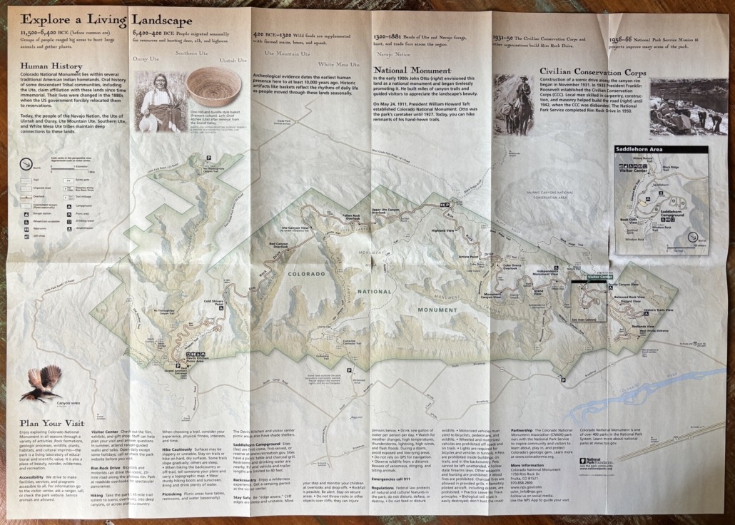
When you open the map for the Colorado National Monument, you might wonder “Where do I start? What should we do first? What is a ‘must see’ with the time we have?”
In general, most people experience the Colorado National Monument by driving through on Rim Rock Drive from Fruita to Grand Junction or vice versa. After three years of exploration, we have had a chance to really discover everything the Monument has to offer. It’s quite an amazing place and we are lucky to have it in our backyard. In fact, it’s now in the backyard of several clients that I helped move to the Redlands area at the base of the Monument!
I’ll start with the basics, then give you some tips based on our experience.
“Inch by inch, foot by foot. All around you, this dramatic landscape is always changing. Earth’s powerful forces and past climates built the land up; erosion continually wears it down. They tell a spectacular story of our dynamic planet.”
-a quote from the Colorado National Monument brochure/map you get from the Visitor Center
Rim Rock Drive
Rim Rock Drive is a wonderful 23-mile paved road that climbs to the top and winds along the canyon rim. It takes you from end to end with lots of roadside overlooks with spectacular views.
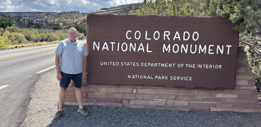
Construction of the road started in 1931 by the Civilian Conservation Corp and was finished in 1950 by the National Park Service. We prefer to enter from the West Fruita Entrance, closest to the Visitor Center, and complete our drive by exiting the East Grand Junction Entrance. You can also enter the park from a couple of small trailhead parking lots at the base of the Monument in the Redlands.
If you want to get to Glade Park (the General Store is something to see), you exit Rim Rock Drive at about the half-way point. This exit has a bathroom and also leads you to the Rattlesnake Arches trailhead via Black Ridge Road. We’ve taken this road and done the arches hike. Warning: you need a high clearance, 4WD vehicle to get to the Rattlesnake Arches trailhead. It’s worth the slow drive to see arches in Colorado.
Fun Fact: The second-largest concentration of natural arches in the world is in Rattlesnake Canyon within the McInnis Canyons National Conservation Area. It’s a cool hike, once you get there! Ask me about the drive to the trailhead.
If all you do is drive through the park, it’s exceptional. Views change with every curve in the road. Some of our favorite scenic overlooks are Fruita Canyon View, Independence Monument View, Grand View, and Cold Shivers Point.
All Four Seasons
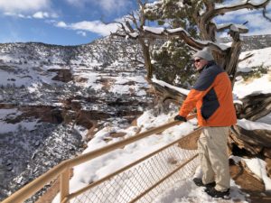
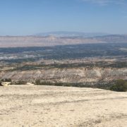
Paul overlooking Monument Canyon
You can enjoy “the Monument”, as locals call it, during all four seasons. Walking or hiking on the trails during the summer is best done in the morning since there isn’t a lot of shade. In the winter, mid-day hikes are perfect. To see the landscape with a dusting of fresh snow is magical!
The overlooks and several of the trails are accessible to people with all levels of abilities. The park is like a living place of beauty with stunning rock formations, plants, wildlife, and wilderness. There is so much to discover. If you can, dedicate a full day to exploration or two half days while you are in Grand Junction. And when you live here, you can go as often as you like in any season!
Amenities
Visitor Center
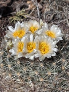
Blooming cactus in the Monument
They have a gift shop at the Visitor Center. Check out the exhibits to learn about the area. They offer ranger-guided walks and talks too. The bathrooms are accessed from the outside, so they are available all the time. There are pit toilets about midway along Rim Rock Drive and at the picnic area near the East Grand Junction entrance. There is an outdoor picnic area, and we recommend the Canyon Rim Trail or short Alcove Nature Trail across the street from the Visitor Center. Both are great options if you don’t want to walk very far but still want to feel immersed in the park.
While the main entrance gates are open 24/7 year-round, the Visitor Center is not. It’s open daily from 9AM to 4PM (with extended hours from 9AM to 5PM during the spring and summer months). It is closed on Thanksgiving Day, Christmas Day, and New Year’s Day.
Campground
We often drive through the Saddlehorn Campground to get to the Book Cliffs View overlook. We take everyone here for views into Wedding Canyon and of the city. Campsites are first-come, first-served or you can make reservations at Recreation.gov. There are restrooms, picnic tables, charcoal grills and drinking water nearby. Watch for bighorn sheep! We’ve had to stop on our way out to let them cross the road in the campground.
Picnic Areas
A fun way to experience the Monument is to pack a lunch or snacks so you can stop whenever you get hungry and soak in the beauty all around you. We have eaten at overlooks, or you can go to the dedicated picnic areas at Devils Kitchen Picnic Area (near the East Grand Junction entrance) or use the picnic area at the campground and Visitor Center.
Hiking
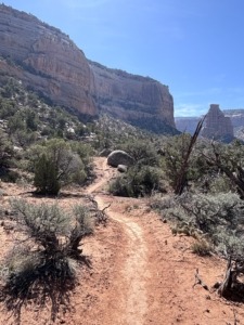
Wedding Canyon Trail
Aside from driving through, the Monument is best known for the 45-mile trail system. There are easy, moderate, and difficult trails. Some are super short, others go on for miles and miles! They can be steep or slope gradually. They are mostly dry but can be rocky or feel unstable in sections. The trails can take you deep into the canyons or across the plateaus. Michelle uses the AllTrails app to help choose trails based on our abilities and enjoyment. Remember to always stay on the trail so you don’t disturb the fragile desert crust. Leave no trace.
We have personally hiked or partially hiked 10-12 trails in the park. Remember to bring plenty of water, wear protective clothing or sunscreen and a hat, plus sturdy hiking shoes for rough trails or tennis shoes for shorter walks. You probably won’t have a cell signal, so you might want to download Google Maps for this area, especially if you go hiking.
Wildlife
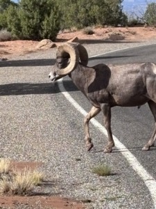 You are likely to see mule deer, and hopefully desert bighorn sheep. You’ll also see cottontail rabbits, golden eagles, turkey vultures, hawks, birds, squirrels, chipmunks and lizards, including the collard lizard, the most colorful lizard in the Southwest. While we have seen all of those, we have not witnessed other wildlife reported to roam the Monument like coyote, mountain lion (also known as cougar, panther or puma in other parts of the country), fox, and the rarely seen rattlesnake.
Insight After 3 Years of Exploration
Simply driving up to the top from the Fruita Entrance is amazing. If we see bighorn sheep, they are likely in this section of the park.
The Book Cliffs View accessed from the Saddlehorn Campground is a popular spot where you can hike the trail to Window Rock. There is a narrow, rocky ledge, but not too scary.
The Canyon Rim Trail goes from the Visitor Center to Book Cliffs View, so you can hike to it vs drive to it as well. The trail is wide with a gradual slope and gets you close to the drop-off, if you want.
While at the Visitor Center, pay attention to the garden of plants. You can wander through and discover their names. We like seeing the blooms on prickly pear cacti in May or June.
If you are mainly driving through but want a couple of short hikes, we recommend Otto’s Trail or go out to Grand View Point.
If you have a little more time, hiking on the ledge of the canyon to the Coke Ovens is a cool hike and not as busy as other spots.
If you want a longer, more strenuous but memorable hike, start at the Wedding Canyon trailhead from Broadway in the Redlands and hike counterclockwise to the base of Independence Monument and back on Monument Canyon Trail. Read the post about the day we did this hike. When you see photos of the Colorado National Monument, they most likely feature Independent Monument.
I have hiked Corkscrew Trail up, up, up to Liberty Cap on the Liberty Cap Trail. I wanted to turn around about three times but I did it. Thought I might die, but I did it! This trailhead is also in the Redlands off of South Broadway.
Cold Shivers Point, yes, it feels colder there because of the constant breeze into the canyon, is a fun stop. Once you reach the railing of the overlook, look to your right and venture a little farther. Out on the cliff edge, be careful, you can see where people have etched their names into the rock. If you go here in May, you might find some CMU graduates taking photos. It’s a popular spot.
One last thing to savor is not a sight but a smell. The pinyon pine and juniper trees smell absolutely amazing. Especially if you can go after it’s rained, which is rare, but it does happen. So many times we are on a trail and just stop to breathe in the fresh air.
Serpents Trail
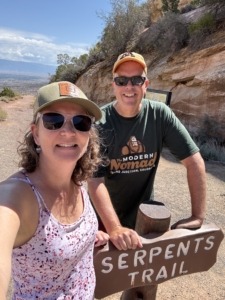
Hiking Serpents Trail
If you want a workout, hike 3.9 miles out and back up Serpents Trail, built in the 1900’s. It’s an elevation gain of 797 feet and is called “the crookedest road in the world,” because of the 16 switchbacks. Don’t be surprised to see runners pass by like you are standing still on this hike. One of our favorite spots is at the top of the trail. There is a small 3-space parking lot. Park there, if you can, and walk out about 30 yards. You get an excellent view of the Grand Valley. The trailhead for Serpents Trail is near the East Grand Junction Entrance. There is a parking lot on Rim Rick Drive but we usually park in the Devils Kitchen Picnic Area.
This unique trail deserves a bit more explanation. In the early 1900’s John Otto built miles of canyon trails and guided visitors to the spectacular wonderland. On May 24, 1911, President Taft established Colorado National Monument. Otto was the park’s caretaker until 1927. Today, when you hike the trails, they are the remnants of his trails, built by hand! However, Serpents Trail stands out because this road was a part of the original road to get to the top of the canyon until 1950 when they completed Rim Rock Drive.
Cherish Independence at Independence Monument
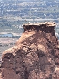
Flag raising July 4, 2026
Every fourth of July, local first responders and climbers scale the 450-foot-tall Independence Monument in Colorado National Monument to raise the American flag, a tradition started in 1911 by John Otto. They return about a week later to take it down.
On July 4, 2026, Michelle and I witnessed this monumental event, pun intended. They didn’t do it in 2025 due to a raptor’s nest at the top of Independence Monument. We went to the Independence Monument View Overlook and were able to park along the road. We gathered with about 30-40 people for this patriotic experience. Among the spectators were past climbers, a park-ranger, interested community members, and the local tv news station reporter. It was fun to chat with and hear stories as we watched the climbers get to the top. They start early in the morning to hike 3 miles to the base. Then they climb up 450 feet to secure the pole and raise the flag. It was very meaningful. Very American.
We especially wanted to participate this year because we had just experienced the nearby Knowles Canyon Wildfire (renamed the Snyder Fire) where 4 wildland firefighters lost their lives and a fifth was injured. We are thankful for their service. The fire started in June 2026 and on July 4 we still had a haze of smoke in the valley and we were worried we wouldn’t be able to see the climbers. Luckily the higher we got, the clearer it got. We are thankful we live in America.
Living in the Redlands at the Base of the Colorado National Monument
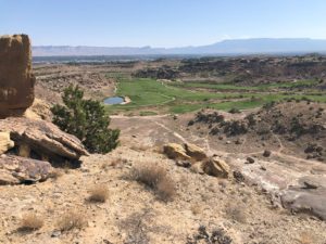
Redlands Mesa Golf Course photo taken from above on a trail from Redlands 360 neighborhood
The general area at the base of the Monument stretching to the Colorado River is called the Redlands. The Redlands is a region not a town or its own municipality. The area gets its name from its distinct red soil, dramatic red rock canyons, and towering sandstone cliffs. If you live in the Redlands, you live in Grand Junction. When I take clients on a tour of the Grand Valley, we always drive through the Redlands neighborhoods and stop at the Redland Mesa Golf Course Clubhouse.
Visitors ask me what it’s like to live in the Redlands. There are lots of opportunities and home styles including established homes and new construction. Yes, there are large single-family homes that surround the golf course, but I helped a client purchase a home in the Redlands with an ADU on a larger lot with numerous fruit trees and large gardens. I also sold a homesite in an upcoming neighborhood for a custom-built home.
I brought the first buyer for a custom-built home by Goetzmann Homes in the Redlands 360 development. I have a post about that area if you want to learn more about Redlands 360 and see the master plan map for the development that stretches beyond the Easter Hill neighborhood where my buyers live. We hiked the trails near Easter Hill and the Canyon Rim neighborhood.
To sum it up, if you are in Grand Junction, Fruita, or Palisade, or driving by on I-70, it’s worth a stop to experience the Colorado National Monument. It’s one of over 400 parks in the National Park system, so your America the Beautiful Pass works here.
And, if you think you might be interested in living near the Monument, let me know! There are some interesting pockets and housing opportunities available if you know where to look.
You can experience the Colorado National Monument as a day trip or go over several days. Read about other Day Trips you might be interested in on our Day Trip Collections page.
Move to Grand Junction… We’ve been waiting for you!
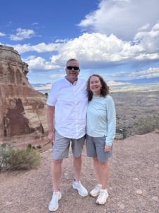
Top of Serpents Trail
Text/Call 612-306-9558
PAUL ASPELIN, REALTOR®
GRI, SRES®, CNE
Grand Junction Real Estate Expert
Connect with me on LinkedIn or send me an email.
Learn more about my experience and how I serve my clients.
Serving Mesa County and the Grand Valley in Colorado.
© 2026 Paul Aspelin, REALTOR®. MovetoGrandJunction.com Copyright protected. All rights reserved.