Guest post by Michelle Aspelin
What it feels like to Live Your Vacation in Grand Junction
We want to share our experience about hiking Crag Crest Trail on the Grand Mesa. We still consider ourselves beginner hikers. We enjoy easy trails and some moderate hikes, but we’re not looking for anything too strenuous. So, when we decided to tackle Crag Crest Trail on the Grand Mesa, we wanted to see if this signature hike was something we could enjoy without pushing ourselves beyond our limits.
 It turned out to be one of our favorite hikes! I’ll share what we experienced, what we saw along the way, and how you can prepare for your own adventure on the Grand Mesa.
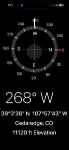
The Grand Mesa is the world’s largest flattop mountain, and it takes about 45 minutes to get to the top from Grand Junction. The Grand Valley sits at about 4600’ elevation. The top of the mesa varies from 10,000 to 11,000 feet. We hiked to 11,120′ to be precise, but that wasn’t the exact “top” of the trail.
Tip: We used the Compass app on our iPhones to know our exact elevation along our hike. The app works even when you don’t have cell service. We use it all the time.
About Crag Crest
Hiking Crag Crest Trail on the Grand Mesa is a unique experience. The Crag Crest Trail is a designated National Recreation Trail. You will encounter other hikers on the trail. Some more experienced than you, and some less experienced. However, since the hike is in higher elevation, it likely will not be crowded.
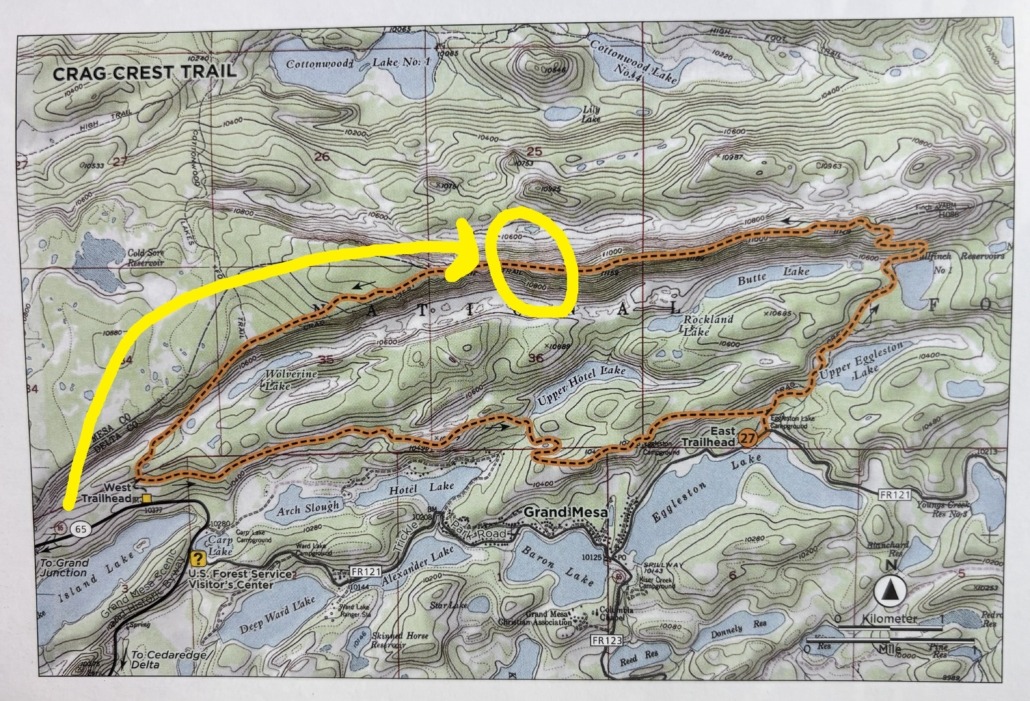
Type of Hike/Distance: 10.4 mile loop trail, but you don’t have to hike the whole thing. You can shuttle a vehicle and go one way; the upper trail is the most scenic.
 Elevation: the East trailhead is at 10,087’ and the West trailhead is at 10,447’. The peak is at 11,189’. Our AllTrails app said we had an elevation gain on our hike of 926’ when we were at the top.
Difficulty: Moderate to strenuous – I think we avoided the “strenuous” part on the East side.
Hiking Time: If you do the full hike, AllTrails says to allow for 5-6 hours. We did 3 miles in and 3 miles out on the same section. It took us about 2.5 hours to get to the top, stopping for a 15-minute snack break at a scenic overlook. It was faster going down the 3 miles back to the truck, so it took us about 3.5-4 hours to hike a total of 6 miles.
Seasons: Best to hike this in the fall when there are no bugs and no snow. You can hike it in summer but bring bug spray and wear long pants and sleeves. Not open to winter hiking since the trail is buried under deep, heavy snow.
Dogs: Are allowed, under control.
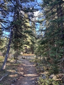
Trail Surface: This is a backcountry trail through wet meadows, spruce and pine forest, and over a massive volcanic rock field. You are mostly walking on dirt to the top, then rocks. There is one rock section midway up if you start at the West trailhead like we did.
AllTrails: Here’s the link to Crag Crest Trail on the AllTrails Map.
Is Crag Crest Trail Suitable for Beginner Hikers?
Can beginner hikers enjoy Crag Crest Trail? Absolutely, depending on which section you hike and how far you want to go. We chose to hike from the West Trailhead because I read that it’s a more gradual climb and you start higher up the mountain. We hiked approximately six miles round trip rather than completing the entire 10.4-mile loop. The elevation is something to take seriously. We recommend taking your time, bringing plenty of water and protein snacks, and choosing a day with good weather.
WHEN we hiked Crag Crest Trail
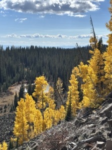
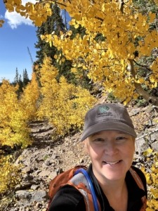
Yellow aspen leaves on the hike to the top
We had been wanting to hike this trail for a while, but we wanted the conditions to be perfect, and it was worth the wait. I worried about bears in the spring, bugs in the summer, and so fall seemed like the perfect time. It was about 55-60 degrees the day we hiked and it was absolutely perfect. Sunny, slight breeze, not windy, even at the top. I think waiting for the best circumstances made this hike as enjoyable as it was.
We also waited until we felt confident to hike 6 miles and at an elevation two miles above sea level. We brought plenty of water and snacks. Read our post about How to Avoid Altitude Sickness.
We got to the trailhead about 10am and were done by early afternoon. You don’t want to be at such a high elevation in the afternoons if there is rain and lightning in the forecast. We dressed in layers and brought our hiking poles.
WHY we hiked Crag Crest Trail
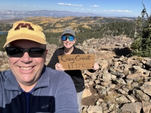
Taken at the top, the view behind us is to the north.
I really wanted to get to the top of the mesa and stand there, looking down on everything else around us. To experience what it’s like to “be at the top” of a mountain. Our daughter and son-in-law hike 14ers (mountains 14,000’+ elevation). I know I will never do that, but I wanted to experience the same sense of joy and accomplishment, just at a lower elevation. Crag Crest Trail offered us that opportunity.
When people hike 14ers, they hold up a sign at the top with the name of the mountain and the elevation at the peak. I wanted to do the same thing! I made my cardboard sign before we left but didn’t include the elevation because I wasn’t sure how high we would actually get. Once at the top, Paul filled it in and we got our photos. When I sent the photo to my daughter, she thought it was funny. So did we. I still have the sign!
What we saw along the Trail
Everything was amazing. I will try to keep the adjectives to a minimum. This hike is in our top 5 favorites, we are so glad we had the courage to do it and enjoyed it so much.
The West Trailhead is practically across the street from the Grand Mesa Lodge. We went there for lunch afterwards. Their was plenty of parking available and a pit toilet. Starting on the West Trailhead means it’s a more gradual hike up, and you start at a higher elevation. The East Trailhead is steeper. I think that’s where the “strenuous” reviews came into play, so we wanted to avoid that section. One of the reviews I read mentioned hiking on scree, loose gravel rock on a steep slope. I wanted to avoid that.
Once we started on the trail, the first thing I did was ask the person coming off the trail if she had seen any bears. Negative. That put me at ease.
The hike was a continuous gradual uphill climb, but we never had to stop to catch our breath like we did on the Monument Canyon Trail or hiking to Delicate Arch in Arches. We stopped to soak in the view, take photos, or watch wildlife.
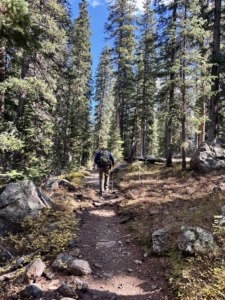
Walking through the woods
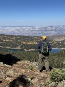
Scenic overlook where we had our snack. View is to the south.
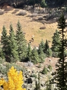
View of the deer in the meadow below us
Along the trail, we hiked above a meadow and a few small lakes. We saw deer here on our way back. We were in the woods the whole time until we reached the crest. The views off the ridge got increasingly more stunning.
Then BOOM! No trees. Just vast open skies. We could see forever! Amazing panorama views!
The crest is a 6.5-mile ridge left behind by two parallel glaciers in the last ice age. It’s not difficult to hike on the crest portion, but it is rocky so I recommend good hiking boots to help keep your footing. If you fear heights, you can just step out on the crest and then go back into the woods or just admire it from good footing. The view was spectacular. 360 degrees of mountains, forest, lakes, meadows, and lava rocks.
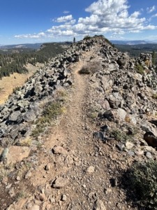
Spine of the Crag Crest Trail
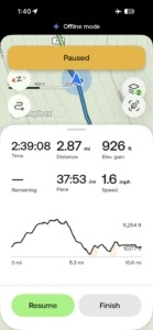
AllTrails app screenshot showing time, distance, and elevation gain.
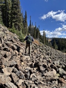
Rocky section near the switchbacks
Before we started the hike, I wasn’t sure if I was going to go out on the crest or just get to the point where I could see it. The spine of the trail was wider than I expected, about 2 feet, so we kept going. Having the land drop about 1000’ on both sides of you is intimidating but I was never scared. We slowly hiked about 10 minutes onto the spine and stopped. Took our photos with our homemade sign and videos of the view.
The San Juan Mountains are visible to the south. The West Elk Mountains to the east. The Bookcliffs can be seen to the north. On most clear days you can see all the way to the LaSal Mountains in Utah near Moab! I put a link to the video at the end of this post.
Sharing the Experience
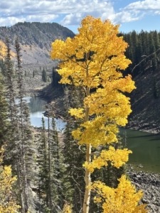
Beautiful fall colors
Our daughter, Emma, climbed her first 14er after she was in college at CMU for about a month. She called us around 8am from the top. She was out of breath but wanted to tell us where she was. She was so excited! We were excited for her. We didn’t realize until later what an accomplishment that was for her after only living in Grand Junction for a month!
So, when we got to the top, we Facetimed with my parents in Michigan. We shared our accomplishment “in the moment”. We were grinning from ear to ear. We took more photos, then started the hike back.
We were mesmerized by the views, the smell of the forest, and the soft trail full of pine needles. Our trekking poles came in handy on the decent and also on the ascent when we crossed a section with big rocks.
One of the things we love most about living in Grand Junction is having places like the Grand Mesa so close. Within about 45 minutes, we can leave the valley and be hiking at elevations above 10,000 feet. It’s one more reason we love calling the Grand Valley home. You don’t have to be expert hikers to enjoy living in the Grand Valley.
If you are thinking of hiking Crag Crest Trail on the Grand Mesa, I encourage you to give it a try. We loved every minute of it. We planned a fall hike and that was the absolute best time to go in our opinion. In fact, we might make it an annual event. Who knows, maybe next time we can hike farther out on the spine portion and make it to the actual top. However, we do cherish our sign and getting to 11,120 feet.
Remember, you are in the Rockies and weather can change quickly, so be prepared for this “signature hike” and you won’t be disappointed.
Paul posted a video from the top on Live Your Vacation in Grand Junction on Instagram and Facebook. Here are those links:
https://www.instagram.com/liveyourvacationingj
https://www.facebook.com/LiveYourVacationinGrandJunction
 Live Your Vacation in Grand Junction
Michelle Aspelin
Mindshare Marketing & Implementation Services LLC
Connect with Michelle on LinkedIn
Paul Aspelin, Grand Junction Real Estate Expert
© 2026 Paul and Michelle Aspelin, Aspelin Real Estate LLC. All rights reserved. Do not copy.