612-306-9558
  • Home
  • About Paul Aspelin
  • Blog
  • 10-Day GJ Challenge
  • Day Trip Collection
  • Why Grand Junction?
  • Get Started
  • Featured Listings
  • Homes For Sale
  • Contact
  • Menu Menu
Move to Grand Junction CO
  • Link to LinkedIn
  • Link to Youtube
  • Link to Facebook
  • Link to Instagram
  • Link to Pinterest
  • Link to X

Tag Archive for: Independence Monument

Day Trips, Local or Nearby Attractions

Experience the Colorado National Monument in Grand Junction

When you open the map for the Colorado National Monument, you might wonder “Where do I start? What should we do first? What is a ‘must see’ with the time we have?”

In general, most people experience the Colorado National Monument by driving through on Rim Rock Drive from Fruita to Grand Junction or vice versa. After three years of exploration, we have had a chance to really discover everything the Monument has to offer. It’s quite an amazing place and we are lucky to have it in our backyard. In fact, it’s now in the backyard of several clients that I helped move to the Redlands area at the base of the Monument!

I’ll start with the basics, then give you some tips based on our experience.

“Inch by inch, foot by foot. All around you, this dramatic landscape is always changing. Earth’s powerful forces and past climates built the land up; erosion continually wears it down. They tell a spectacular story of our dynamic planet.”

-a quote from the Colorado National Monument brochure/map you get from the Visitor Center

Rim Rock Drive

Rim Rock Drive is a wonderful 23-mile paved road that climbs to the top and winds along the canyon rim. It takes you from end to end with lots of roadside overlooks with spectacular views.

Construction of the road started in 1931 by the Civilian Conservation Corp and was finished in 1950 by the National Park Service. We prefer to enter from the West Fruita Entrance, closest to the Visitor Center, and complete our drive by exiting the East Grand Junction Entrance. You can also enter the park from a couple of small trailhead parking lots at the base of the Monument in the Redlands.

If you want to get to Glade Park (the General Store is something to see), you exit Rim Rock Drive at about the half-way point. This exit has a bathroom and also leads you to the Rattlesnake Arches trailhead via Black Ridge Road. We’ve taken this road and done the arches hike. Warning: you need a high clearance, 4WD vehicle to get to the Rattlesnake Arches trailhead. It’s worth the slow drive to see arches in Colorado.

Fun Fact: The second-largest concentration of natural arches in the world is in Rattlesnake Canyon within the McInnis Canyons National Conservation Area. It’s a cool hike, once you get there! Ask me about the drive to the trailhead.

If all you do is drive through the park, it’s exceptional. Views change with every curve in the road. Some of our favorite scenic overlooks are Fruita Canyon View, Independence Monument View, Grand View, and Cold Shivers Point.
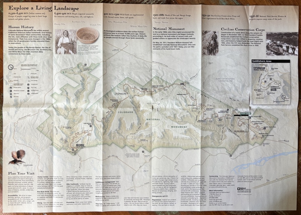
Colorado National Monument Brochure Map

All Four Seasons

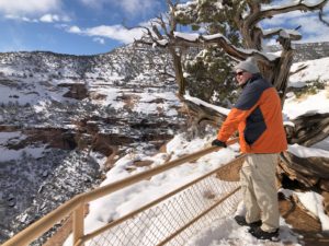
Paul Aspelin overlooking a monument canyon

Paul overlooking Monument Canyon

You can enjoy “the Monument”, as locals call it, during all four seasons. Walking or hiking on the trails during the summer is best done in the morning since there isn’t a lot of shade. In the winter, mid-day hikes are perfect. To see the landscape with a dusting of fresh snow is magical!

The overlooks and several of the trails are accessible to people with all levels of abilities. The park is like a living place of beauty with stunning rock formations, plants, wildlife, and wilderness. There is so much to discover. If you can, dedicate a full day to exploration or two half days while you are in Grand Junction. And when you live here, you can go as often as you like in any season!

Amenities

Visitor Center
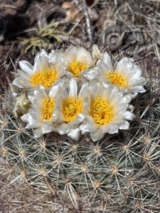
Cactus blooming with white pedals and a yellow center flower

Blooming cactus in the Monument

They have a gift shop at the Visitor Center. Check out the exhibits to learn about the area. They offer ranger-guided walks and talks too. The bathrooms are accessed from the outside, so they are available all the time. There are pit toilets about midway along Rim Rock Drive and at the picnic area near the East Grand Junction entrance. There is an outdoor picnic area, and we recommend the Canyon Rim Trail or short Alcove Nature Trail across the street from the Visitor Center. Both are great options if you don’t want to walk very far but still want to feel immersed in the park.

While the main entrance gates are open 24/7 year-round, the Visitor Center is not. It’s open daily from 9AM to 4PM (with extended hours from 9AM to 5PM during the spring and summer months). It is closed on Thanksgiving Day, Christmas Day, and New Year’s Day.

Campground
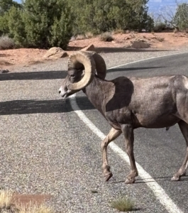
Big Horn Sheep crossing the road in the Monument

We often drive through the Saddlehorn Campground to get to the Book Cliffs View overlook. We take everyone here for views into Wedding Canyon and of the city. Campsites are first-come, first-served or you can make reservations at Recreation.gov. There are restrooms, picnic tables, charcoal grills and drinking water nearby. Watch for bighorn sheep! We’ve had to stop on our way out to let them cross the road in the campground.

Picnic Areas

A fun way to experience the Monument is to pack a lunch or snacks so you can stop whenever you get hungry and soak in the beauty all around you. We have eaten at overlooks, or you can go to the dedicated picnic areas at Devils Kitchen Picnic Area (near the East Grand Junction entrance) or use the picnic area at the campground and Visitor Center.

Hiking
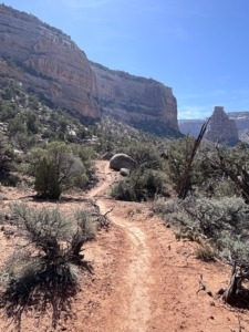
Wedding Canyon Trail

Wedding Canyon Trail

Aside from driving through, the Monument is best known for the 45-mile trail system. There are easy, moderate, and difficult trails. Some are super short, others go on for miles and miles!  They can be steep or slope gradually. They are mostly dry but can be rocky or feel unstable in sections. The trails can take you deep into the canyons or across the plateaus. Michelle uses the AllTrails app to help choose trails based on our abilities and enjoyment. Remember to always stay on the trail so you don’t disturb the fragile desert crust. Leave no trace.

We have personally hiked or partially hiked 10-12 trails in the park. Remember to bring plenty of water, wear protective clothing or sunscreen and a hat, plus sturdy hiking shoes for rough trails or tennis shoes for shorter walks. You probably won’t have a cell signal, so you might want to download Google Maps for this area, especially if you go hiking.

Wildlife
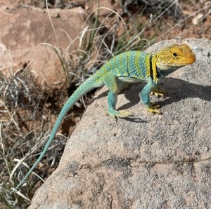
Collard Lizard photo by Emma Aspelin

Collard Lizard photo by Emma Aspelin from EmmaGetsOutside.com

You are likely to see mule deer, and hopefully desert bighorn sheep. You’ll also see cottontail rabbits, golden eagles, turkey vultures, hawks, birds, squirrels, chipmunks and lizards, including the collard lizard, the most colorful lizard in the Southwest. While we have seen all of those, we have not witnessed other wildlife reported to roam the Monument like coyote, mountain lion (also known as cougar, panther or puma in other parts of the country), fox, and the rarely seen rattlesnake.

Insight After 3 Years of Exploration

Simply driving up to the top from the Fruita Entrance is amazing. If we see bighorn sheep, they are likely in this section of the park.

The Book Cliffs View accessed from the Saddlehorn Campground is a popular spot where you can hike the trail to Window Rock. There is a narrow, rocky ledge, but not too scary.

The Canyon Rim Trail goes from the Visitor Center to Book Cliffs View, so you can hike to it vs drive to it as well. The trail is wide with a gradual slope and gets you close to the drop-off, if you want.

While at the Visitor Center, pay attention to the garden of plants. You can wander through and discover their names. We like seeing the blooms on prickly pear cacti in May or June.

If you are mainly driving through but want a couple of short hikes, we recommend Otto’s Trail or go out to Grand View Point.

If you have a little more time, hiking on the ledge of the canyon to the Coke Ovens is a cool hike and not as busy as other spots.

If you want a longer, more strenuous but memorable hike, start at the Wedding Canyon trailhead from Broadway in the Redlands and hike counterclockwise to the base of Independence Monument and back on Monument Canyon Trail. Read the post about the day we did this hike. When you see photos of the Colorado National Monument, they most likely feature Independent Monument.

I have hiked Corkscrew Trail up, up, up to Liberty Cap on the Liberty Cap Trail. I wanted to turn around about three times but I did it. Thought I might die, but I did it! This trailhead is also in the Redlands off of South Broadway.

Cold Shivers Point, yes, it feels colder there because of the constant breeze into the canyon, is a fun stop. Once you reach the railing of the overlook, look to your right and venture a little farther. Out on the cliff edge, be careful, you can see where people have etched their names into the rock. If you go here in May, you might find some CMU graduates taking photos. It’s a popular spot.

One last thing to savor is not a sight but a smell. The pinyon pine and juniper trees smell absolutely amazing. Especially if you can go after it’s rained, which is rare, but it does happen. So many times we are on a trail and just stop to breathe in the fresh air.

Serpents Trail
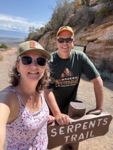
Hiking Serpents Trail

If you want a workout, hike 3.9 miles out and back up Serpents Trail, built in the 1900’s. It’s an elevation gain of 797 feet and is called “the crookedest road in the world,” because of the 16 switchbacks. Don’t be surprised to see runners pass by like you are standing still on this hike. One of our favorite spots is at the top of the trail. There is a small 3-space parking lot. Park there, if you can, and walk out about 30 yards. You get an excellent view of the Grand Valley. The trailhead for Serpents Trail is near the East Grand Junction Entrance. There is a parking lot on Rim Rick Drive but we usually park in the Devils Kitchen Picnic Area.

This unique trail deserves a bit more explanation. In the early 1900’s John Otto built miles of canyon trails and guided visitors to the spectacular wonderland. On May 24, 1911, President Taft established Colorado National Monument. Otto was the park’s caretaker until 1927. Today, when you hike the trails, they are the remnants of his trails, built by hand! However, Serpents Trail stands out because this road was a part of the original road to get to the top of the canyon until 1950 when they completed Rim Rock Drive.

Cherish Independence at Independence Monument
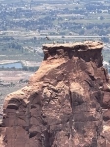
Independence Monument flag raising on 4th of July

Flag raising July 4, 2026

Every fourth of July, local first responders and climbers scale the 450-foot-tall Independence Monument in Colorado National Monument to raise the American flag, a tradition started in 1911 by John Otto. They return about a week later to take it down.

On July 4, 2026, Michelle and I witnessed this monumental event, pun intended. They didn’t do it in 2025 due to a raptor’s nest at the top of Independence Monument. We went to the Independence Monument View Overlook and were able to park along the road. We gathered with about 30-40 people for this patriotic experience. Among the spectators were past climbers, a park-ranger, interested community members, and the local tv news station reporter. It was fun to chat with and hear stories as we watched the climbers get to the top. They start early in the morning to hike 3 miles to the base. Then they climb up 450 feet to secure the pole and raise the flag. It was very meaningful. Very American.

We especially wanted to participate this year because we had just experienced the nearby Knowles Canyon Wildfire (renamed the Snyder Fire) where 4 wildland firefighters lost their lives and a fifth was injured. We are thankful for their service. The fire started in June 2026 and on July 4 we still had a haze of smoke in the valley and we were worried we wouldn’t be able to see the climbers. Luckily the higher we got, the clearer it got. We are thankful we live in America.

Living in the Redlands at the Base of the Colorado National Monument
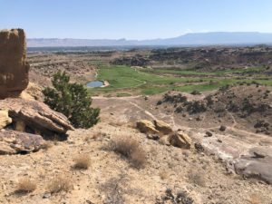
Redlands Mesa Golf Course

Redlands Mesa Golf Course photo taken from above on a trail from Redlands 360 neighborhood

The general area at the base of the Monument stretching to the Colorado River is called the Redlands. The Redlands is a region not a town or its own municipality. The area gets its name from its distinct red soil, dramatic red rock canyons, and towering sandstone cliffs. If you live in the Redlands, you live in Grand Junction. When I take clients on a tour of the Grand Valley, we always drive through the Redlands neighborhoods and stop at the Redland Mesa Golf Course Clubhouse.

Visitors ask me what it’s like to live in the Redlands. There are lots of opportunities and home styles including established homes and new construction. Yes, there are large single-family homes that surround the golf course, but I helped a client purchase a home in the Redlands with an ADU on a larger lot with numerous fruit trees and large gardens. I also sold a homesite in an upcoming neighborhood for a custom-built home.

I brought the first buyer for a custom-built home by Goetzmann Homes in the Redlands 360 development. I have a post about that area if you want to learn more about Redlands 360 and see the master plan map for the development that stretches beyond the Easter Hill neighborhood where my buyers live. We hiked the trails near Easter Hill and the Canyon Rim neighborhood.

To sum it up, if you are in Grand Junction, Fruita, or Palisade, or driving by on I-70, it’s worth a stop to experience the Colorado National Monument. It’s one of over 400 parks in the National Park system, so your America the Beautiful Pass works here.

And, if you think you might be interested in living near the Monument, let me know! There are some interesting pockets and housing opportunities available if you know where to look.

You can experience the Colorado National Monument as a day trip or go over several days. Read about other Day Trips you might be interested in on our Day Trip Collections page.

Move to Grand Junction… We’ve been waiting for you!
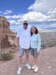
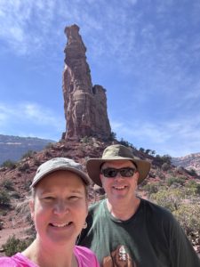
Paul and Michelle Aspelin standing at the top of Serpents Trail with Grand Junction in the distance

Top of Serpents Trail

Text/Call 612-306-9558

PAUL ASPELIN, REALTOR®
GRI, SRES®, CNE

Grand Junction Real Estate Expert
Connect with me on LinkedIn or send me an email.
Learn more about my experience and how I serve my clients.

Serving Mesa County and the Grand Valley in Colorado.

© 2026 Paul Aspelin, REALTOR®. MovetoGrandJunction.com Copyright protected. All rights reserved.
by Paul Aspelin, Relocation & Listing Expert
https://movetograndjunction.com/wp-content/uploads/2026/10/Colorado-National-Monument-East-entrance-Paul.jpg 1117 2284 Paul Aspelin, Relocation & Listing Expert https://movetograndjunction.com/wp-content/uploads/2024/09/Move-to-Grand-Junction-logo-wide-Mesa-County-1030x167.png Paul Aspelin, Relocation & Listing Expert2026-10-09 13:30:362026-10-12 11:34:10Experience the Colorado National Monument in Grand Junction
Local or Nearby Attractions

Hiking Monument Canyon Trail – Grand Junction Hike Tips

Hiking Monument Canyon Trail Review: What to Expect

Guest post by Michelle Aspelin

What it’s Really Like Hiking Monument Canyon Trail

If you’re planning on hiking Monument Canyon Trail in the Colorado National Monument, you’ve probably heard it’s “moderate” and takes 2–3 hours. Spoiler alert: it might take longer, it did for us.

I attempted hiking Monument Canyon Trail with Wedding Canyon twice before finishing it, and even seasoned hikers feel the challenge. Here’s our honest experience, so you can plan accordingly.

When we first moved to Grand Junction, Paul completed this hike and found it to be much more of a challenge than he expected. He couldn’t believe he finished it.

I want to prepare you because locals will encourage you to hike this popular trail when you first move to Grand Junction. I want to give you our impression so you can decide for yourself when you are ready to hike it.

Quick Stats: Monument Canyon Trail

  • Distance: 5 miles
  • Elevation Gain: 770’ (that’s like 77 flights of stairs)
  • Difficulty: Moderate to challenging
  • Time: 2-3 hours (or 5 hours!)

Is Monument Canyon Trail really “moderate”? Our experience says otherwise.

Our Monument Canyon Trail Experience

Here’s the link to Paul’s quick Hiking Monument Canyon Trail Video on his Move to Grand Junction YouTube Channel – be sure to watch and give it a “like”.

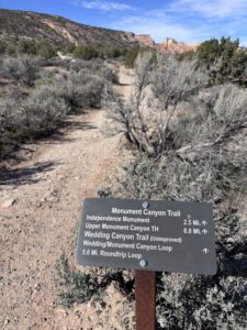
trailhead sign with miles for the hiking route options

Hiking at higher elevation makes even a “moderate” trail more challenging. We stopped often to catch our breath, despite living at 4,583’ of elevation in Grand Junction. Adding time for lunch, snacks, and scenic stops, the 5-mile hike took us 5 hours.

We quickly learned that “moderate” doesn’t always match expectations, it depends on elevation, terrain, and pacing. We purposely hiked at a slower pace, we had to stop to breathe, but the 770’ elevation gain during the hike does have an impact, even though we are acclimated to the elevation. It’s like climbing 77 flights of stairs.

Hiking Monument Canyon Trail: Trailhead Route and Tips

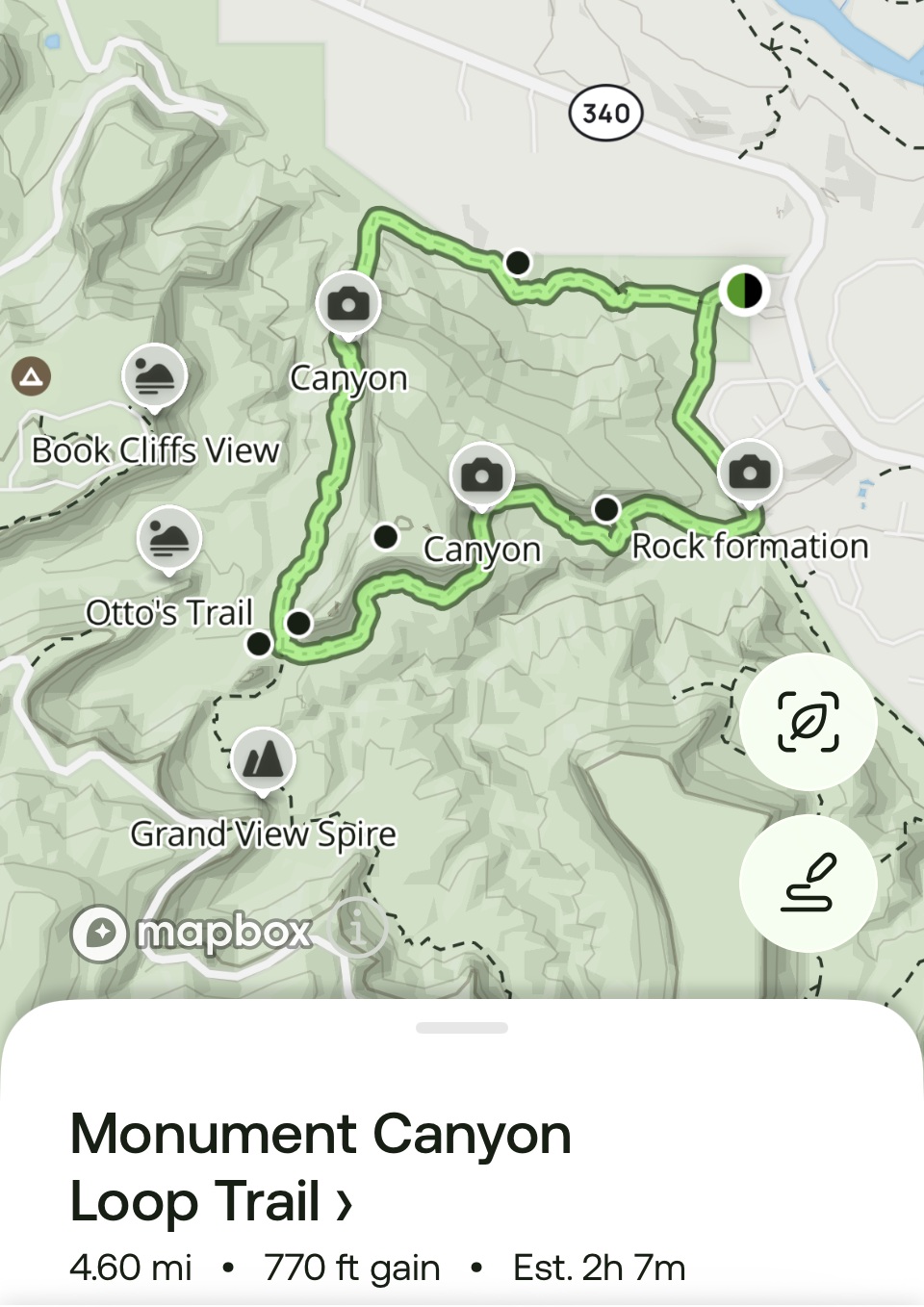
hiking Monument Canyon Trail map from All Trails appThe AllTrails app says that hiking Monument Canyon Trail loop with Wedding Canyon should take 2 hours and 7 minutes and is moderate. We knew it would take us longer, but not 5 hours! After all, we aren’t 25 anymore. We were just surprised. Were we really THAT slow or was it just more challenging?

On this map, Wedding Canyon is at the top, trailhead on the right, Monument Canyon is on the bottom, Independence Monument on the left.

Our 2026 experience was mixed initially. After the hike we were exhausted and I wasn’t sure I wanted to write about it and promote this hike. But after we recovered, and I reflected on what we saw, and more importantly, experienced, I thought it would be good to warn you, I mean, share it with you.

Trailhead: Take Broadway/Hwy 340 to the Lower Monument Canyon Trailhead. There’s a small parking lot with two portable toilets.

The Trail Itself

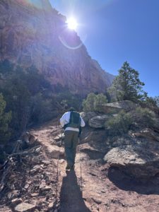
Paul hiking Wedding Canyon

Paul hiking the Wedding Canyon Trail

After our first two attempts at starting on the Lower Monument Canyon Trail, we were advised to start on the Wedding Canyon Trail and I think that’s what made the difference in our ability to complete the 5-mile hike.

Starting the hike with Monument Canyon Trail is a slow uphill climb almost the entire time, with lots of steps. From the loop trailhead it’s 2.5 miles to reach Independence Monument, considered the half-way point of this loop hike.

Wedding Canyon Trail starts out with a steep descent with switchbacks over loose gravel, a walk across flat open land, then the ascent to Independence Monument. It was much easier to descend through Monument Canyon than to start on that trail, in our opinion.

We discovered after we reached Independence Monument that the Wedding Canyon Trail is “unimproved”. Ah, ok, that makes sense. That’s why there were steep climbs, no steps, loose gravel, rocky terrain, and several spots that were washed out.

In one section, run-off washed away the “shelf” part of the trail so much so that the edge to step across the wash was about as wide as your shoe. We went slow and sort of hopped over the gap in the trail. Luckily, we had our hiking poles to balance us on the ascent. We both slipped a couple of times but didn’t fall. The trail is both narrow and wide. We were walking along a huge sandstone cliff which offered some shade.

We started at 10:30am so the sun was behind the cliff part of the time. That helped keep us cool. It was about 55 degrees, but the sun made it feel like it was in the 70s. We hiked in mid-March. Be careful when you decide to hike, mornings are always better than mid-afternoons due to the heat and sun.

Independence Monument: The Highlight

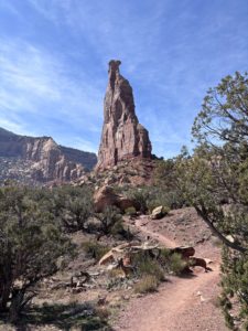
Independence Monument baseOnce we reached the base of Independence Monument we stopped to eat our lunch. It was much-needed break. We discovered a huge rock with words etched into the top, likely the Declaration of Independence or they could be about John Otto and the significance of this monument in the park. The words were difficult to read after years of exposure to the elements. Let us know what you think they say if you do this hike.
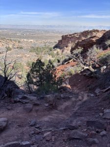
Independence Monument was formed after water and ice eroded walls that once connected the pinnacle to mesas on each side. Sandstone was deposited in this area 210 million years ago and forms the cliffs we see today. Quite amazing. There are so many colorful layers.

The Tradition of Climbing Independence Monument

One of the highlights of hiking Monument Canyon Trail is reaching Independence Monument, a 450-foot sandstone monolith. Every year on the 4th of July, a crew climbs the monument to hoist an American flag, celebrating our nation’s independence. The flag flies for about a week.

John Otto was the first to climb Independence Monument in June and July in 1910, honoring Flag Day and Independence Day. He also built many of the trails in the Monument and became the first official custodian after the Monument was established in 1911, earning a salary of just $1 a month, according to my book Scenic Driving Colorado by Stewart M. Green.

Standing at the base of Independence Monument, knowing its history, makes the hike feel both physically rewarding and historically significant. I’m glad we went.

Hiking Monument Canyon Trail: Returning via Lower Monument Canyon

After reaching Independence Monument, we turned left onto Lower Monument Canyon Trail to head back, which was mostly downhill. (If you turn right, you’ll be on Upper Monument Canyon Trail, which climbs up to Rim Rock Drive.) The full Monument Canyon Trail from bottom to top is about 6 miles with an elevation gain of 1,843 feet, rated “moderate and steep.” We were only on the lower part of the trail.

With the sun at our backs, the return hike was more comfortable. We stopped frequently to take photos of Independence Monument again. We were grateful we weren’t climbing the steps this time. The trail hugs the cliff wall in a few spots but is wide enough elsewhere for other hikers to pass us safely.

The last half mile felt exhausting. When we finally reached the parking lot, we joined hands and raised our arms like we were finishing a marathon. We were completely spent but thrilled to have completed our longest hike to date.

Afterward, we drove home, collapsed on the couch, and groaned every time we moved. My hips, middle back, ankles, and even toes were sore. But two days later, we went on another hike.

Gear & Preparation Checklist

  • Water (more than you think)
  • Snacks/lunch
  • Sturdy hiking shoes or boots
  • Sun protection
  • A hat and sunglasses
  • Trekking poles (recommended but not required)
  • Layered clothing if starting out early when it’s still cool
  • For fast-acting hydration we take electrolyte fast chews by Salt Stick
  • Hydration powder with electrolytes in your water helps too
  • For a burst of energy, we like Skratch Labs brand of energy chews (sport fuel)

You can get these items at REI in Grand Junction including a small waist pack, backpack or hydration vest with pockets to carry everything you need to be prepared for hiking in the high desert. Read our post about Water Bottles in Grand Junction: Why it Matters Here.

You can read our How to Avoid Altitude Sickness in Grand Junction guide for more hydration tips.

Wildlife + Wow Factor

Wedding Canyon Trail and view towards Fruita

Wedding Canyon Trail and view towards Fruita

If you want to see bighorn sheep, look for them in Monument Canyon about midway between Independence Monument and where the trail leaves the neighborhood fence line. We did see two in Wedding Canyon on our hike, but people see them regularly in the Monument Canyon, especially early or later in the day, not so much midday.

Seeing the canyons themselves is amazing. The pretty little flowers, the diverse landscape, the huge walls of different rock layers are all stunning.

To be at the base of Independence Monument was very satisfying and, to be honest, felt a bit patriotic. I was glad we did the hike. I am thankful to be able to say, “I’ve been there” and experienced this special place in the Colorado National Monument. Will I hike the loop again? Probably, but not anytime soon. I need the trauma of the experience to wear off first.

Hiking Mary’s Loop to Pizza Point: A Scenic McInnis Canyons Hike

Pizza Point Colorado River Overlook

Pizza Point Colorado River Overlook

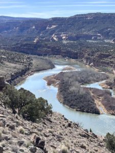
Two days after our Monument Canyon/Wedding Canyon loop hike, we tackled a 4-mile hike in the McInnis Canyons National Conservation Area with only 568 feet of elevation gain, and it felt much easier and enjoyable.

We took Mary’s Loop to Pizza Point. We returned via Steve’s Loop, which offers breathtaking views of a steep canyon and we saw grazing cows, and an interesting slot canyon to explore. This is in the Horsethief Canyon area between Mack and Loma.

Pizza Point is an incredible overlook of the Colorado River and was our halfway point. We spotted boaters and kayakers below and enjoyed a quick snack while taking in the scenery. The full 4-mile hike took us just about 2 hours, including the stop at the river overlook. Much faster than the Monument Trail loop hike!

This trail is shared with mountain bikers, hikers, and trail runners, so be aware of bikers coming up behind you. Across the river, we could see the dramatic Rattlesnake Canyon, a truly stunning view. We have hiked to Rattlesnake Arches, very cool.

For reference, here’s the official BLM map of McInnis Canyon National Conservation Area if you want to hike in this beautiful area.

What This Hike Taught Us About Living in Grand Junction

The outdoor lifestyle is real here. While this particular hike was challenge for us, there are many more trails we’ve hiked before this that we really enjoyed. Anything 4 miles and under is likely going to be enjoyable to us, longer than that starts to be “not so fun” anymore.

We learned what “moderate” mixed with 770’ elevation gain really means. Know we know what an unimproved trail looks like and feels like. We were glad to have our trekking poles.

You build up to this type of hike.

I felt good knowing we CAN do this sort of hike, given enough time. We planned it on a day when we wouldn’t feel rushed. We did try to enjoy it along the way. Sometimes you look down at the trail itself too much (so you don’t trip on a rock) that you forget to look up and enjoy the scenery and stop to hear the sounds of nature.

I guess we did more stopping and looking than we realized. Reflecting back, I enjoyed it. I am glad we did it mid-March. If it was hot out, it would have made it even more difficult.

If you’re planning on hiking Monument Canyon Trail after moving to Grand Junction, knowing what to expect can make all the difference.

If you’d like to live near trails like this, Get Started!

You might also enjoy these posts…

  • Your Grand Junction Relocation Guide
  • Things to do in Grand Junction: Easy Hikes
  • Why people are moving to Grand Junction
  • Retire in Grand Junction
  • Don’t Wait, Semi-Retire in Grand Junction
Michelle and Paul Aspelin at the base of Independence Monument

at the base of Independence Monument

If you’re thinking about moving to Grand Junction and want honest insight into what daily life is really like here, we share that on this site and we’re always happy to help answer questions.

Contact Paul for a tour of Fruita, Grand Junction or Palisade, or sign up for his real estate market updates if you want to learn more about properties in Mesa County.

Guest post by Michelle Aspelin


by Michelle
https://movetograndjunction.com/wp-content/uploads/2026/03/Independence-Monument-near-the-base-scaled.jpg 1440 2560 Michelle https://movetograndjunction.com/wp-content/uploads/2024/09/Move-to-Grand-Junction-logo-wide-Mesa-County-1030x167.png Michelle2026-03-26 17:23:052026-04-14 15:01:52Hiking Monument Canyon Trail – Grand Junction Hike Tips
30 Best Colorado Blogs 2026
Search Search
10-Day Grand Junction Challenge could she see herself living here image of Megan sitting on rock looking out over the Grand Junction valley

Follow us on Instagram

Follow us on Facebook

Logo image
Click to load facebook widget
Join our Facebook community

Google

Find us on Google Maps

Write a Review on Google

PAUL ASPELIN, REALTOR®

Paul Aspelin standing on a trail in the Colorado National Monument

Paul Aspelin Reviews and Recommendations

Read Paul Aspelin Reviews and Recommendations-personal notes and survey results from happy clients not found online.

“Paul went above and beyond in our home search, we looked at 17 homes in 2 days! Was very thorough with our search parameters and coordinating showings, even provided a book of all the listings he had scheduled for us. I would wholeheartedly recommend Paul!”

-Jeff Alexander, Grand Junction, CO (originally published on my Zillow profile)

loader-image
Today’s Weather
Grand Junction, CO
11:07 am, Nov 14, 2026
temperature icon 49°F
overcast clouds
87 %
1009 mb
5 mph
Wind Gust: 0 mph
Clouds: 100%
Sunrise: 6:56 am
Sunset: 5:01 pm

Get the 7-Day Forecast for Grand Junction and 20+ cities from local KKCO Weather. Read about Grand Junction Monthly Weather

Post Categories

  • 10-Day GJ Challenge (6)
  • Day Trips (15)
  • Featured Properties (2)
  • Fruita (7)
  • Grand Junction (13)
  • Grand Junction Real Estate (26)
  • Local or Nearby Attractions (34)
  • More to Know (16)
  • Palisade (6)
  • Property Taxes and Land Ownership (6)
  • Relocating to Grand Junction (26)
  • Retire in Grand Junction (6)
Search Search
Popular
  • Paul Aspelin sitting in his winter jacket on the fishing dock while it's snowing
    Move to Colorado: No Need to Hunker Downin: Relocating to Grand Junction
  • Uhaul trailer and our Rav4 driving to Colorado
    Establish Residency in Coloradoin: More to Know, Relocating to Grand Junction
  • Retire in Grand Junction Coloradoin: Retire in Grand Junction
  • map of Grand Junction area
    Property Tax Programs for Colorado Seniorsin: Property Taxes and Land Ownership, Retire in Grand Junction
  • Relocating to Grand Junction with towable moving trailer
    Essential Steps for Relocating to Grand Junctionin: Relocating to Grand Junction
  • Custom Painted Mailbox by Emma Aspelin
    Wealth is Where Your Friends Arein: More to Know, Relocating to Grand Junction
  • 11 Reasons to Move to Fruita Coloradoin: Fruita, Local or Nearby Attractions
  • Move to Palisade Coloradoin: Local or Nearby Attractions, Palisade
Recent
  • 10-Day Grand Junction Challenge graphic with Megan overlooking the city of Grand Junction
    A Challenge to Prove Why Grand Junction Deserves a Closer...in: 10-Day GJ Challenge, More to Know
  • 10-Day Grand Junction Challenge Megan Jirele Writer sitting on slickrock looking out over the valley towards Grand Junction
    10-Day Grand Junction, Colorado Challenge: What Did Megan...in: 10-Day GJ Challenge
  • Megan standing in front of a slot canyon on a hike in Arches National Park
    10-Day Grand Junction Challenge: Exploring Beyond Grand...in: 10-Day GJ Challenge
  • Megan's muddy shoes while she's sitting in the truck
    10-Day Grand Junction Challenge: Could Grand Junction, Colorado...in: 10-Day GJ Challenge
  • Megan Jirele overlooking Grand Junction from the top of Serpents Trail in the Colorado National Monument
    Could I Actually Build a Life in Grand Junction? A 10-Day...in: 10-Day GJ Challenge
  • Megan doing Cheers with cocktail with Mount Garfield in the background
    What Happened After My 10-Day Grand Junction Challenge?in: 10-Day GJ Challenge
  • Colorado National Monument East Entrance Sign
    Experience the Colorado National Monument in Grand Junc...in: Day Trips, Local or Nearby Attractions
  • Marble CO day trip from Grand Junction showing our 4Runner parked in front of the Marble quarry entrance
    Get Your Marble in Marble, CO: Day Trip from Grand Junc...in: Day Trips, Local or Nearby Attractions

Paul Aspelin, Realtor®

(612) 306-9558

Based in Grand Junction and serving Fruita, Palisade, and all of Mesa County

Member of the:

Grand Junction Area REALTOR® Association

Colorado Association of REALTORS®

National Association of REALTORS®

Categories

  • 10-Day GJ Challenge
  • Day Trips
  • Featured Properties
  • Fruita
  • Grand Junction
  • Grand Junction Real Estate
  • Local or Nearby Attractions
  • More to Know
  • Palisade
  • Property Taxes and Land Ownership
  • Relocating to Grand Junction
  • Retire in Grand Junction

Search Properties

Start your search on the Realty ONE Group Western Slope website.

Relocation & Listing Expert with Realty ONE Group Western Slope

734 Main Street
Grand Junction, CO 81501

map

Follow us on Facebook

Logo image
Click to load facebook widget
Join our Facebook community

Follow us on Instagram

© 2023-2026 PAUL ASPELIN, REALTOR®. Aspelin Real Estate LLC. MovetoGrandJunction.com. All rights reserved. Licensed in Colorado FA100103754.
  • Link to LinkedIn
  • Link to Youtube
  • Link to Facebook
  • Link to Instagram
  • Link to Pinterest
  • Link to X
  • Privacy Policy
  • Accessibility
  • Code of Ethics and Equal Housing
Scroll to top Scroll to top Scroll to top