612-306-9558
  • Home
  • About Paul Aspelin
  • Blog
  • 10-Day GJ Challenge
  • Day Trip Collection
  • Why Grand Junction?
  • Get Started
  • Featured Listings
  • Homes For Sale
  • Contact
  • Menu Menu
Move to Grand Junction CO
  • Link to LinkedIn
  • Link to Youtube
  • Link to Facebook
  • Link to Instagram
  • Link to Pinterest
  • Link to X

Tag Archive for: McInnis Canyons National Conservation Area

10-Day GJ Challenge

10-Day Grand Junction Challenge: Exploring Beyond Grand Junction

ARTICLE 2: DAYS 4-7


The Grand Junction Backyard: Mountains, Small Towns and National Parks

What if you could spend Friday exploring the San Juan Mountains, enjoy a relaxing Saturday on the Grand Mesa, spend Sunday driving off-road trails, and visit a national park in Utah on Monday, all without taking a vacation? That’s exactly what I wanted Megan to experience during Days 4–7 of the 10-Day Grand Junction Challenge. As we explored mountain towns, discovered familiar scenery, experienced the thrill of getting off the pavement, and crossed state lines for a day trip, I wanted her to see something bigger than the destinations themselves. I wanted her to understand what makes living in Grand Junction, Colorado, different: the freedom to explore an extraordinary variety of places without having to travel far from home.

Day 4 – Friday: Your Backyard Is Bigger Than You Think

What does Grand Junction’s location make possible?
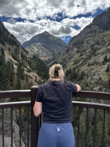
Megan looking out to the Million Dollar Highway in the San Juan Mountains at the Bear Creek waterfall

Bear Creek Falls overlook with the San Juan Mountains in Ouray, CO

By Friday, everyone had agreed that we would start the Labor Day weekend a little early. It was time for Megan to experience her first real day trip of the challenge, taking us 100 miles south into the San Juan Mountains and the towns of Ouray and Telluride.

In one of our conversations before Megan arrived, she mentioned that she wanted to visit Switzerland someday to see the mountains. I took that as the perfect invitation to introduce her to our own “Switzerland of America” on the Western Slope.

This day was the biggest itinerary challenge of the entire 10 days. There was simply too much to experience and nowhere near enough time to do it all. So, I thought long and hard about what I wanted Megan to get out of this experience.

Most importantly, I wanted her to understand something: When you live in Grand Junction, monumental vacation-like experiences can become simple day trips. Grand Junction isn’t just a place to live. It’s a basecamp for experiencing unforgettable moments.  

We got an early start and headed directly to Ouray for our first stop.
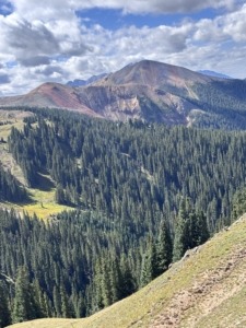
Red Mountains along trail in the San Juan Mountains

Red Mountain Mining Trail view from the top of the Red Mountains in the San Juan Mountains

This quaint little mining town tucked into the heart of the San Juan Mountains will literally take your breath away. And then there’s the adrenaline rush and sheer amazement of driving the Million Dollar Highway toward Silverton. Megan was getting to see the eye candy that people come to Colorado for. But I didn’t just want her to see the mountains. I wanted her to experience them.

After driving much of the Million Dollar Highway, we took a mountain-pass detour that put us into four-wheel drive low and well off the beaten path. We were taking Megan over Red Mountain Pass, climbing to elevations of more than 11,000 feet and into some of the most spectacular scenery in all of Colorado.

Backroad exploration is part of living in Colorado. But on the Western Slope, it can also become part of everyday life. I wanted Megan to realize that there was an entire layer of Colorado that most visitors never get to experience. I didn’t want her driving past trailheads filled with people unloading their RZRs and ATVs, wondering where they were going and what they were seeing that the average tourist never gets to experience.

Because getting there is part of the experience. The drive up these mountain roads can be spectacular in itself, but what I really wanted Megan to understand was that some of the most incredible places I’ve experienced during my time in Colorado weren’t found along the paved highway. They were off the beaten path.

There are places people visit on vacation. And then there are places locals go exploring.

Halfway through our up-and-over adventure, we stopped for a picnic lunch, explored the remnants of some old gold and silver mines, and eventually made our way back toward Ouray, stopping at the ghost town of Ironton along the way.
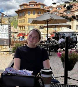
Megan enjoying hot chocolate at a coffee shop in Mountain Village, CO

Enjoying hot chocolate at a coffee shop in Mountain Village, CO

Our original plan was to take the heart pumping, off road, Ophir Pass into Telluride, but it was closed for some maintenance work. And, frankly, after some of the anxiety-inducing driving we’d already put Megan through, I think she was perfectly happy to take the longer paved route.

On our way to Telluride, we pulled over at the Double RL Ranch overlook. Megan was amazed to learn that the ranch is owned by Ralph Lauren of fashion industry fame.

Then we arrived in Telluride. The town was hosting a film festival, so it was busier than normal. We parked and immediately headed for the gondola to go up to Mountain Village. There may not be a better way to experience the incredible mountain scenery of Telluride than from the gondola. It was spectacular.

We first got off at the San Sophia station to explore the empty ski slopes and soak in some views before hopping back on and continuing to Mountain Village.

My wife, Michelle, tells everyone that Mountain Village feels like Santa’s north pole village.
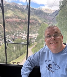
Paul riding the Gondola in Telluride CO

Telluride free gondola up to Mountain Village

She’s not wrong. It’s spectacular, upscale and almost surreal. Walking through the village during the off-season offers a completely different experience than being there during ski season, but the scenery and atmosphere are always impressive. As we wandered through the European-inspired village, we stopped for some Telluride hot chocolate, found an empty table outside, and simply soaked it all in. 

And then, because this day apparently wasn’t already full enough, we noticed our barista taking pictures of someone outside. We soon realized there were some A-list celebrities in town for the film festival. Megan’s eyes lit up. “I literally cannot believe this right now.” It was one of those completely unplanned moments that you couldn’t have put on an itinerary if you tried. But it made the day for her and us too. 

We took the gondola back down to Telluride, walked the shops along Main Street and eventually headed out of town. And since this day had already been one surprise after another, of course we spotted a herd of roughly 50 elk in a field on our way out.

Seeing one elk for the first time is memorable. Seeing fifty of them together? That’s something else entirely.

By the time we finally made it home, it was late. We were tired. We were exhilarated. And we had packed an absolutely ridiculous amount of Colorado into a single day. For most people, a day like this would be the highlight of a two-week Colorado vacation.

For Megan, it was only Day 4. 

This wasn’t about how much we could cram into one vacation. It was about showing her what could be possible when Grand Junction was your home base.

Megan’s Take: Boy oh boy there is so much I could say about day four. I think I lived ten different lives that day. Day four was the day of firsts, the day of high blood pressure, and the day of wondering if this is real life? We had another early wake up call in order to hit every stop Paul had planned for the day, which I was ready for! 

It started with the San Juan Mountains in Ouray and when I say I felt like I was in Switzerland, I mean it. Pictures will never do what my own eyes saw, justice. My life flashed before my eyes on the million dollar highway as I was both in awe of the scene around me but concerned if I moved even one muscle I was going to flip the car over the mountain. One of the most incredible parts about that morning in Ouray was making our way through the Red Mountain Pass, where I experienced my first natural bathroom break, riding at what felt like a 90 degree angle in a moving vehicle, and exploring a gold mine. The fact that I experienced all of that in the span of a few hours was incredibly surreal.

And then there was Telluride… I still sometimes can’t comprehend how ALL OF THESE PLACES are just a couple hour drive at most from Grand Junction. This town was one I see in my dreams to be honest. The energy of the town, the endless shops and restaurants, and then you hop on the gondola that takes you to one of the most incredible places I have ever been too. It is like its own little oasis, and I felt like I was in a movie scene. I was in complete awe with every single thing I experienced that day.

Day 5 – Saturday: A Little Taste of Home

After a long day on Friday, we were all ready to sleep in and have a little downtime. Saturday morning was exactly what we needed. We had coffee, made a big breakfast, did some laundry, and Megan went out for a quick run. There was no set in stone agenda for the day other than dinner at my daughter and son-in-law’s house that evening.

We would simply play things by ear. And that’s exactly what I wanted Megan to experience.

After a slow morning at home, we decided to take the afternoon to explore the Grand Mesa, the world’s largest flat-top mountain and home to more than 300 lakes. I was especially excited about this one because I knew it would give Megan a little taste of northern Minnesota right here on the Western Slope.

One of the things I wanted Megan to experience throughout the 10-day challenge was just how dramatically the landscape can change within a relatively short drive of Grand Junction. There aren’t many places where you can snow ski in the morning and play golf in the afternoon. But that’s possible here, with Powderhorn Mountain Resort only about 45 minutes from Grand Junction.

After our slow morning at home, we were caught up on our chores and ready to head up the mountain. 

The leaves were just beginning to change, but the views were already impressive. And, because apparently we were becoming magnets for wildlife, we spotted a few bighorn sheep soon after we exited I-70.

We drove through the small town of Mesa, and our first stop was Powderhorn.

Although the ski season was still months away, the resort was open for its summer activities, with mountain bikers using the chairlift to get to the top before riding back down. We wandered around for a while, talking about all the activities Powderhorn offers beyond skiing, including events like Color Weekend and Oktoberfest. It really is a fun place even if you don’t ski.

Megan had downhill skied before, but this was her first time standing at the bottom of a Colorado ski run and looking up at the terrain around her. A bit intimidating to say the least.

From there, the elevation really started to climb. Our next stop was Mesa Lakes Lodge. Michelle and I love walking around Beaver Lake because the water is so clear that you can actually see trout from the shoreline. On this particular day, the lake was alive with people fishing from shore and others out enjoying the water in kayaks.

Megan immediately recognized something familiar. That was another thing I loved about watching her experience the Grand Mesa. It wasn’t Minnesota. But there were pieces of it that I’m sure felt surprisingly comfortable.
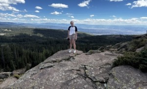
Megan on top of rocks on the Land o' Lakes trail on the Grand Mesa with expansive mountain views behind her

Land o’ Lakes Trail on the Grand Mesa

Next, we headed to the Land o’ Lakes trailhead for a short quarter-mile hike to an incredible overlook of Island Lake. 

From the overlook, you can see the Elk Mountains and the San Juan Mountains stretching out in the distance. A must-see overlook when visiting the Grand Mesa. 

A few more quick stops at Grand Mesa Lodge and Mountain Top Resort gave Megan an even better feel for the whole “Up North” Western Slope experience.

And then, just like that, our relaxing little afternoon was getting away from us. 

We headed back down the mountain and made one more stop in Palisade at Clark & Co.’s Distillery. Megan had never visited a distillery before, so this was another first for her. It’s one of our favorites, and the combination of unique drinks, incredible food, the riverfront setting and views of Mount Garfield makes it a pretty great place to spend an hour.

By now, we were officially running out of Saturday. We quickly headed home to get cleaned up and ready for dinner.

We had a wonderful relaxing evening at my daughter and son-in-law’s house, filled with good food, great conversation and, of course, some fresh Palisade peach cobbler to finish things off.

It had been a completely different kind of day than Friday.

Just coffee, breakfast, laundry, a little exploring, family, dinner and peach cobbler.

And somehow, we still managed to squeeze a pretty incredible amount of Colorado into it. That was the point, too. Not every day in Grand Junction has to be an adventure. Sometimes, it’s just Saturday. And that’s pretty damn good.

Megan’s Take:  Day five was another perfect day to grasp what a free day could look like as a Grand Junction local. I really appreciated that we got to have a slow morning but still do some exploring. This day was another experience I didn’t quite realize until the ten day test was over, just how possible adventure can be in Grand Junction if you desire. You can sip your coffee and relax on the porch, but still get a hike in and observe the mountain beauties on the same day while not feeling rushed. Or you can wake up and say I want to do absolutely nothing and have a total change of heart hours later and still go on that adventure. The lakes were the perfect slice of home and also mind boggling to me just how diverse the environment in and around Grand Junction was.

Day 6 – Sunday: Getting Off the Pavement
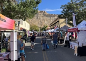
Palisade Farmers Market showing booths and Mount Garfield in the backdrop

Sunday Palisade Farmers Market

By now, Megan was starting to get a pretty good feel for what everyday life in the Grand Valley could look like. But there was still another part of the local lifestyle I wanted her to experience. 

We started the morning in Palisade at the Sunday Palisade Farmers Market. Megan was really excited about this one.

The Palisade Farmers Market runs from early June through early October, and Michelle and I probably make it there about three weekends out of every month. It’s one of those things that has become part of our own routine.

We wandered through the streets of Palisade, stopping at the different vendors, visiting storefronts, and just taking our time. There is a vibe to this market that is difficult to explain until you’re there. Megan grabbed a coffee with sweet peach cream, which seemed like a pretty appropriate way to start a Sunday morning in Palisade. “When in Rome” as she stated a few times over her visit. 

And then there was the produce. Oh, my. If you’ve never had fresh Palisade peaches, I’m not sure you’ve really experienced what a peach can taste like. All of the local produce at this market is something else.

But what I really wanted Megan to experience was the community.

The market is incredibly easy to attend. You don’t have the parking headaches you might expect at a similar event in a larger city. You’re not packed shoulder-to-shoulder with thousands of people trying to navigate through the crowd. Instead, you can park, walk around, talk to vendors, run into people you know, get what you came for, and simply enjoy the morning.

It feels relaxed. 

It feels local.

And it feels like something local people actually do, not something created just for tourists to come experience. That’s part of what I love about Palisade. There is a genuine sense of community here, and the Farmers Market captures it perfectly. After spending some time wandering the market and enjoying a slow Sunday morning, it was time to shift gears.
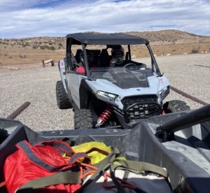
Polaris RZR side by side off road vehicle

Polaris RZR side by side off road vehicles

It was time to get off the pavement.

Megan, Michelle and I rented a side-by-side RZR and headed toward Rabbit Valley in the McInnis Canyons National Conservation Area near the Utah border with our daughter and son-in-law, who joined us in another RZR.

This was going to be a first for Megan. She had never driven an ATV, much less a RZR, and I wasn’t quite sure what she was going to think once we got out on the trails.

For the first half hour, I did the driving. The trails were incredible, but the machines were even more impressive. These things can climb, maneuver and tackle terrain that would make you think twice about taking a regular vehicle anywhere near it.

After about 30 minutes, we pulled over and I asked Megan if she was ready to take the wheel. She reluctantly said yes, with a smile.

“Just take it slow and drive at your own pace.” 

She did great. But I knew she was nervous.

There was a lot to take in. The terrain was unfamiliar, the RZR was incredibly capable, and we also had another RZR leading us that was being driven by someone who was very experienced and fast! Keeping up was a little intimidating.

At our next stop, I asked how she liked it so far. She said, “When we descended that one hill, I think I closed my eyes for part of it.” Oh my!!!! I took the wheel again for the next leg. 

We eventually stopped for lunch overlooking the Colorado River. Sitting there, high above the canyon walls, soaking in the incredible scenery, it was hard not to appreciate how different this experience was from simply driving through the area.

After lunch, I asked Megan if she was ready to give it another try.

“I think I am OK,” she said.

I encouraged her a little, not wanting to push too hard. She reluctantly climbed back behind the wheel. This time, I could tell something changed. She was still cautious, but she was starting to figure it out. She was getting a feel for the machine, learning what it could do and becoming more comfortable with the terrain.

Then we got separated from the other RZR. We were following the same trail when we suddenly lost sight of the vehicle in front of us. We continued for a while, but after about ten minutes we still hadn’t seen them and the trail was getting rougher.

Had we taken a wrong turn? We weren’t sure.

Eventually, we came to a particularly technical section of trail and decided to stop. The other RZR was stopped up ahead waiting to see if we needed guidance or help on this next obstacle. 

Megan was still driving.

The RZR was sitting at what felt like a 45-degree angle from side to side, and directly in front of us was a huge mud hole with an immediate climb up on some rocks beyond it.

You could see the deep tire tracks coming out the other side showing us others had struggled to get through. Apparently, we weren’t the first people to wonder whether this was a good idea.

Megan looked at the obstacle.

Then she looked at me.

“I’m not sure I can do this.”

My advice was pretty simple.

“If you’re going to go for it, just don’t stop. If you hesitate in the middle, we might get ourselves into trouble.”

I hadn’t even finished the sentence when Megan essentially had a “hold my beer” moment.

She hit the gas and plowed straight through the obstacle. Like an absolute pro. We cheered with excitement as she came out the other side. I still haven’t ever asked if her eyes were open on that one. But, I think I know the answer. 

Right then, I was so proud of what had just happened. That was her moment. She had gone way outside her comfort zone, trusted herself, trusted the machine and absolutely crushed it.

Sometimes you just need a little experience before something that initially feels intimidating starts to feel like fun. And sometimes you need someone sitting next to you saying, “You’ve got this. Go.”

That was exactly what happened with Megan.

I also understood why she was nervous. This wasn’t a gentle scenic drive. We were bouncing over trails, climbing rocky terrain and navigating a landscape that looked very different from anything she was used to driving. But that’s part of what I wanted her to experience.
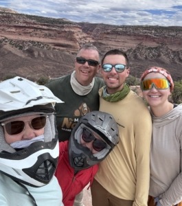
Group photo of Michelle Paul Megan and more with helmets on with Colorado River Valley in the background

RZR ride in Rabbit Valley – Colorado River view stop for a snack at the Knowles Overlook Campground

Outdoor trail riding is a big part of the culture on the Western Slope. People explore on mountain bikes, motorcycles, RZRs, ATVs, four-wheel-drive vehicles and just about anything else capable of getting beyond the pavement.

For someone moving to Grand Junction, I think that’s an important part of the equation to understand. This isn’t just a place where you can look at the outdoors. It’s a place where you can actually get out into it. 

As our afternoon was coming to a close, we loaded up the RZRs and headed back toward Grand Junction. Megan had gone from being nervous about what these machines could do to understanding why people on the Western Slope enjoy them.

And that was another piece of the puzzle I wanted her to notice. The Grand Valley isn’t just surrounded by incredible scenery. There is an entire culture built around getting out and experiencing it.

By the time we got home, we got cleaned up, had some appetizers, talked about the day’s adventures, and enjoyed a quiet dinner at home.

Another day. Another completely different experience.

Suddenly, this entire challenge was starting to feel less like we were trying to show Megan everything Grand Junction has to offer and more like she was simply beginning to experience what life here could actually look like.

Six days in.

And we still had four to go.

Megan’s Take:  I woke up on day six ready for whatever was in store! There are a few lessons that have truly stuck with me from my ten day experience and this day provided one of them. The morning was filled with dare I say the best farmers market I have ever been to. The community at the Palisade farmers market was one I’d never seen before between every single stand being a small or locally owned business, to the energy just walking down the street. 

Afterwards I experienced my first ever RZR as both a passenger and driver. Like Paul mentioned in the day six debrief, I had a major “hold my beer moment.” I won’t lie, I was freaking out, not sure whether or not I would be able to make it through as the driver. The anxiety and stress of the mudhole situation definitely made me uncomfortable, but afterwards I felt like I was on cloud nine. The adrenaline and joy I felt was an incredible reminder that sometimes you just have to go for it. Sometimes you’re left with no option but to just step on the gas and pray you make it. This experience reminded me to do things even when you’re scared because if you don’t, you’re likely going to miss out on some of the best lessons, greatest adventures, and some awesome stories. 

Day 7 – Monday (Labor Day): Two States. One Day.

Colorado in the morning. Utah for the day. Back home in Colorado by evening. 
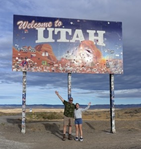
Paul and Megan standing on the side of I-70 at the Welcome to Utah road sign

Day seven started with what has become something of a rite of passage for our out of town guests whenever we head west from Grand Junction.

A stop at the Welcome to Utah sign for pictures and proof. 

We had crossed the state line, and just like that, we were off to explore another state for the day. But this wasn’t going to be an overnight trip. We weren’t packing a suitcase. We weren’t booking a hotel. We weren’t even particularly far from home.

We were headed to Moab and Arches National Park.

One of the things I wanted Megan to understand during the 10-Day Challenge was that Grand Junction’s location isn’t just a nice bonus. It fundamentally changes what a normal day can look like. Moab is only about 90 miles from Grand Junction. Only an hour’s drive if you ask some local people. I know…Feel free to do the math. 

And because we were coming in from the Colorado side, we were able to enter Arches through what I think of as the park’s back door. That little geographic advantage would essentially give us another hour or more in our day. Instead of driving all the way to the main entrance and then backtracking, we could enter from the north, work our way through the park, and keep moving. 

And we were going to need it.

Delicate Arch
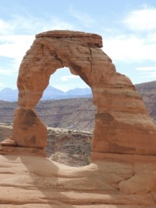
Delicate Arch in Arches National Park

The hike to Delicate Arch in Arches National Park

First up was the quintessential Utah experience: Delicate Arch.

If you’ve seen pictures of Arches National Park, or even a Utah license plate you’ve probably seen this one. But pictures don’t really prepare you for standing there. The hike has such a “moment” attached to it because you come around the corner on a cliff-like ledge of a trail and “BOOM”…the arch is right there in all its glory.

We stopped at the arch for a half hour, took in the scenery and let Megan experience one of the most recognizable landscapes in the Southwest for herself. And then, because apparently one famous arch wasn’t enough, we kept going.

We explored a few more incredible arches, stopped for a picnic lunch, and took in more of the park before eventually making our way toward the visitor center.

By then, we were all getting hungry. So we headed into Moab.

You might enjoy this post about going in the back door to Arches and hiking Tower Arch.

A Little Bit of Moab

The first priority was iced coffee.

Then we did what we always like to do when we’re in Moab: wander through some of our favorite shops along the main drag. One of those stops was the Made in Moab store, where we took our time looking around. We didn’t need to rush through town just to check another box off the itinerary.

That was another little distinction I wanted Megan to experience. 

Yes, we had spent part of the day hiking through one of Utah’s most famous national parks. But we weren’t treating Moab like some distant destination where every minute had to be maximized because it might be years before we return, if ever. 

We could slow down. Grab a coffee. Browse a few shops.

And eventually make our way to the real star of the show.

Pasta Jay’s

Oh, how we love this place.

After a full day of hiking and exploring, sitting down for dinner at one of our favorite Moab restaurants felt less like the end of some epic vacation excursion and more like what it was becoming throughout this challenge: Just another day out.

Except this particular day happened to include two states, a national park and Delicate Arch. And we weren’t done yet.

The Scenic Way Home

After dinner, we could have simply headed back to Grand Junction on the interstate. Instead, we took the back way. We followed the Colorado River past Castle Valley and into some of the most unmistakably Western scenery you can imagine. This stretch of road has been used as the backdrop for countless Western films, including movies associated with John Wayne. 

And as we drove through it, I couldn’t help thinking about the bigger point of the day.

This wasn’t just about getting to Moab. It was about what was between Moab and home. The red rock cliffs. The river. The enormous canyon walls. The open landscape that seems to stretch forever. And then, eventually, we were back in Colorado.

And Megan still had three days left.

Megan’s Take:  What kind of place allows a national-park experience to become a routine day trip? Well, I’ve got an answer for you. Day seven was a multi state day and even just saying that is still so surreal. The drive to Arches National Park felt like a breeze, and in my opinion was the perfect distance to feel like you are entering a whole new world even if it wasn’t all that far from Grand Junction. It felt like you had a little slice of everything between rock, sand, agriculture, animals and more.

The hike to the Delicate Arch was extraordinary. When I tell you my jaw was on the floor, I mean it. The view of the Arch and the surrounding area didn’t feel real at first, and it took me a minute to take it all in. I could have sat and looked out at it for hours. 

Afterwards we explored Moab which was a wonderful little town that didn’t feel all that large but still offered so much as far as activities, culture and community gathering spots go. Once we wrapped up dinner having some of the best pasta I’ve had, we were on our way home. 

It didn’t dawn on me until we were all settled into the car and half way through our drive home that this day was nowhere near a vacation for the group I was with. 

They can just wake up and do this. 

Four days. Four completely different experiences. And a whole new perspective on what it could mean to live on Colorado’s Western Slope. From the mountain scenery of Ouray and Telluride to the familiar comforts of the Grand Mesa, the community atmosphere of Palisade, the excitement of off-road exploration, and a day trip to Arches National Park, Megan was beginning to understand that Grand Junction’s appeal isn’t just about what you can do here. It’s about everything you can experience from here. But could all that adventure translate into a lifestyle she’d actually want to call home? We still had three days left in the 10-Day Grand Junction Challenge, and it was time to explore another side of life in the Grand Valley.

The Challenge Continues

CONTINUE TO…
The 10-Day Grand Junction Challenge: Days 8-10: Discovering What Life in the Grand Valley Is Really Like

Want to understand Grand Junction from Megan’s perspective? Read her entire independent account of the challenge, including what surprised her, what questions she was left asking, and whether she could imagine building a life here.

CONTINUE TO…
Could I Actually Build a Life in Grand Junction? A 10-Day Challenge


Series: 10-Day Grand Junction Challenge

View the all of the posts and videos on the 10-Day Grand Junction Challenge page.

Paul Aspelin REALTORPAUL ASPELIN
Your Grand Junction Relocation and Listing Expert
REALTOR®, GRI, SRES®, CNE

Call or Text (612) 306-9558 (locally based)
Connect with Paul on LinkedIn or send Paul an email

Megan Jirele Independent Journalist and WriterMEGAN JIRELE
Independent Journalist & Writer
Digital Storytelling & Content Creation
Connect with Megan on LinkedIn


© 2026 Paul Aspelin, REALTOR®. MovetoGrandJunction.com Copyright protected. All rights reserved.
by Paul Aspelin, Relocation & Listing Expert
https://movetograndjunction.com/wp-content/uploads/2026/10/Megan-at-Arches-National-Park.jpg 934 1726 Paul Aspelin, Relocation & Listing Expert https://movetograndjunction.com/wp-content/uploads/2024/09/Move-to-Grand-Junction-logo-wide-Mesa-County-1030x167.png Paul Aspelin, Relocation & Listing Expert2026-10-19 13:28:252026-10-19 15:12:0510-Day Grand Junction Challenge: Exploring Beyond Grand Junction
Day Trips, Local or Nearby Attractions

Experience the Colorado National Monument in Grand Junction

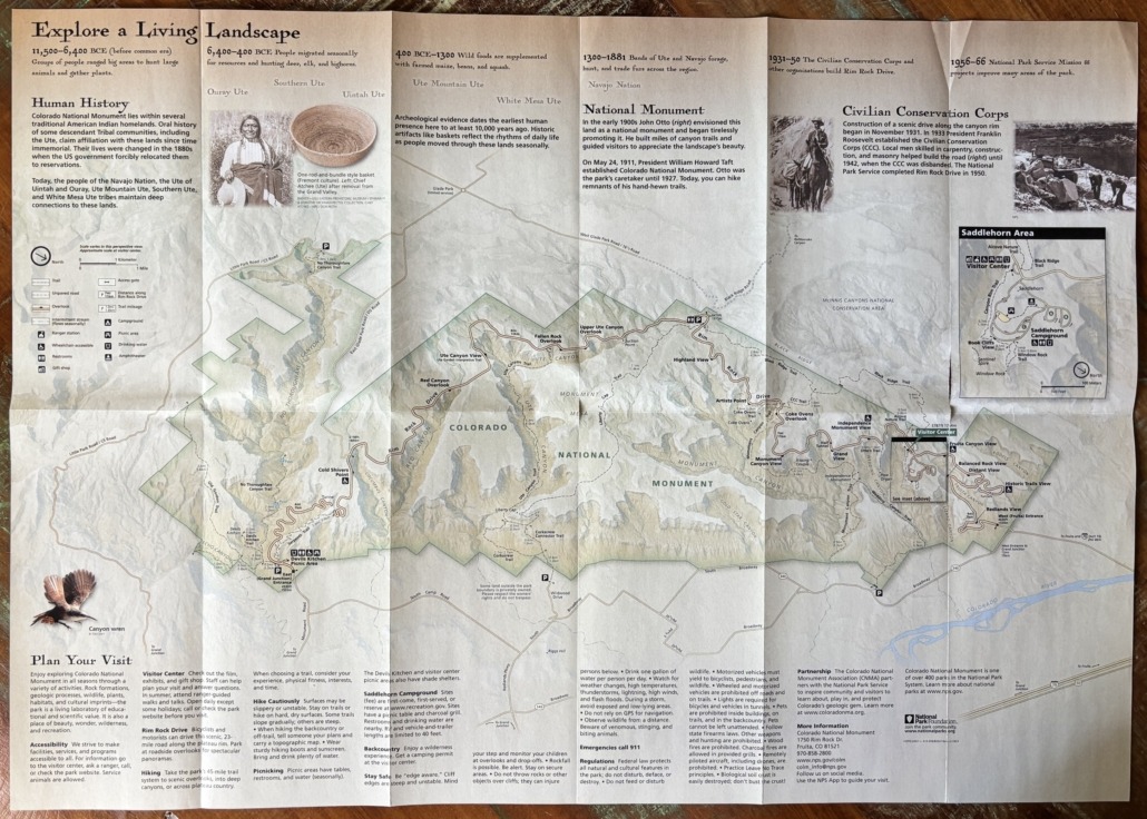
When you open the map for the Colorado National Monument, you might wonder “Where do I start? What should we do first? What is a ‘must see’ with the time we have?”

In general, most people experience the Colorado National Monument by driving through on Rim Rock Drive from Fruita to Grand Junction or vice versa. After three years of exploration, we have had a chance to really discover everything the Monument has to offer. It’s quite an amazing place and we are lucky to have it in our backyard. In fact, it’s now in the backyard of several clients that I helped move to the Redlands area at the base of the Monument!

I’ll start with the basics, then give you some tips based on our experience.

“Inch by inch, foot by foot. All around you, this dramatic landscape is always changing. Earth’s powerful forces and past climates built the land up; erosion continually wears it down. They tell a spectacular story of our dynamic planet.”

-a quote from the Colorado National Monument brochure/map you get from the Visitor Center

Rim Rock Drive

Rim Rock Drive is a wonderful 23-mile paved road that climbs to the top and winds along the canyon rim. It takes you from end to end with lots of roadside overlooks with spectacular views.

Construction of the road started in 1931 by the Civilian Conservation Corp and was finished in 1950 by the National Park Service. We prefer to enter from the West Fruita Entrance, closest to the Visitor Center, and complete our drive by exiting the East Grand Junction Entrance. You can also enter the park from a couple of small trailhead parking lots at the base of the Monument in the Redlands.

If you want to get to Glade Park (the General Store is something to see), you exit Rim Rock Drive at about the half-way point. This exit has a bathroom and also leads you to the Rattlesnake Arches trailhead via Black Ridge Road. We’ve taken this road and done the arches hike. Warning: you need a high clearance, 4WD vehicle to get to the Rattlesnake Arches trailhead. It’s worth the slow drive to see arches in Colorado.

Fun Fact: The second-largest concentration of natural arches in the world is in Rattlesnake Canyon within the McInnis Canyons National Conservation Area. It’s a cool hike, once you get there! Ask me about the drive to the trailhead.

If all you do is drive through the park, it’s exceptional. Views change with every curve in the road. Some of our favorite scenic overlooks are Fruita Canyon View, Independence Monument View, Grand View, and Cold Shivers Point.

Colorado National Monument Brochure Map

All Four Seasons

Paul Aspelin overlooking a monument canyon

Paul overlooking Monument Canyon

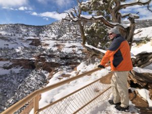
You can enjoy “the Monument”, as locals call it, during all four seasons. Walking or hiking on the trails during the summer is best done in the morning since there isn’t a lot of shade. In the winter, mid-day hikes are perfect. To see the landscape with a dusting of fresh snow is magical!

The overlooks and several of the trails are accessible to people with all levels of abilities. The park is like a living place of beauty with stunning rock formations, plants, wildlife, and wilderness. There is so much to discover. If you can, dedicate a full day to exploration or two half days while you are in Grand Junction. And when you live here, you can go as often as you like in any season!

Amenities

Visitor Center

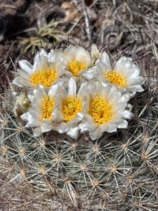
Cactus blooming with white pedals and a yellow center flower

Blooming cactus in the Monument

They have a gift shop at the Visitor Center. Check out the exhibits to learn about the area. They offer ranger-guided walks and talks too. The bathrooms are accessed from the outside, so they are available all the time. There are pit toilets about midway along Rim Rock Drive and at the picnic area near the East Grand Junction entrance. There is an outdoor picnic area, and we recommend the Canyon Rim Trail or short Alcove Nature Trail across the street from the Visitor Center. Both are great options if you don’t want to walk very far but still want to feel immersed in the park.

While the main entrance gates are open 24/7 year-round, the Visitor Center is not. It’s open daily from 9AM to 4PM (with extended hours from 9AM to 5PM during the spring and summer months). It is closed on Thanksgiving Day, Christmas Day, and New Year’s Day.

Campground

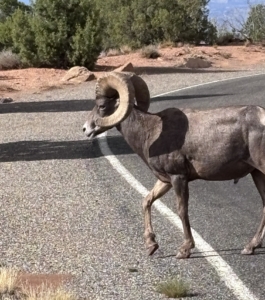
Big Horn Sheep crossing the road in the Monument

We often drive through the Saddlehorn Campground to get to the Book Cliffs View overlook. We take everyone here for views into Wedding Canyon and of the city. Campsites are first-come, first-served or you can make reservations at Recreation.gov. There are restrooms, picnic tables, charcoal grills and drinking water nearby. Watch for bighorn sheep! We’ve had to stop on our way out to let them cross the road in the campground.

Picnic Areas

A fun way to experience the Monument is to pack a lunch or snacks so you can stop whenever you get hungry and soak in the beauty all around you. We have eaten at overlooks, or you can go to the dedicated picnic areas at Devils Kitchen Picnic Area (near the East Grand Junction entrance) or use the picnic area at the campground and Visitor Center.

Hiking

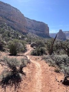
Wedding Canyon Trail

Wedding Canyon Trail

Aside from driving through, the Monument is best known for the 45-mile trail system. There are easy, moderate, and difficult trails. Some are super short, others go on for miles and miles!  They can be steep or slope gradually. They are mostly dry but can be rocky or feel unstable in sections. The trails can take you deep into the canyons or across the plateaus. Michelle uses the AllTrails app to help choose trails based on our abilities and enjoyment. Remember to always stay on the trail so you don’t disturb the fragile desert crust. Leave no trace.

We have personally hiked or partially hiked 10-12 trails in the park. Remember to bring plenty of water, wear protective clothing or sunscreen and a hat, plus sturdy hiking shoes for rough trails or tennis shoes for shorter walks. You probably won’t have a cell signal, so you might want to download Google Maps for this area, especially if you go hiking.

Wildlife

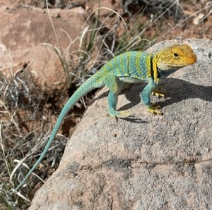
Collard Lizard photo by Emma Aspelin

Collard Lizard photo by Emma Aspelin from EmmaGetsOutside.com

You are likely to see mule deer, and hopefully desert bighorn sheep. You’ll also see cottontail rabbits, golden eagles, turkey vultures, hawks, birds, squirrels, chipmunks and lizards, including the collard lizard, the most colorful lizard in the Southwest. While we have seen all of those, we have not witnessed other wildlife reported to roam the Monument like coyote, mountain lion (also known as cougar, panther or puma in other parts of the country), fox, and the rarely seen rattlesnake.

Insight After 3 Years of Exploration

Simply driving up to the top from the Fruita Entrance is amazing. If we see bighorn sheep, they are likely in this section of the park.

The Book Cliffs View accessed from the Saddlehorn Campground is a popular spot where you can hike the trail to Window Rock. There is a narrow, rocky ledge, but not too scary.

The Canyon Rim Trail goes from the Visitor Center to Book Cliffs View, so you can hike to it vs drive to it as well. The trail is wide with a gradual slope and gets you close to the drop-off, if you want.

While at the Visitor Center, pay attention to the garden of plants. You can wander through and discover their names. We like seeing the blooms on prickly pear cacti in May or June.

If you are mainly driving through but want a couple of short hikes, we recommend Otto’s Trail or go out to Grand View Point.

If you have a little more time, hiking on the ledge of the canyon to the Coke Ovens is a cool hike and not as busy as other spots.

If you want a longer, more strenuous but memorable hike, start at the Wedding Canyon trailhead from Broadway in the Redlands and hike counterclockwise to the base of Independence Monument and back on Monument Canyon Trail. Read the post about the day we did this hike. When you see photos of the Colorado National Monument, they most likely feature Independent Monument.

I have hiked Corkscrew Trail up, up, up to Liberty Cap on the Liberty Cap Trail. I wanted to turn around about three times but I did it. Thought I might die, but I did it! This trailhead is also in the Redlands off of South Broadway.

Cold Shivers Point, yes, it feels colder there because of the constant breeze into the canyon, is a fun stop. Once you reach the railing of the overlook, look to your right and venture a little farther. Out on the cliff edge, be careful, you can see where people have etched their names into the rock. If you go here in May, you might find some CMU graduates taking photos. It’s a popular spot.

One last thing to savor is not a sight but a smell. The pinyon pine and juniper trees smell absolutely amazing. Especially if you can go after it’s rained, which is rare, but it does happen. So many times we are on a trail and just stop to breathe in the fresh air.

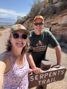
Serpents Trail

Hiking Serpents Trail

If you want a workout, hike 3.9 miles out and back up Serpents Trail, built in the 1900’s. It’s an elevation gain of 797 feet and is called “the crookedest road in the world,” because of the 16 switchbacks. Don’t be surprised to see runners pass by like you are standing still on this hike. One of our favorite spots is at the top of the trail. There is a small 3-space parking lot. Park there, if you can, and walk out about 30 yards. You get an excellent view of the Grand Valley. The trailhead for Serpents Trail is near the East Grand Junction Entrance. There is a parking lot on Rim Rick Drive but we usually park in the Devils Kitchen Picnic Area.

This unique trail deserves a bit more explanation. In the early 1900’s John Otto built miles of canyon trails and guided visitors to the spectacular wonderland. On May 24, 1911, President Taft established Colorado National Monument. Otto was the park’s caretaker until 1927. Today, when you hike the trails, they are the remnants of his trails, built by hand! However, Serpents Trail stands out because this road was a part of the original road to get to the top of the canyon until 1950 when they completed Rim Rock Drive.

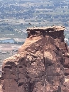
Cherish Independence at Independence Monument

Independence Monument flag raising on 4th of July

Flag raising July 4, 2026

Every fourth of July, local first responders and climbers scale the 450-foot-tall Independence Monument in Colorado National Monument to raise the American flag, a tradition started in 1911 by John Otto. They return about a week later to take it down.

On July 4, 2026, Michelle and I witnessed this monumental event, pun intended. They didn’t do it in 2025 due to a raptor’s nest at the top of Independence Monument. We went to the Independence Monument View Overlook and were able to park along the road. We gathered with about 30-40 people for this patriotic experience. Among the spectators were past climbers, a park-ranger, interested community members, and the local tv news station reporter. It was fun to chat with and hear stories as we watched the climbers get to the top. They start early in the morning to hike 3 miles to the base. Then they climb up 450 feet to secure the pole and raise the flag. It was very meaningful. Very American.

We especially wanted to participate this year because we had just experienced the nearby Knowles Canyon Wildfire (renamed the Snyder Fire) where 4 wildland firefighters lost their lives and a fifth was injured. We are thankful for their service. The fire started in June 2026 and on July 4 we still had a haze of smoke in the valley and we were worried we wouldn’t be able to see the climbers. Luckily the higher we got, the clearer it got. We are thankful we live in America.

Living in the Redlands at the Base of the Colorado National Monument

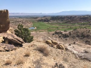
Redlands Mesa Golf Course

Redlands Mesa Golf Course photo taken from above on a trail from Redlands 360 neighborhood

The general area at the base of the Monument stretching to the Colorado River is called the Redlands. The Redlands is a region not a town or its own municipality. The area gets its name from its distinct red soil, dramatic red rock canyons, and towering sandstone cliffs. If you live in the Redlands, you live in Grand Junction. When I take clients on a tour of the Grand Valley, we always drive through the Redlands neighborhoods and stop at the Redland Mesa Golf Course Clubhouse.

Visitors ask me what it’s like to live in the Redlands. There are lots of opportunities and home styles including established homes and new construction. Yes, there are large single-family homes that surround the golf course, but I helped a client purchase a home in the Redlands with an ADU on a larger lot with numerous fruit trees and large gardens. I also sold a homesite in an upcoming neighborhood for a custom-built home.

I brought the first buyer for a custom-built home by Goetzmann Homes in the Redlands 360 development. I have a post about that area if you want to learn more about Redlands 360 and see the master plan map for the development that stretches beyond the Easter Hill neighborhood where my buyers live. We hiked the trails near Easter Hill and the Canyon Rim neighborhood.

To sum it up, if you are in Grand Junction, Fruita, or Palisade, or driving by on I-70, it’s worth a stop to experience the Colorado National Monument. It’s one of over 400 parks in the National Park system, so your America the Beautiful Pass works here.

And, if you think you might be interested in living near the Monument, let me know! There are some interesting pockets and housing opportunities available if you know where to look.

You can experience the Colorado National Monument as a day trip or go over several days. Read about other Day Trips you might be interested in on our Day Trip Collections page.

Move to Grand Junction… We’ve been waiting for you!

Paul and Michelle Aspelin standing at the top of Serpents Trail with Grand Junction in the distance

Top of Serpents Trail

Text/Call 612-306-9558

PAUL ASPELIN, REALTOR®
GRI, SRES®, CNE

Grand Junction Real Estate Expert
Connect with me on LinkedIn or send me an email.
Learn more about my experience and how I serve my clients.

Serving Mesa County and the Grand Valley in Colorado.

© 2026 Paul Aspelin, REALTOR®. MovetoGrandJunction.com Copyright protected. All rights reserved.
by Paul Aspelin, Relocation & Listing Expert
https://movetograndjunction.com/wp-content/uploads/2026/10/Colorado-National-Monument-East-entrance-Paul.jpg 1117 2284 Paul Aspelin, Relocation & Listing Expert https://movetograndjunction.com/wp-content/uploads/2024/09/Move-to-Grand-Junction-logo-wide-Mesa-County-1030x167.png Paul Aspelin, Relocation & Listing Expert2026-10-09 13:30:362026-10-12 11:34:10Experience the Colorado National Monument in Grand Junction
Local or Nearby Attractions

Hiking Monument Canyon Trail – Grand Junction Hike Tips

Hiking Monument Canyon Trail Review: What to Expect

Guest post by Michelle Aspelin

What it’s Really Like Hiking Monument Canyon Trail

If you’re planning on hiking Monument Canyon Trail in the Colorado National Monument, you’ve probably heard it’s “moderate” and takes 2–3 hours. Spoiler alert: it might take longer, it did for us.

I attempted hiking Monument Canyon Trail with Wedding Canyon twice before finishing it, and even seasoned hikers feel the challenge. Here’s our honest experience, so you can plan accordingly.

When we first moved to Grand Junction, Paul completed this hike and found it to be much more of a challenge than he expected. He couldn’t believe he finished it.

I want to prepare you because locals will encourage you to hike this popular trail when you first move to Grand Junction. I want to give you our impression so you can decide for yourself when you are ready to hike it.

Quick Stats: Monument Canyon Trail

  • Distance: 5 miles
  • Elevation Gain: 770’ (that’s like 77 flights of stairs)
  • Difficulty: Moderate to challenging
  • Time: 2-3 hours (or 5 hours!)

Is Monument Canyon Trail really “moderate”? Our experience says otherwise.

Our Monument Canyon Trail Experience

Here’s the link to Paul’s quick Hiking Monument Canyon Trail Video on his Move to Grand Junction YouTube Channel – be sure to watch and give it a “like”.

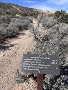
trailhead sign with miles for the hiking route options

Hiking at higher elevation makes even a “moderate” trail more challenging. We stopped often to catch our breath, despite living at 4,583’ of elevation in Grand Junction. Adding time for lunch, snacks, and scenic stops, the 5-mile hike took us 5 hours.

We quickly learned that “moderate” doesn’t always match expectations, it depends on elevation, terrain, and pacing. We purposely hiked at a slower pace, we had to stop to breathe, but the 770’ elevation gain during the hike does have an impact, even though we are acclimated to the elevation. It’s like climbing 77 flights of stairs.

Hiking Monument Canyon Trail: Trailhead Route and Tips

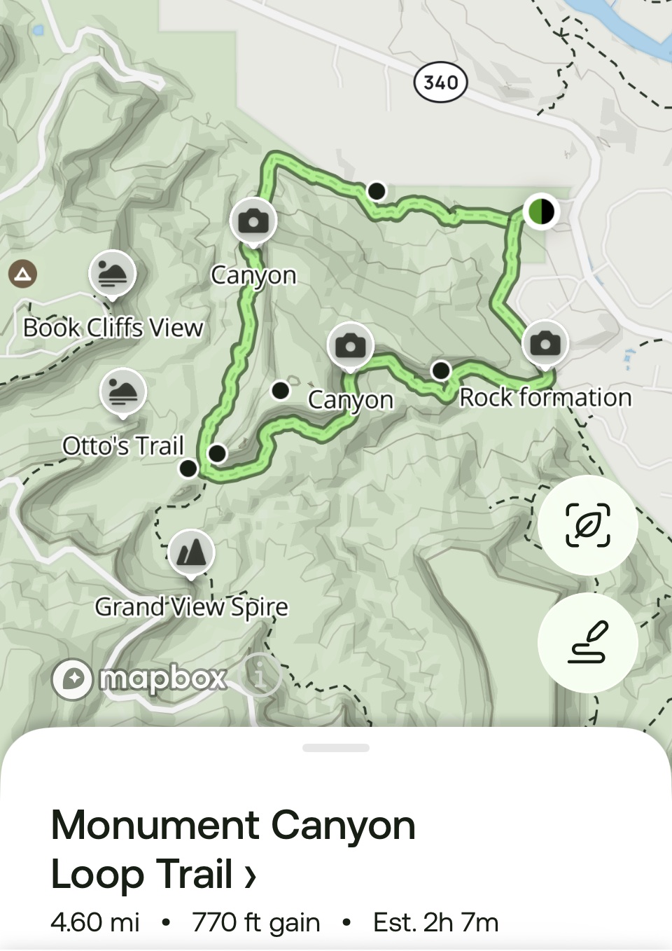
hiking Monument Canyon Trail map from All Trails appThe AllTrails app says that hiking Monument Canyon Trail loop with Wedding Canyon should take 2 hours and 7 minutes and is moderate. We knew it would take us longer, but not 5 hours! After all, we aren’t 25 anymore. We were just surprised. Were we really THAT slow or was it just more challenging?

On this map, Wedding Canyon is at the top, trailhead on the right, Monument Canyon is on the bottom, Independence Monument on the left.

Our 2026 experience was mixed initially. After the hike we were exhausted and I wasn’t sure I wanted to write about it and promote this hike. But after we recovered, and I reflected on what we saw, and more importantly, experienced, I thought it would be good to warn you, I mean, share it with you.

Trailhead: Take Broadway/Hwy 340 to the Lower Monument Canyon Trailhead. There’s a small parking lot with two portable toilets.

The Trail Itself

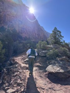
Paul hiking Wedding Canyon

Paul hiking the Wedding Canyon Trail

After our first two attempts at starting on the Lower Monument Canyon Trail, we were advised to start on the Wedding Canyon Trail and I think that’s what made the difference in our ability to complete the 5-mile hike.

Starting the hike with Monument Canyon Trail is a slow uphill climb almost the entire time, with lots of steps. From the loop trailhead it’s 2.5 miles to reach Independence Monument, considered the half-way point of this loop hike.

Wedding Canyon Trail starts out with a steep descent with switchbacks over loose gravel, a walk across flat open land, then the ascent to Independence Monument. It was much easier to descend through Monument Canyon than to start on that trail, in our opinion.

We discovered after we reached Independence Monument that the Wedding Canyon Trail is “unimproved”. Ah, ok, that makes sense. That’s why there were steep climbs, no steps, loose gravel, rocky terrain, and several spots that were washed out.

In one section, run-off washed away the “shelf” part of the trail so much so that the edge to step across the wash was about as wide as your shoe. We went slow and sort of hopped over the gap in the trail. Luckily, we had our hiking poles to balance us on the ascent. We both slipped a couple of times but didn’t fall. The trail is both narrow and wide. We were walking along a huge sandstone cliff which offered some shade.

We started at 10:30am so the sun was behind the cliff part of the time. That helped keep us cool. It was about 55 degrees, but the sun made it feel like it was in the 70s. We hiked in mid-March. Be careful when you decide to hike, mornings are always better than mid-afternoons due to the heat and sun.

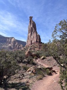
Independence Monument: The Highlight

Independence Monument baseOnce we reached the base of Independence Monument we stopped to eat our lunch. It was much-needed break. We discovered a huge rock with words etched into the top, likely the Declaration of Independence or they could be about John Otto and the significance of this monument in the park. The words were difficult to read after years of exposure to the elements. Let us know what you think they say if you do this hike.
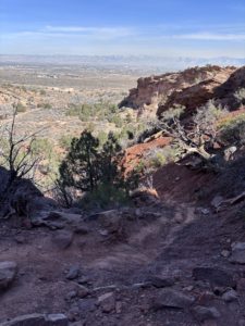
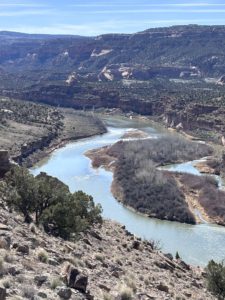
Independence Monument was formed after water and ice eroded walls that once connected the pinnacle to mesas on each side. Sandstone was deposited in this area 210 million years ago and forms the cliffs we see today. Quite amazing. There are so many colorful layers.

The Tradition of Climbing Independence Monument

One of the highlights of hiking Monument Canyon Trail is reaching Independence Monument, a 450-foot sandstone monolith. Every year on the 4th of July, a crew climbs the monument to hoist an American flag, celebrating our nation’s independence. The flag flies for about a week.

John Otto was the first to climb Independence Monument in June and July in 1910, honoring Flag Day and Independence Day. He also built many of the trails in the Monument and became the first official custodian after the Monument was established in 1911, earning a salary of just $1 a month, according to my book Scenic Driving Colorado by Stewart M. Green.

Standing at the base of Independence Monument, knowing its history, makes the hike feel both physically rewarding and historically significant. I’m glad we went.

Hiking Monument Canyon Trail: Returning via Lower Monument Canyon

After reaching Independence Monument, we turned left onto Lower Monument Canyon Trail to head back, which was mostly downhill. (If you turn right, you’ll be on Upper Monument Canyon Trail, which climbs up to Rim Rock Drive.) The full Monument Canyon Trail from bottom to top is about 6 miles with an elevation gain of 1,843 feet, rated “moderate and steep.” We were only on the lower part of the trail.

With the sun at our backs, the return hike was more comfortable. We stopped frequently to take photos of Independence Monument again. We were grateful we weren’t climbing the steps this time. The trail hugs the cliff wall in a few spots but is wide enough elsewhere for other hikers to pass us safely.

The last half mile felt exhausting. When we finally reached the parking lot, we joined hands and raised our arms like we were finishing a marathon. We were completely spent but thrilled to have completed our longest hike to date.

Afterward, we drove home, collapsed on the couch, and groaned every time we moved. My hips, middle back, ankles, and even toes were sore. But two days later, we went on another hike.

Gear & Preparation Checklist

  • Water (more than you think)
  • Snacks/lunch
  • Sturdy hiking shoes or boots
  • Sun protection
  • A hat and sunglasses
  • Trekking poles (recommended but not required)
  • Layered clothing if starting out early when it’s still cool
  • For fast-acting hydration we take electrolyte fast chews by Salt Stick
  • Hydration powder with electrolytes in your water helps too
  • For a burst of energy, we like Skratch Labs brand of energy chews (sport fuel)

You can get these items at REI in Grand Junction including a small waist pack, backpack or hydration vest with pockets to carry everything you need to be prepared for hiking in the high desert. Read our post about Water Bottles in Grand Junction: Why it Matters Here.

You can read our How to Avoid Altitude Sickness in Grand Junction guide for more hydration tips.

Wildlife + Wow Factor

Wedding Canyon Trail and view towards Fruita

Wedding Canyon Trail and view towards Fruita

If you want to see bighorn sheep, look for them in Monument Canyon about midway between Independence Monument and where the trail leaves the neighborhood fence line. We did see two in Wedding Canyon on our hike, but people see them regularly in the Monument Canyon, especially early or later in the day, not so much midday.

Seeing the canyons themselves is amazing. The pretty little flowers, the diverse landscape, the huge walls of different rock layers are all stunning.

To be at the base of Independence Monument was very satisfying and, to be honest, felt a bit patriotic. I was glad we did the hike. I am thankful to be able to say, “I’ve been there” and experienced this special place in the Colorado National Monument. Will I hike the loop again? Probably, but not anytime soon. I need the trauma of the experience to wear off first.

Hiking Mary’s Loop to Pizza Point: A Scenic McInnis Canyons Hike

Pizza Point Colorado River Overlook

Pizza Point Colorado River Overlook

Two days after our Monument Canyon/Wedding Canyon loop hike, we tackled a 4-mile hike in the McInnis Canyons National Conservation Area with only 568 feet of elevation gain, and it felt much easier and enjoyable.

We took Mary’s Loop to Pizza Point. We returned via Steve’s Loop, which offers breathtaking views of a steep canyon and we saw grazing cows, and an interesting slot canyon to explore. This is in the Horsethief Canyon area between Mack and Loma.

Pizza Point is an incredible overlook of the Colorado River and was our halfway point. We spotted boaters and kayakers below and enjoyed a quick snack while taking in the scenery. The full 4-mile hike took us just about 2 hours, including the stop at the river overlook. Much faster than the Monument Trail loop hike!

This trail is shared with mountain bikers, hikers, and trail runners, so be aware of bikers coming up behind you. Across the river, we could see the dramatic Rattlesnake Canyon, a truly stunning view. We have hiked to Rattlesnake Arches, very cool.

For reference, here’s the official BLM map of McInnis Canyon National Conservation Area if you want to hike in this beautiful area.

What This Hike Taught Us About Living in Grand Junction

The outdoor lifestyle is real here. While this particular hike was challenge for us, there are many more trails we’ve hiked before this that we really enjoyed. Anything 4 miles and under is likely going to be enjoyable to us, longer than that starts to be “not so fun” anymore.

We learned what “moderate” mixed with 770’ elevation gain really means. Know we know what an unimproved trail looks like and feels like. We were glad to have our trekking poles.

You build up to this type of hike.

I felt good knowing we CAN do this sort of hike, given enough time. We planned it on a day when we wouldn’t feel rushed. We did try to enjoy it along the way. Sometimes you look down at the trail itself too much (so you don’t trip on a rock) that you forget to look up and enjoy the scenery and stop to hear the sounds of nature.

I guess we did more stopping and looking than we realized. Reflecting back, I enjoyed it. I am glad we did it mid-March. If it was hot out, it would have made it even more difficult.

If you’re planning on hiking Monument Canyon Trail after moving to Grand Junction, knowing what to expect can make all the difference.

If you’d like to live near trails like this, Get Started!

You might also enjoy these posts…

  • Your Grand Junction Relocation Guide
  • Things to do in Grand Junction: Easy Hikes
  • Why people are moving to Grand Junction
  • Retire in Grand Junction
  • Don’t Wait, Semi-Retire in Grand Junction
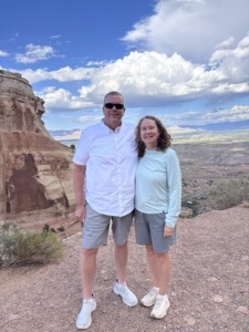
Michelle and Paul Aspelin at the base of Independence Monument

at the base of Independence Monument

If you’re thinking about moving to Grand Junction and want honest insight into what daily life is really like here, we share that on this site and we’re always happy to help answer questions.

Contact Paul for a tour of Fruita, Grand Junction or Palisade, or sign up for his real estate market updates if you want to learn more about properties in Mesa County.

Guest post by Michelle Aspelin


by Michelle
https://movetograndjunction.com/wp-content/uploads/2026/03/Independence-Monument-near-the-base-scaled.jpg 1440 2560 Michelle https://movetograndjunction.com/wp-content/uploads/2024/09/Move-to-Grand-Junction-logo-wide-Mesa-County-1030x167.png Michelle2026-03-26 17:23:052026-04-14 15:01:52Hiking Monument Canyon Trail – Grand Junction Hike Tips
30 Best Colorado Blogs 2026
Search Search
10-Day Grand Junction Challenge could she see herself living here image of Megan sitting on rock looking out over the Grand Junction valley

Follow us on Instagram

Follow us on Facebook

Logo image
Click to load facebook widget
Join our Facebook community

Google

Find us on Google Maps

Write a Review on Google

PAUL ASPELIN, REALTOR®

Paul Aspelin standing on a trail in the Colorado National Monument

Paul Aspelin Reviews and Recommendations

Read Paul Aspelin Reviews and Recommendations-personal notes and survey results from happy clients not found online.

“Paul went above and beyond in our home search, we looked at 17 homes in 2 days! Was very thorough with our search parameters and coordinating showings, even provided a book of all the listings he had scheduled for us. I would wholeheartedly recommend Paul!”

-Jeff Alexander, Grand Junction, CO (originally published on my Zillow profile)

loader-image
Today’s Weather
Grand Junction, CO
5:31 pm, Nov 14, 2026
temperature icon 49°F
scattered clouds
83 %
1012 mb
2 mph
Wind Gust: 3 mph
Clouds: 40%
Sunrise: 6:56 am
Sunset: 5:01 pm

Get the 7-Day Forecast for Grand Junction and 20+ cities from local KKCO Weather. Read about Grand Junction Monthly Weather

Post Categories

  • 10-Day GJ Challenge (6)
  • Day Trips (15)
  • Featured Properties (2)
  • Fruita (7)
  • Grand Junction (13)
  • Grand Junction Real Estate (26)
  • Local or Nearby Attractions (34)
  • More to Know (16)
  • Palisade (6)
  • Property Taxes and Land Ownership (6)
  • Relocating to Grand Junction (26)
  • Retire in Grand Junction (6)
Search Search
Popular
  • Paul Aspelin sitting in his winter jacket on the fishing dock while it's snowing
    Move to Colorado: No Need to Hunker Downin: Relocating to Grand Junction
  • Uhaul trailer and our Rav4 driving to Colorado
    Establish Residency in Coloradoin: More to Know, Relocating to Grand Junction
  • Retire in Grand Junction Coloradoin: Retire in Grand Junction
  • map of Grand Junction area
    Property Tax Programs for Colorado Seniorsin: Property Taxes and Land Ownership, Retire in Grand Junction
  • Relocating to Grand Junction with towable moving trailer
    Essential Steps for Relocating to Grand Junctionin: Relocating to Grand Junction
  • Custom Painted Mailbox by Emma Aspelin
    Wealth is Where Your Friends Arein: More to Know, Relocating to Grand Junction
  • 11 Reasons to Move to Fruita Coloradoin: Fruita, Local or Nearby Attractions
  • Move to Palisade Coloradoin: Local or Nearby Attractions, Palisade
Recent
  • 10-Day Grand Junction Challenge graphic with Megan overlooking the city of Grand Junction
    A Challenge to Prove Why Grand Junction Deserves a Closer...in: 10-Day GJ Challenge, More to Know
  • 10-Day Grand Junction Challenge Megan Jirele Writer sitting on slickrock looking out over the valley towards Grand Junction
    10-Day Grand Junction, Colorado Challenge: What Did Megan...in: 10-Day GJ Challenge
  • Megan standing in front of a slot canyon on a hike in Arches National Park
    10-Day Grand Junction Challenge: Exploring Beyond Grand...in: 10-Day GJ Challenge
  • Megan's muddy shoes while she's sitting in the truck
    10-Day Grand Junction Challenge: Could Grand Junction, Colorado...in: 10-Day GJ Challenge
  • Megan Jirele overlooking Grand Junction from the top of Serpents Trail in the Colorado National Monument
    Could I Actually Build a Life in Grand Junction? A 10-Day...in: 10-Day GJ Challenge
  • Megan doing Cheers with cocktail with Mount Garfield in the background
    What Happened After My 10-Day Grand Junction Challenge?in: 10-Day GJ Challenge
  • Colorado National Monument East Entrance Sign
    Experience the Colorado National Monument in Grand Junc...in: Day Trips, Local or Nearby Attractions
  • Marble CO day trip from Grand Junction showing our 4Runner parked in front of the Marble quarry entrance
    Get Your Marble in Marble, CO: Day Trip from Grand Junc...in: Day Trips, Local or Nearby Attractions

Paul Aspelin, Realtor®

(612) 306-9558

Based in Grand Junction and serving Fruita, Palisade, and all of Mesa County

Member of the:

Grand Junction Area REALTOR® Association

Colorado Association of REALTORS®

National Association of REALTORS®

Categories

  • 10-Day GJ Challenge
  • Day Trips
  • Featured Properties
  • Fruita
  • Grand Junction
  • Grand Junction Real Estate
  • Local or Nearby Attractions
  • More to Know
  • Palisade
  • Property Taxes and Land Ownership
  • Relocating to Grand Junction
  • Retire in Grand Junction

Search Properties

Start your search on the Realty ONE Group Western Slope website.

Relocation & Listing Expert with Realty ONE Group Western Slope

734 Main Street
Grand Junction, CO 81501

map

Follow us on Facebook

Logo image
Click to load facebook widget
Join our Facebook community

Follow us on Instagram

© 2023-2026 PAUL ASPELIN, REALTOR®. Aspelin Real Estate LLC. MovetoGrandJunction.com. All rights reserved. Licensed in Colorado FA100103754.
  • Link to LinkedIn
  • Link to Youtube
  • Link to Facebook
  • Link to Instagram
  • Link to Pinterest
  • Link to X
  • Privacy Policy
  • Accessibility
  • Code of Ethics and Equal Housing
Scroll to top Scroll to top Scroll to top